Escursioni
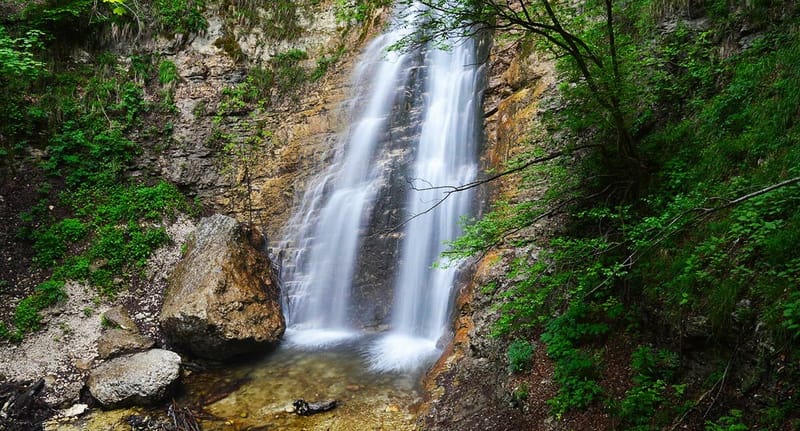
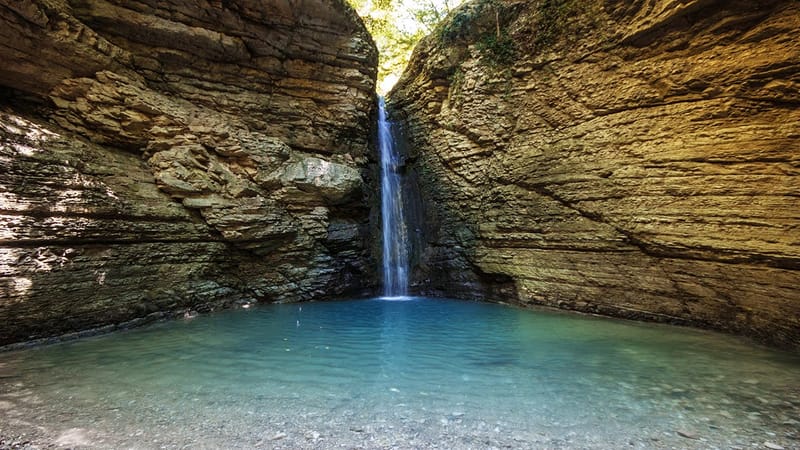
San Giovanni Waterfall
The ring of the S. Giovanni waterfall allows you to get to know the valley of the Vesola torrent: one of the typical river valleys deeply engraved in the eastern sector of the Maiella. The dominant environment is that of the beech forest and the excursion is enhanced by the presence of the stream and above all by the San Giovanni waterfall. During the return, from the panoramic point of view of the clearing of Paina della Civita you can see the Adriatic Sea and, in optimal conditions, also the Tremiti Islands. The itinerary that leads to the San Giovanni waterfall starts from the Fontanile of Bocca di Valle and takes the path that runs alongside the Vesola stream for the entire stretch. At the end of the cart track, turn right, to then reach, after a reservoir on the right, again the Vesola stream near the Cannilluccia (spring spring on the wall invaded by moss). Cross the stream and, following the signs, after a short climb, you arrive at the San Giovanni waterfall. On the way back, before getting back on the cart track, take the path on the right following the signs for Piano della Civita and Bocca Di Valle, flanking and leaving the Favorana Valley on the right after a while. After crossing the clearing of Piano della Civita, you descend in a zigzag pattern in a pine forest until you reach the Fontanile. The excursion does not present particular difficulties, the route is typical of low mountains, not exposed, with slight and constant climbs. It does not require specific technical equipment but it is advisable to use suitable clothing (trousers and trekking shoes). Starting from the Fountain of Bocca di Valle, the walking time, on average, taken to reach the San Giovanni waterfall is one hour / one hour and a quarter. By clicking on the link below, a short video will open which will allow you to see some sections of the route that leads to the San Giovanni waterfall
Learn More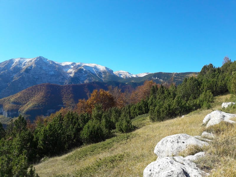
Fonte Carlese
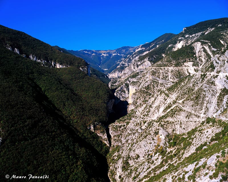
Classic circular excursion along the ridge with wide views of the surrounding peaks and with the presence of large beech woods. Having parked the car near the Bocca di Valle fountain, start climbing on the left, following the indication F2, until you reach Piana della civita at an altitude of 804 m. Continue along the plain, then leave path F2 which leads to the San Giovanni waterfall and proceed straight ahead towards Pietro Cioppo at an altitude of 1638 m. Leave the path that leads to Pomilio and continue on the right along a path that is not very obvious, until you reach Fonte Carlese, where you can admire the valley in all its breadth. After having refreshed yourself at the spring, you begin to descend along path F1 which leads to Bocca di Valle, passing through Campanaro, Valle delle Monache and Piana delle Mele.
The valley
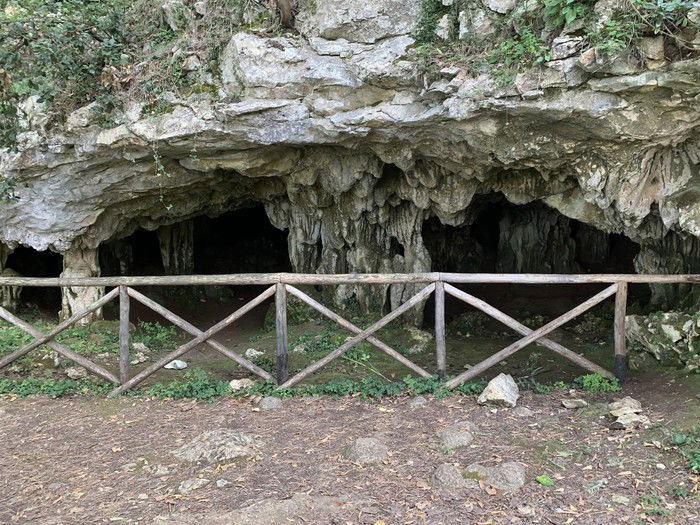
Classic excursion in the lower valleys of the Maiella characterized by thick pine forests which, especially in the summer period, offer an incomparable coolness. On the way back it is possible to admire the Grotta dei Pulcini where you can admire stalactites and stalagmites. The itinerary of the excursion starts from Bocca di Valle, from the car park at the crossroads for Piana delle Mele. Continue on the paved road towards rapino for one kilometre, until you arrive, on the left, at the crossroads for Forcatura. You begin to climb and at an abandoned quarry, turn left along a clear cart track, ignoring the one on the right. Go through the pine forest until you take the cart track again on the right which leads to the Ornello spring. After a well-deserved break at the spring, you begin to climb to the left, along path E1, until you meet the road that leads to Valle Monache. Going all the way and, having arrived at the site, take path F5 until you reach the valley where the Vesola stream flows. Then go back towards Valle delle Monache and from here take path F1 which leads to Piana delle Mele. Then follow the signs for the Grotta dei Pulcini which is less than a kilometer from Piana delle Mele. Descend towards the cart track until you meet the paved road and, once you have crossed it, take the path which, with several small hairpin bends, leads back onto the road and from here, to the left, to the starting point. The excursion does not present particular difficulties or exposed points.
Nuns Valley
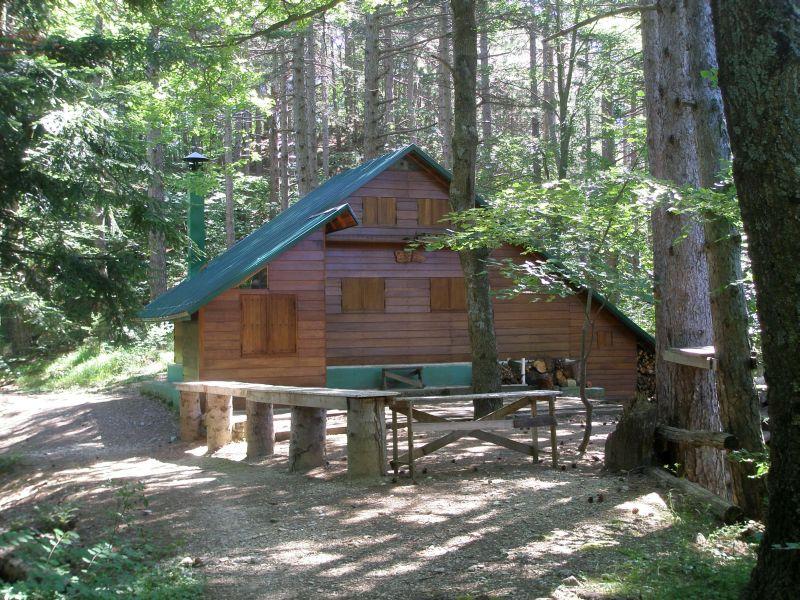
The Valle delle nuns can be reached both starting directly from the upper parking lot of Piana delle Mele and starting from the Fontanella di Bocca di Valle. In the first case, following path F1, you can continue along the dirt road, a very gentle, wide and not very tiring climb that allows you to reach Valle delle Monache in less than half an hour. Once you arrive, you will find the Alpine hut, a picnic area and a fountain. Instead, starting from the path that begins to the right of the Fontanile di Bocca Di Valle, continuing on the same you reach, on the right, a small bridge after which you continue for a 20-minute zig-zag climb until you reach Piana delle Mele and from here take path F1 which leads to Valle Delle Monache.
Balzolo – Grotta dell'Acqua picnic area – Linaro:
From the square of Balzolo, take the easy dirt road which, after the tunnel, introduces us into the fascinating landscape of the Avella river valley, continue on the road reaching, after a short climb, the "tre cantoni" locality. After passing a high tunnel, the road descends almost along the river and after passing the "brick cave", you arrive at the large bifurcation between the "vallone di Selvaromana" and the "vallone delle tre grotte". Among the coolness of the wood, you reach the picnic area of "Grotta dell'Acqua" (930 m asl), an area equipped with tables, cooking point and fountain. Going further up you reach “Linaro” (1100 m asl), where the road ends. Travel time is three hours, plus return.
Balzolo – Humps of Selvaromana – Blockhouse:
Following the itinerary described for "Linaro", after the picnic area "La Grotta dell'Acqua", ford the river and, going slightly uphill, cross the wood, passing through "Grotta Remora" and, following the path on the left, you reach the “Grotta del Vento” from where, with a steep descent, you reach the riverbed. Following the path between the narrow walls of the valley, you pass the entrance to "Valle dell'Inferno", reaching the "Piana dei Faggi". Still, along the river path, between the snowfields and the high walls of the Morelle, after "la Mucchia", you leave the valley on the eastern side of "Monte Cavallo". Enter the lily of the valley in a northerly direction until you reach path G2 on the crest of "Monte Cavallo". Continue halfway up the G2 path up to the "Blokhaus" road, passing by the shepherds' shelter of "Grottilicchia".