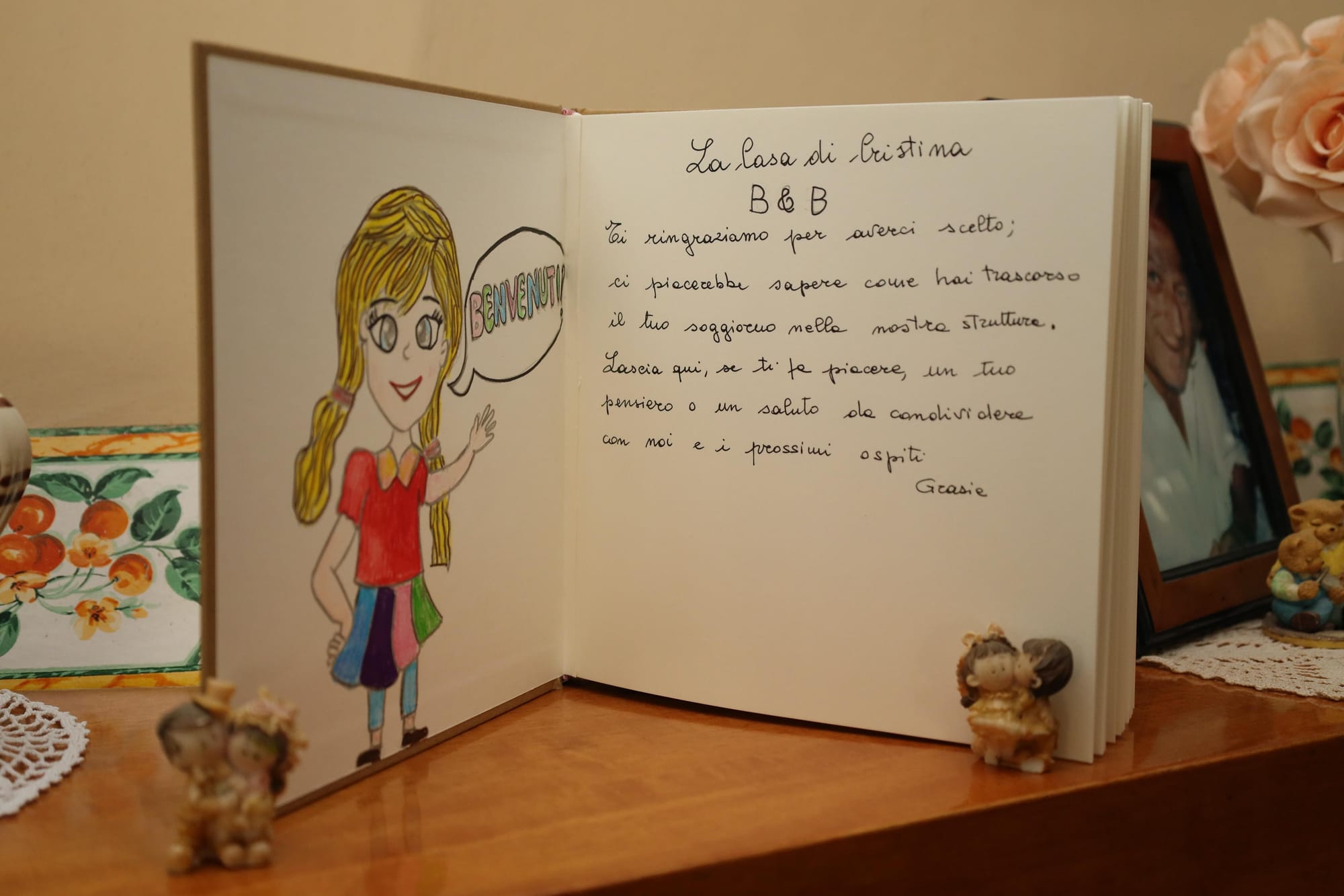
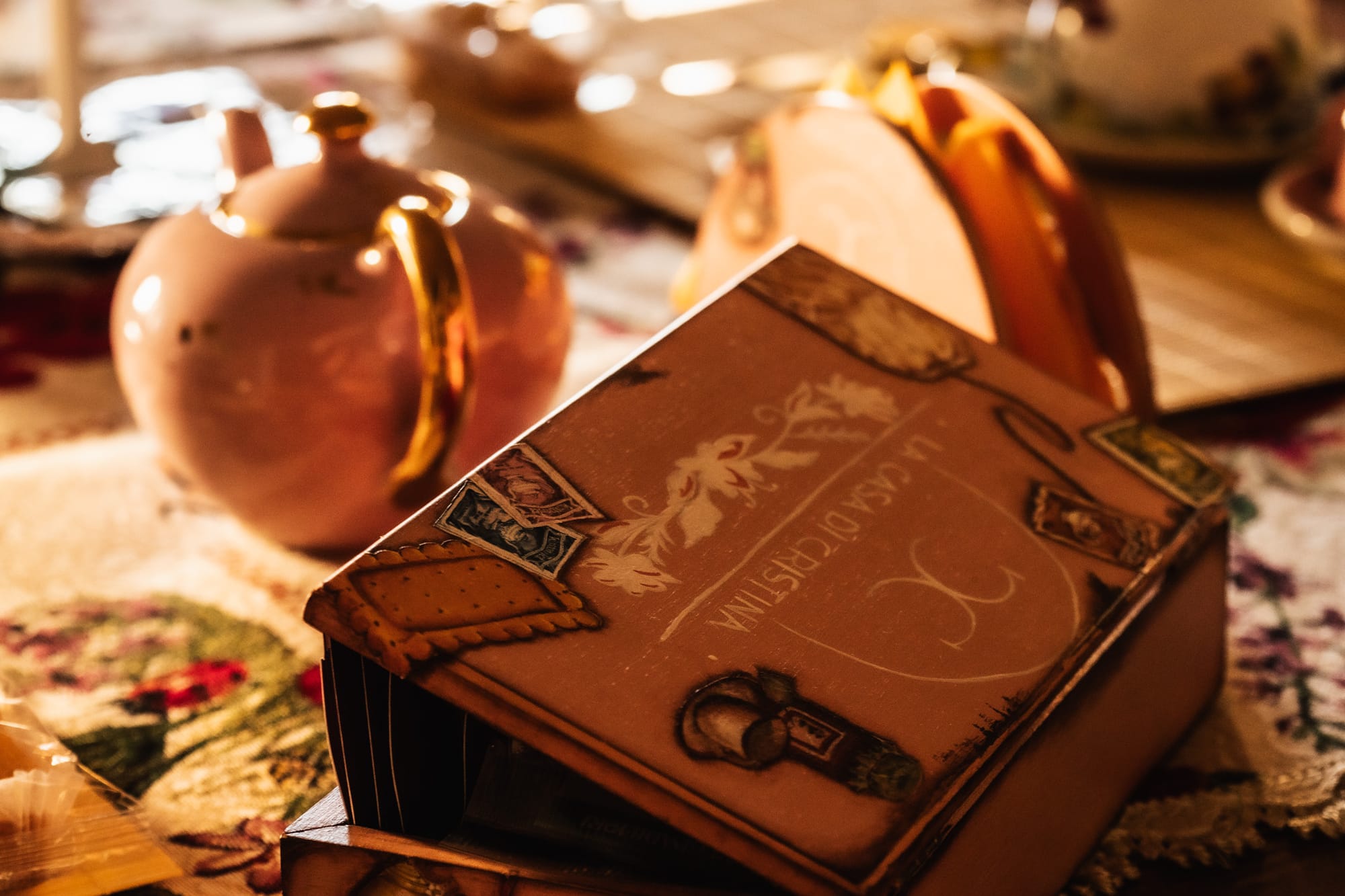
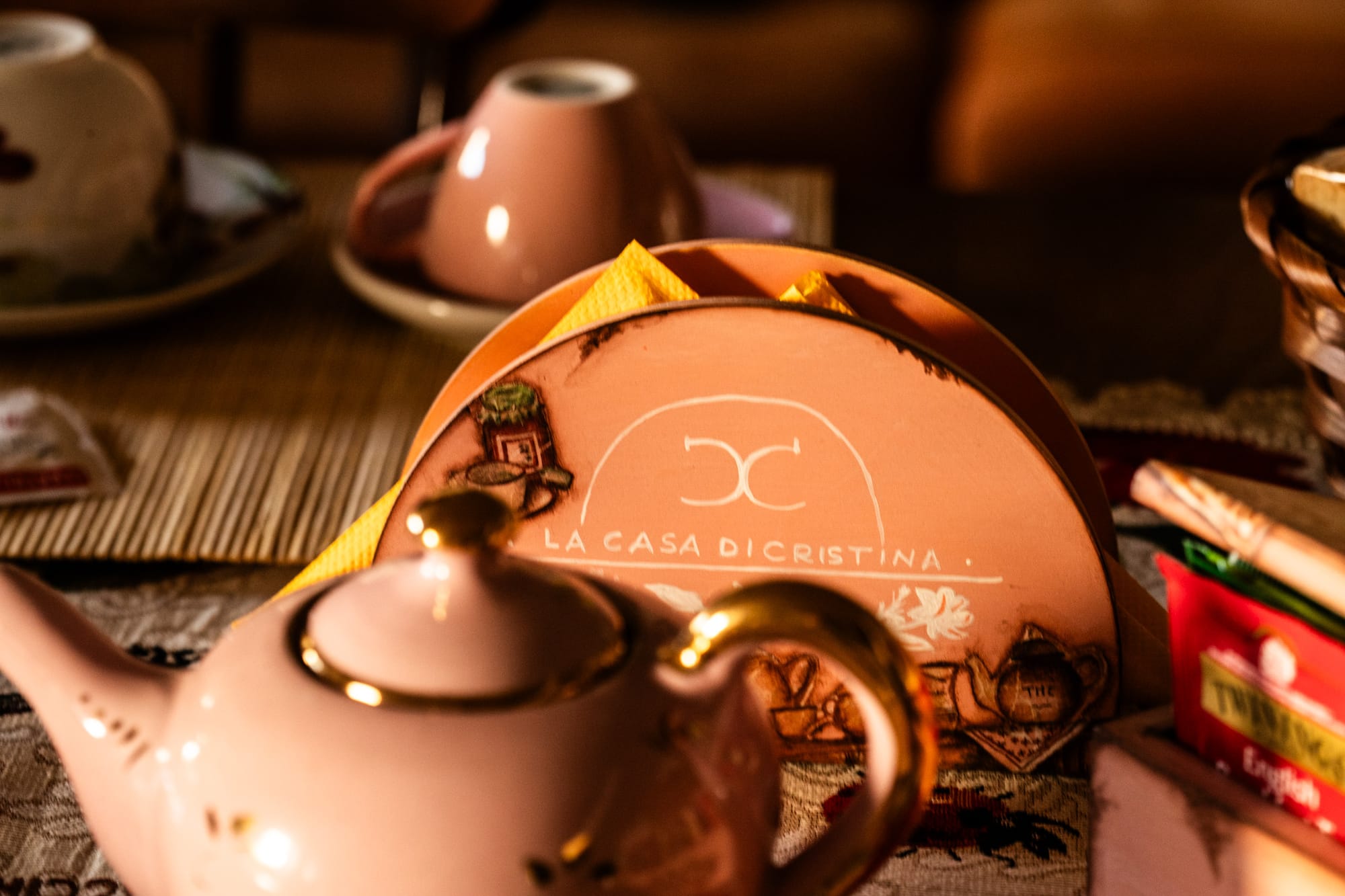
welcome !!!
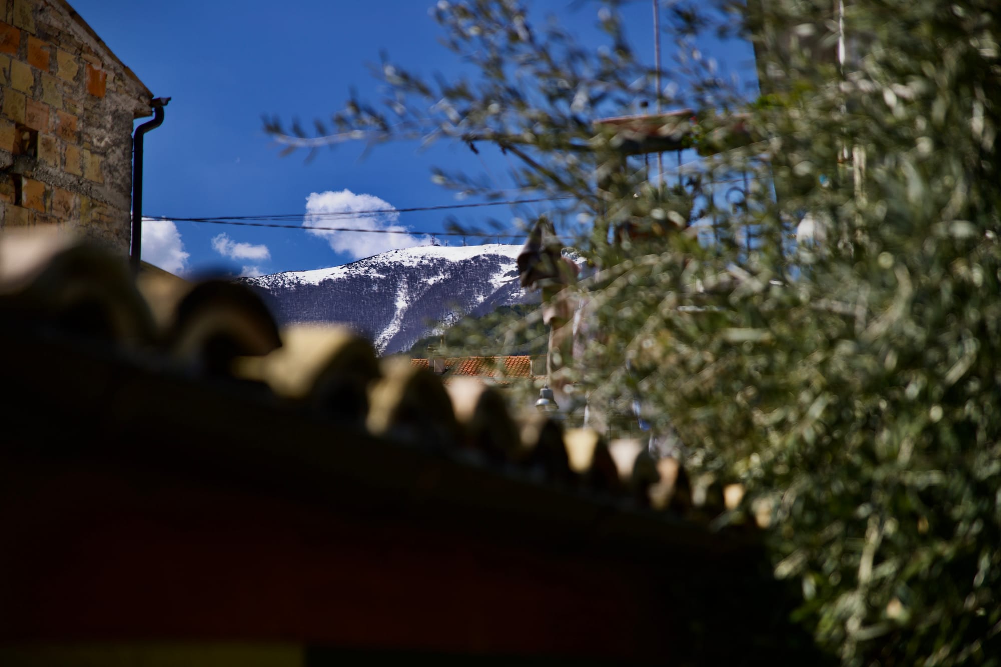
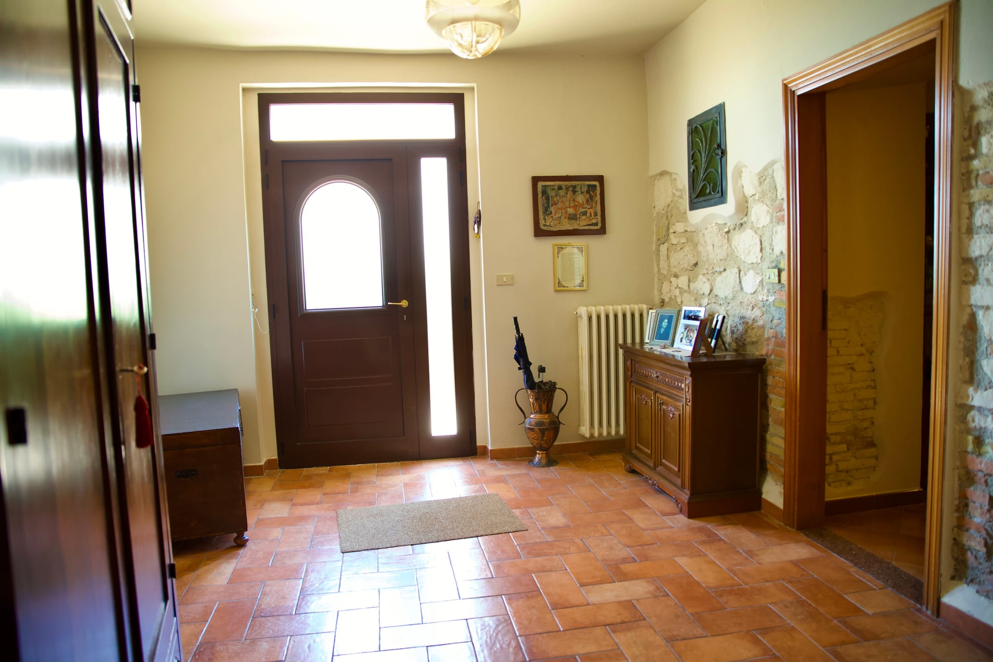
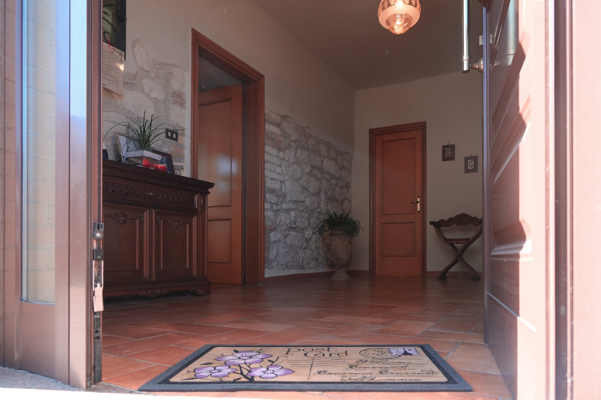
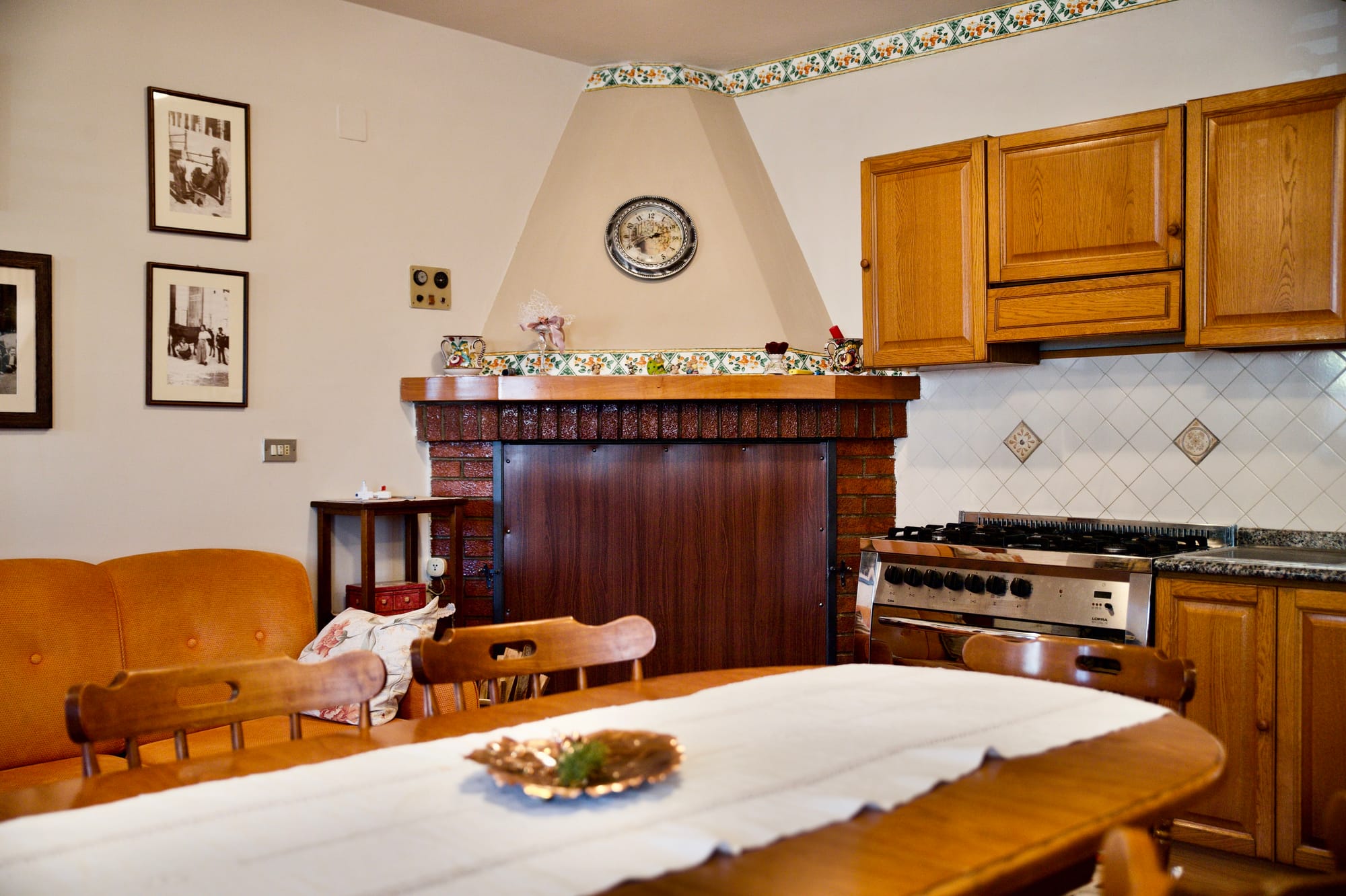
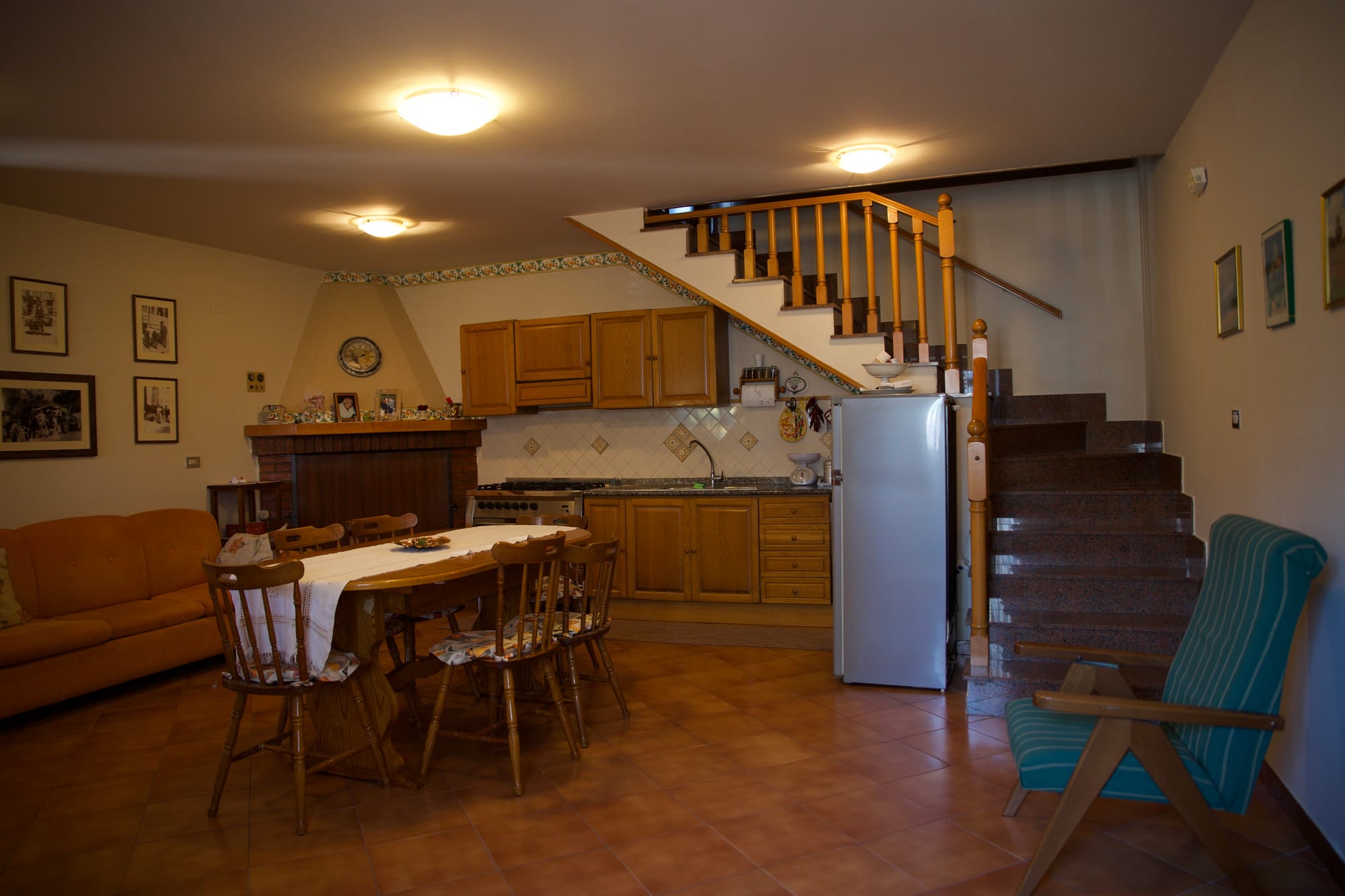
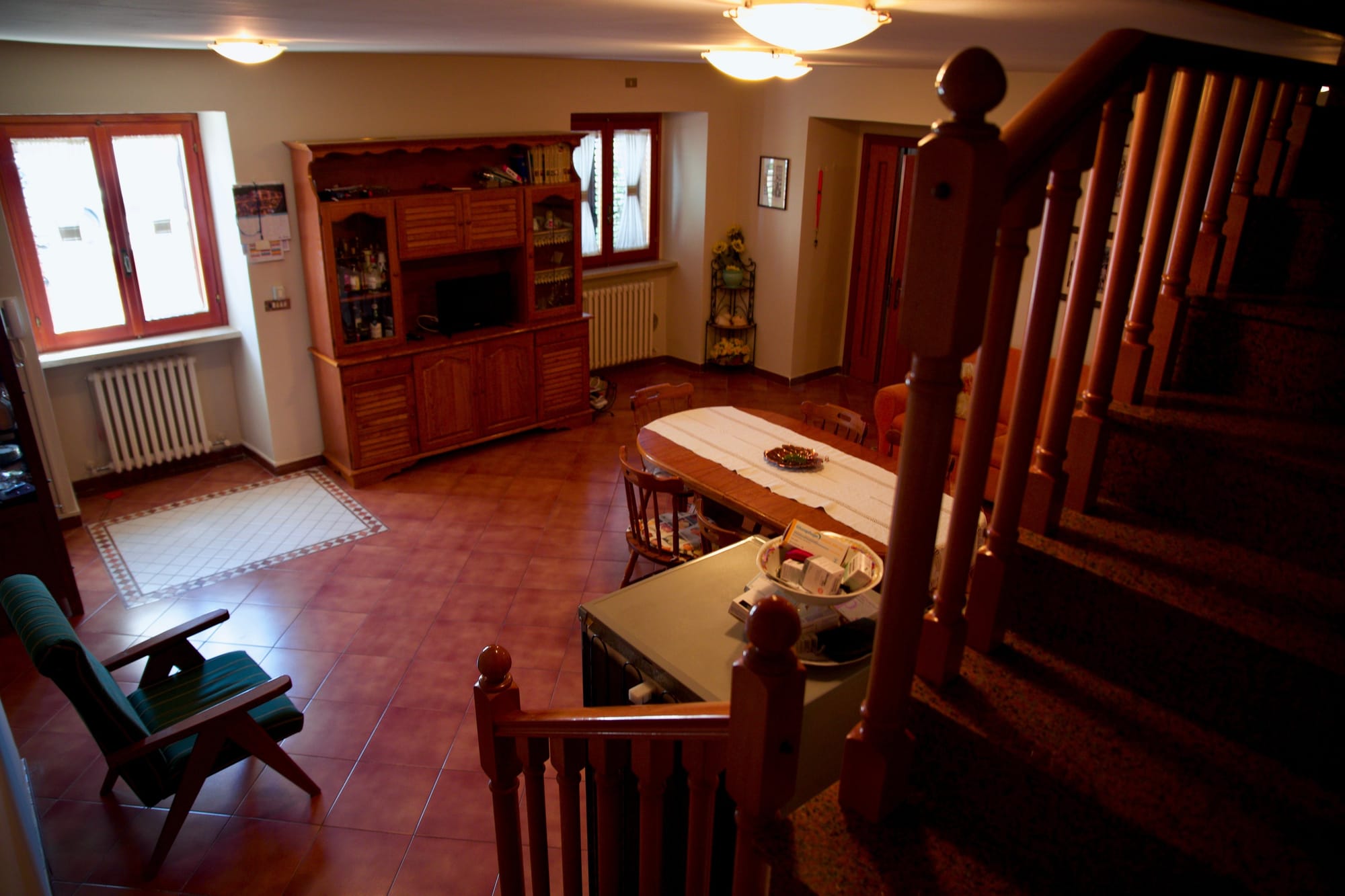
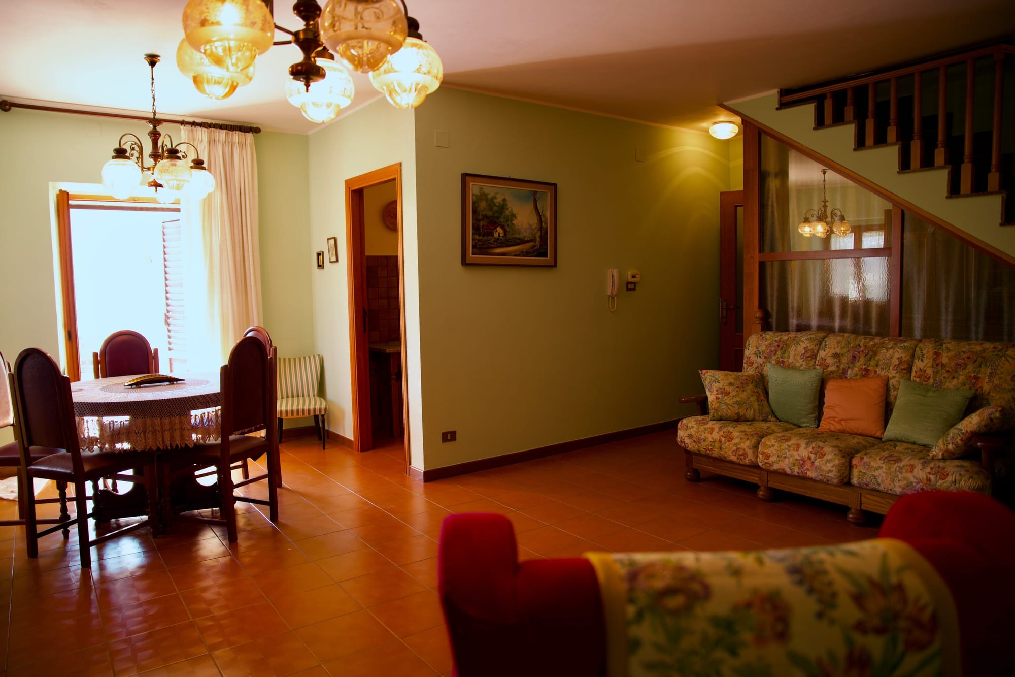
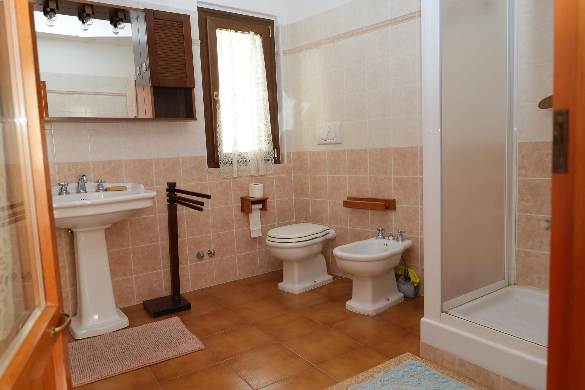
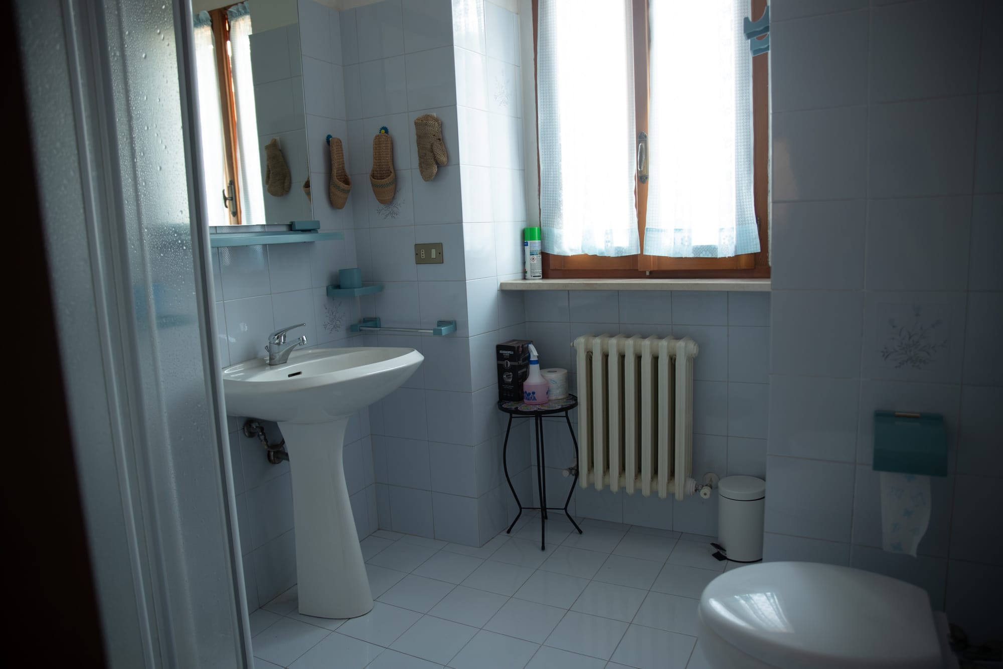
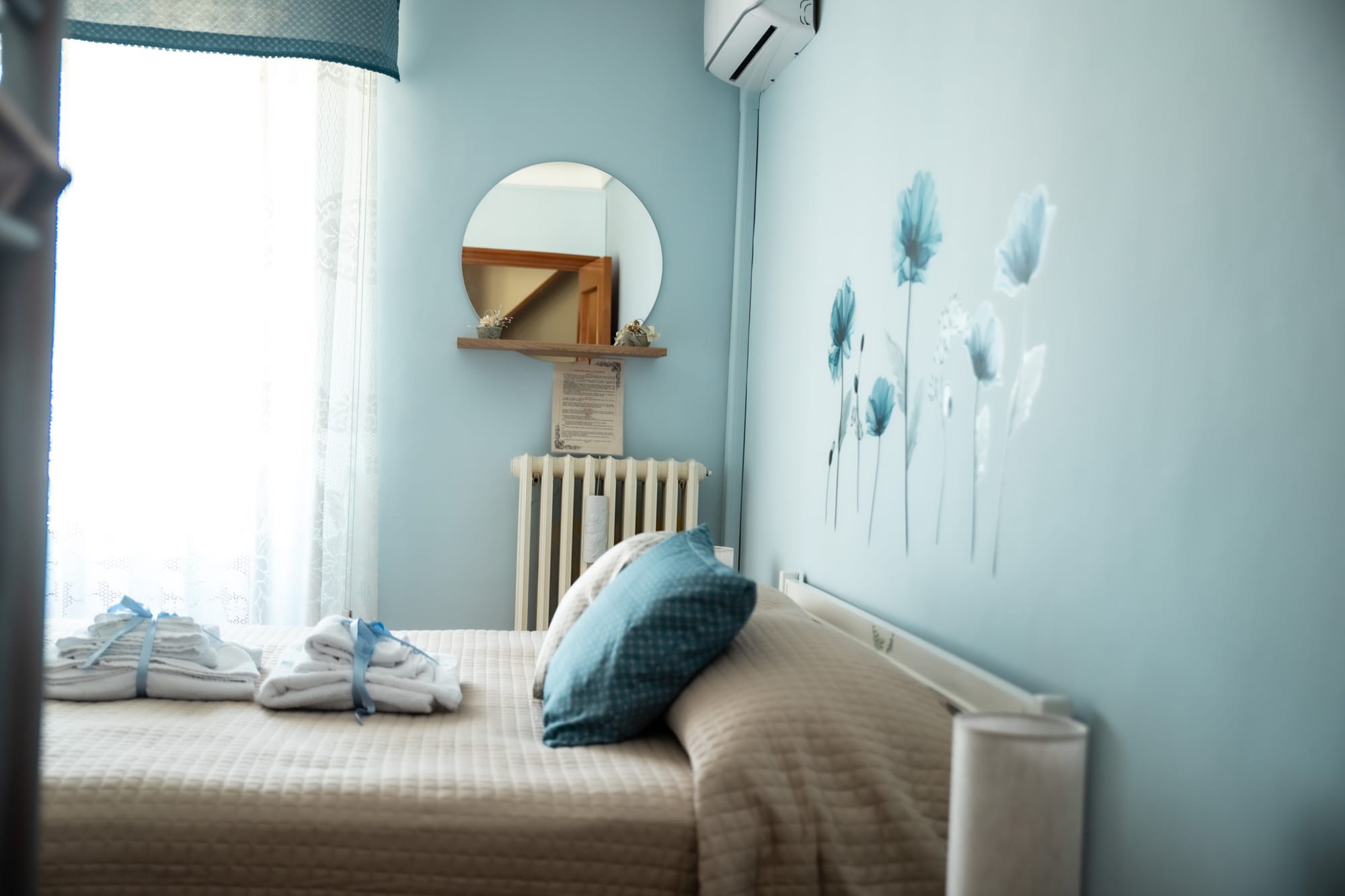
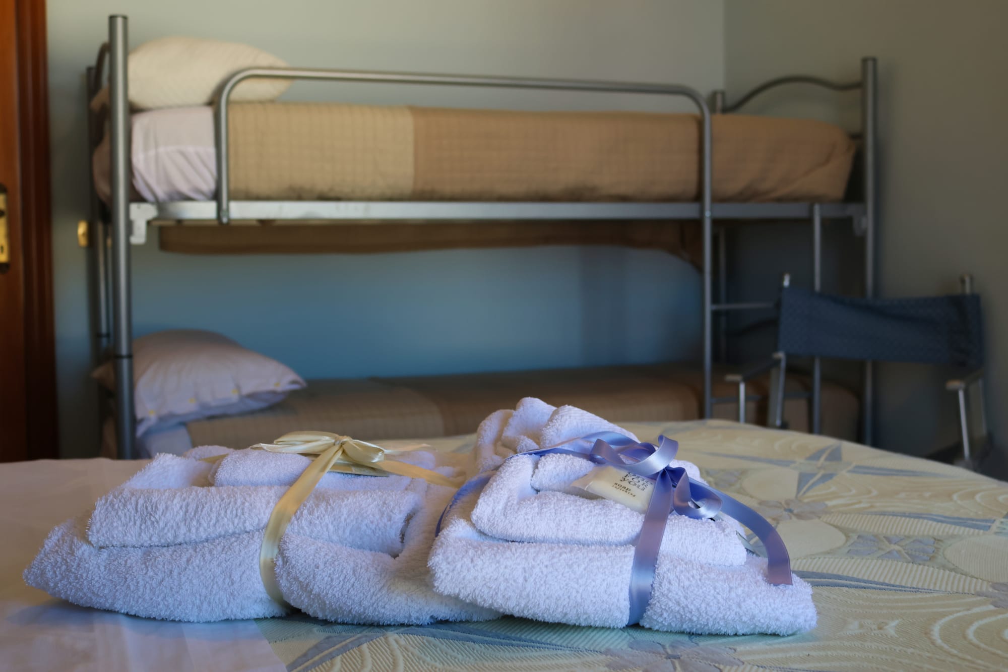
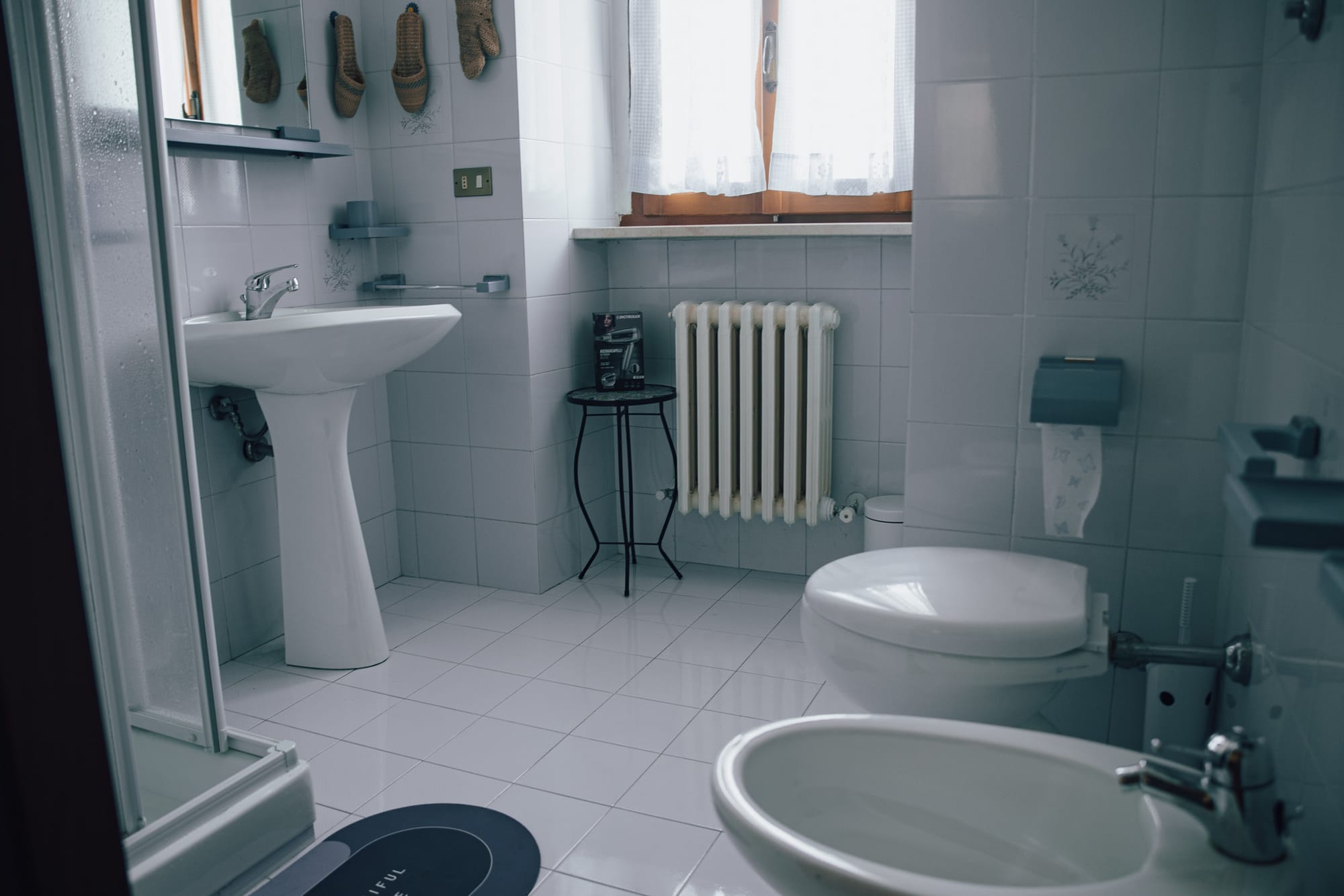
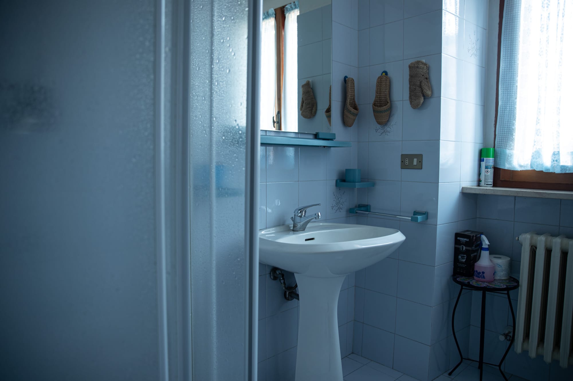
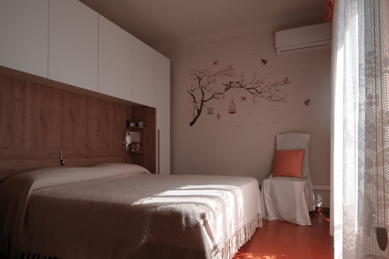
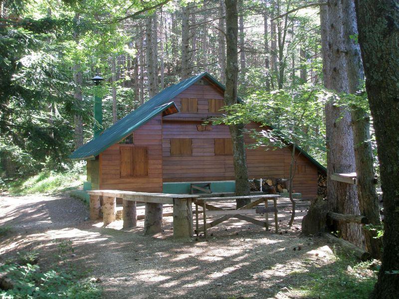
The structure is spread over three levels: on the ground floor there is a spacious kitchen where a do-it-yourself breakfast is offered, included in the price, on the first floor there is a double bedroom with bathroom included and a large balcony where it is possible to admire the panorama montano, on the second floor, however, there are two double bedrooms that share the common bathroom.
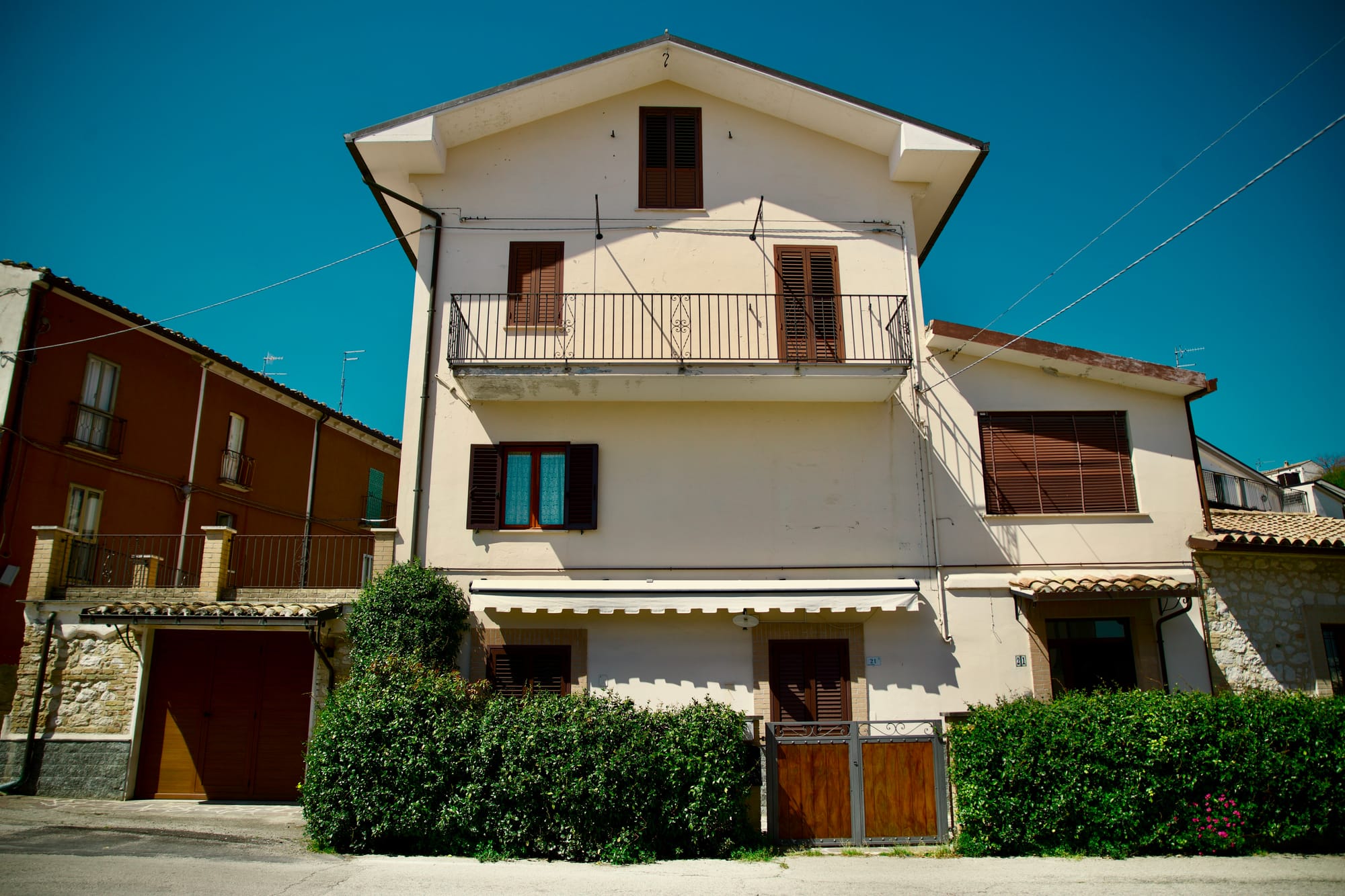
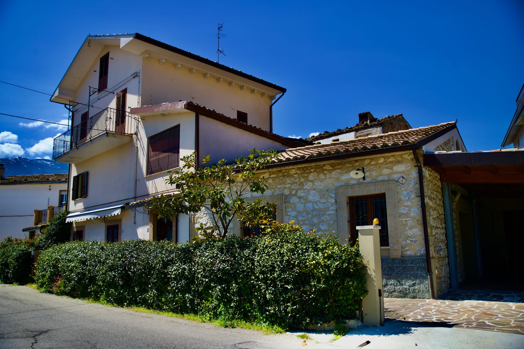
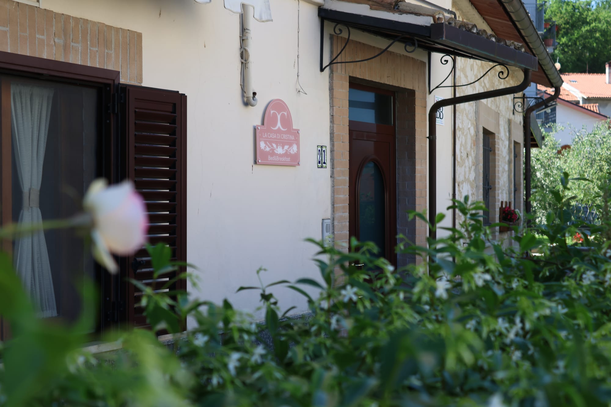
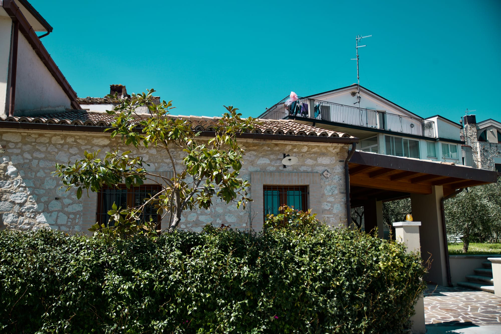
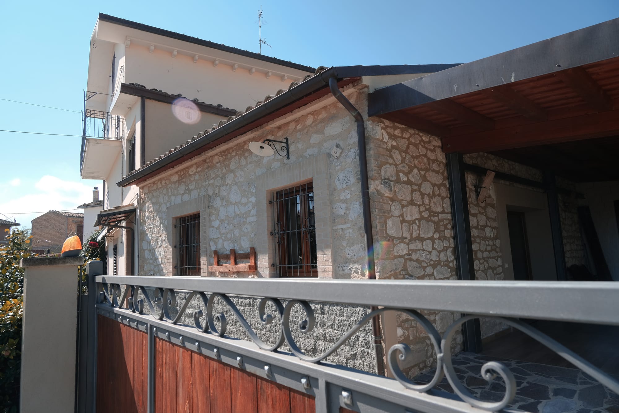
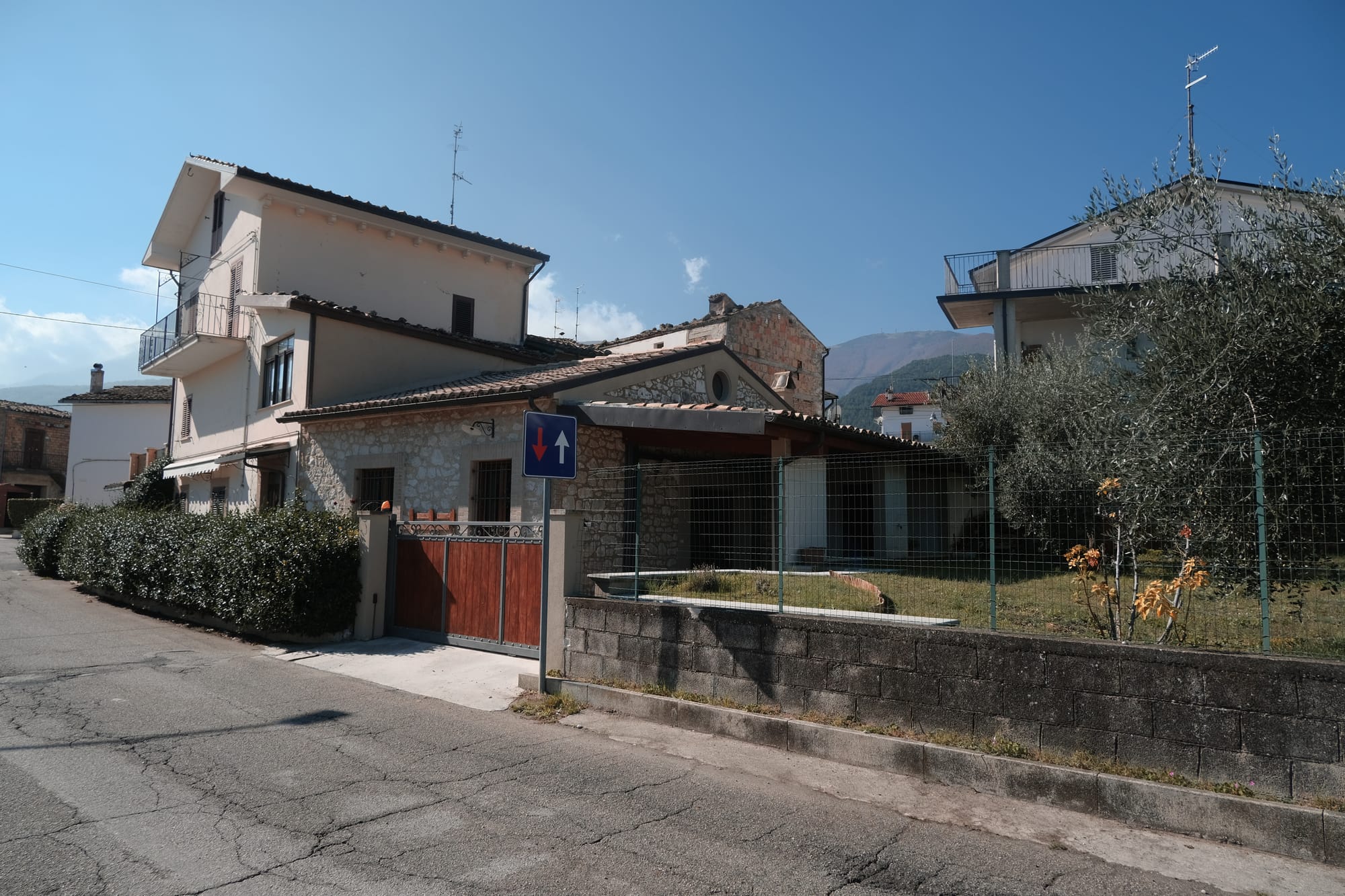
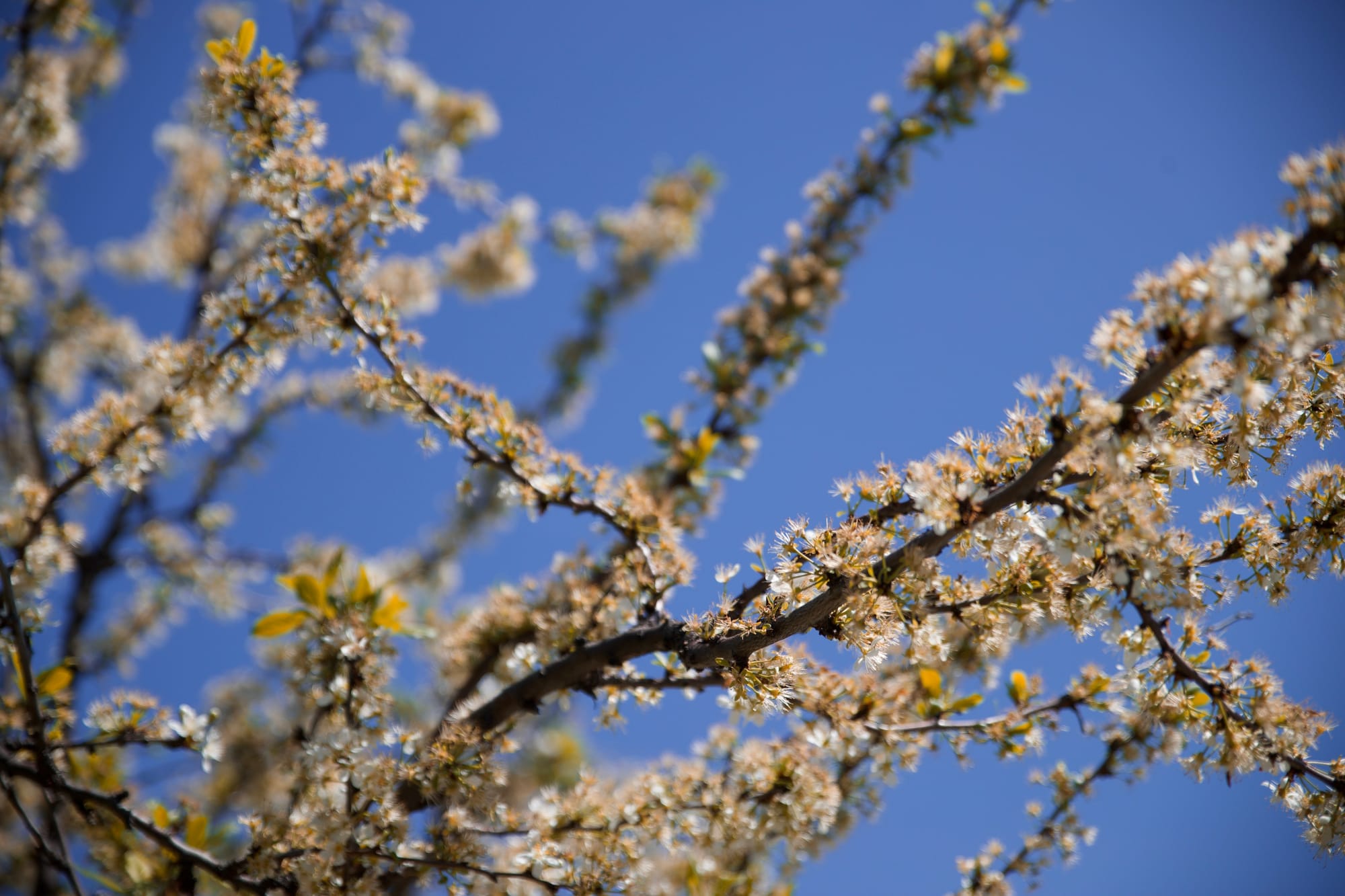
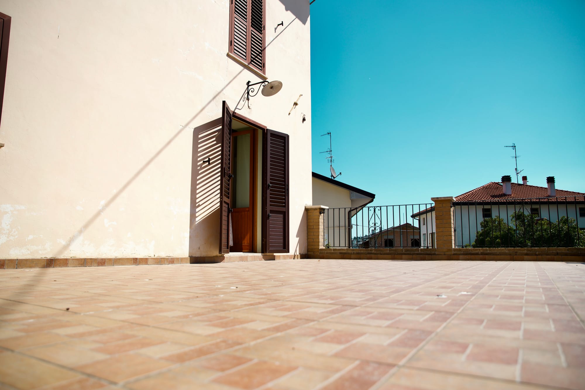
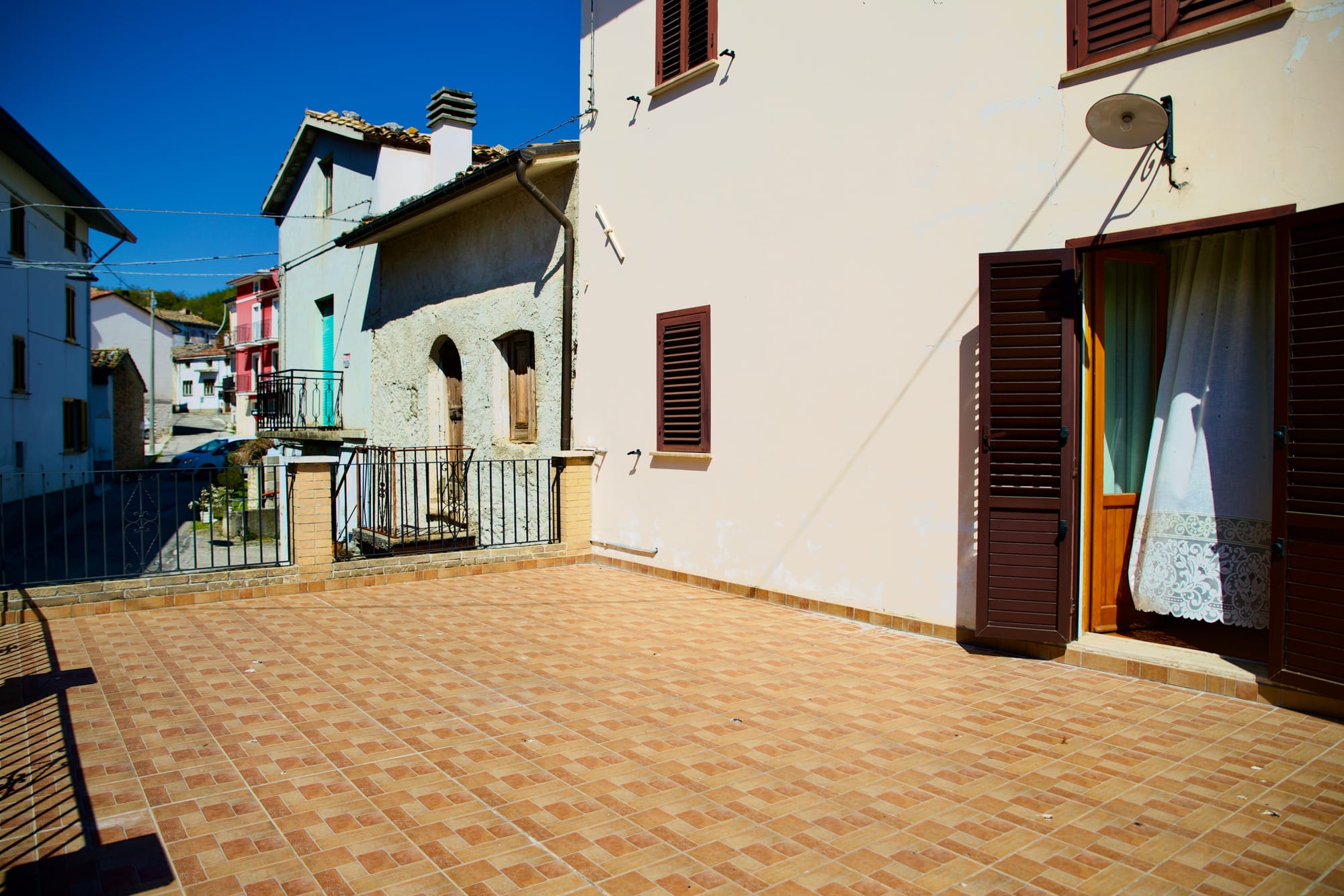
Located in Comino, a small district at the foot of the Majella in the Municipality of Guardiagrele, the B&B la Casa di Cristina enjoys a privileged position, being located a stone's throw from the mountain and five minutes from the historic center of Guardiagrele.
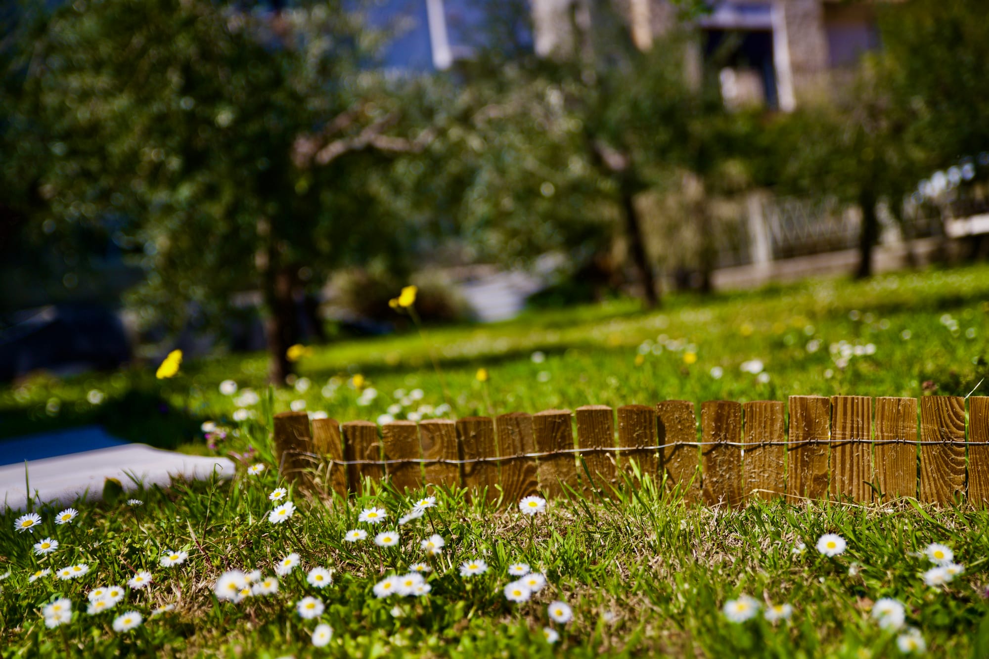
A simple and familiar residence, isolated from the hectic and frenetic city life, where you can spend your holidays, breathe the fresh mountain air and regenerate yourself before returning to everyday life.
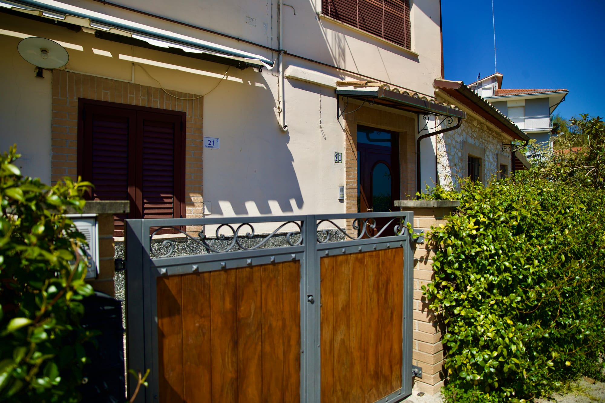
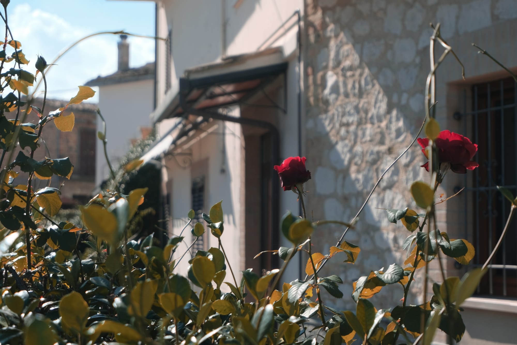
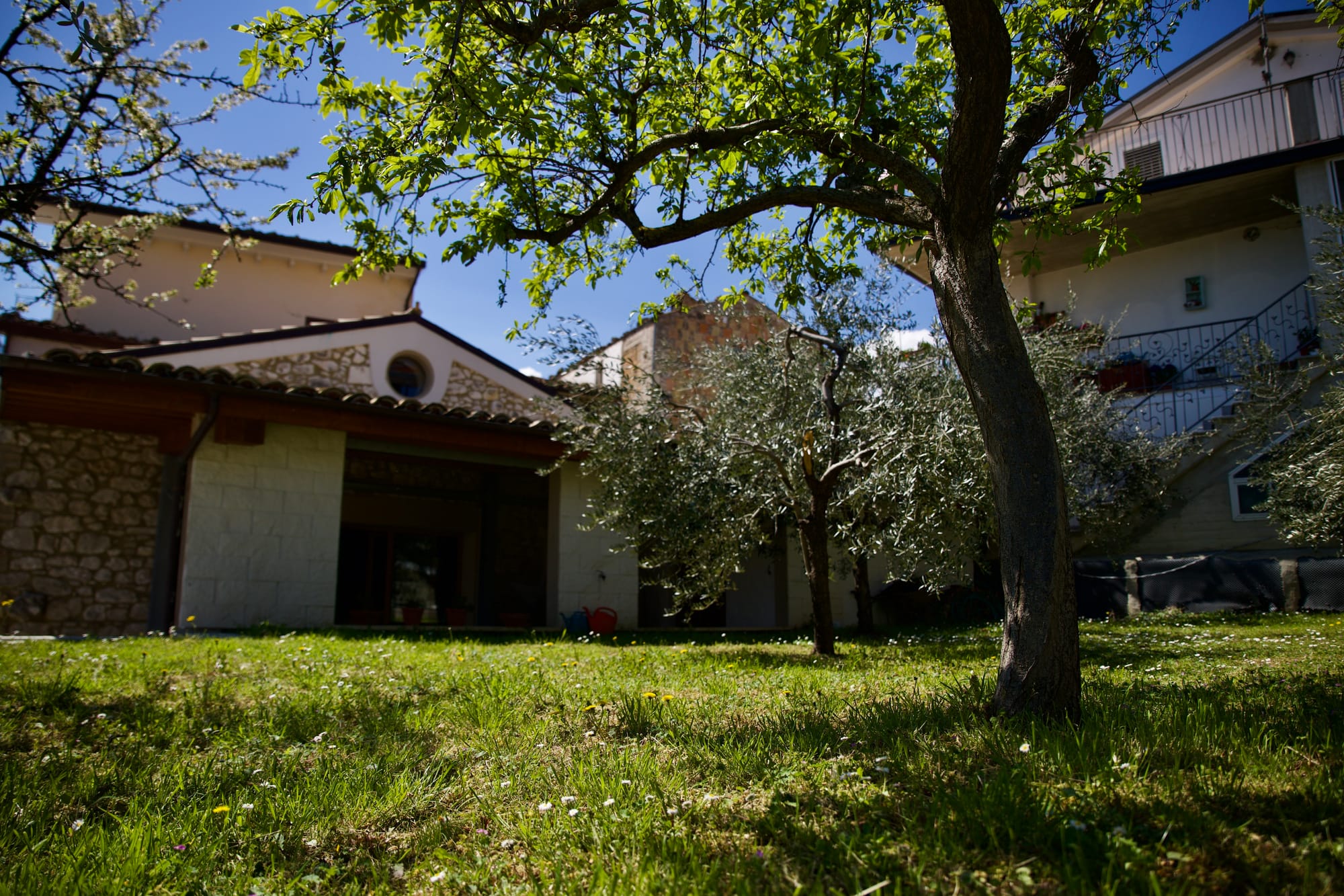
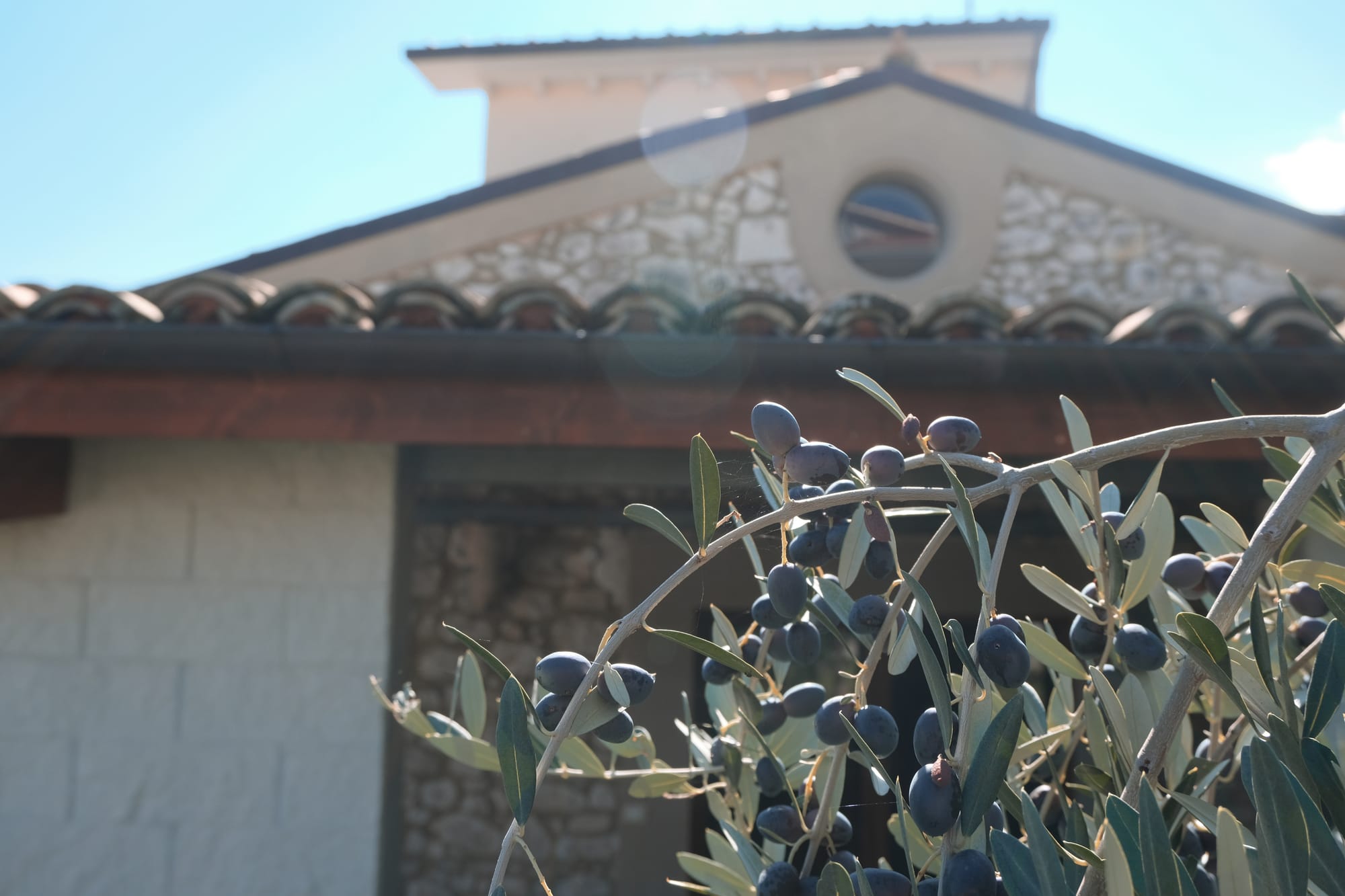
External photo

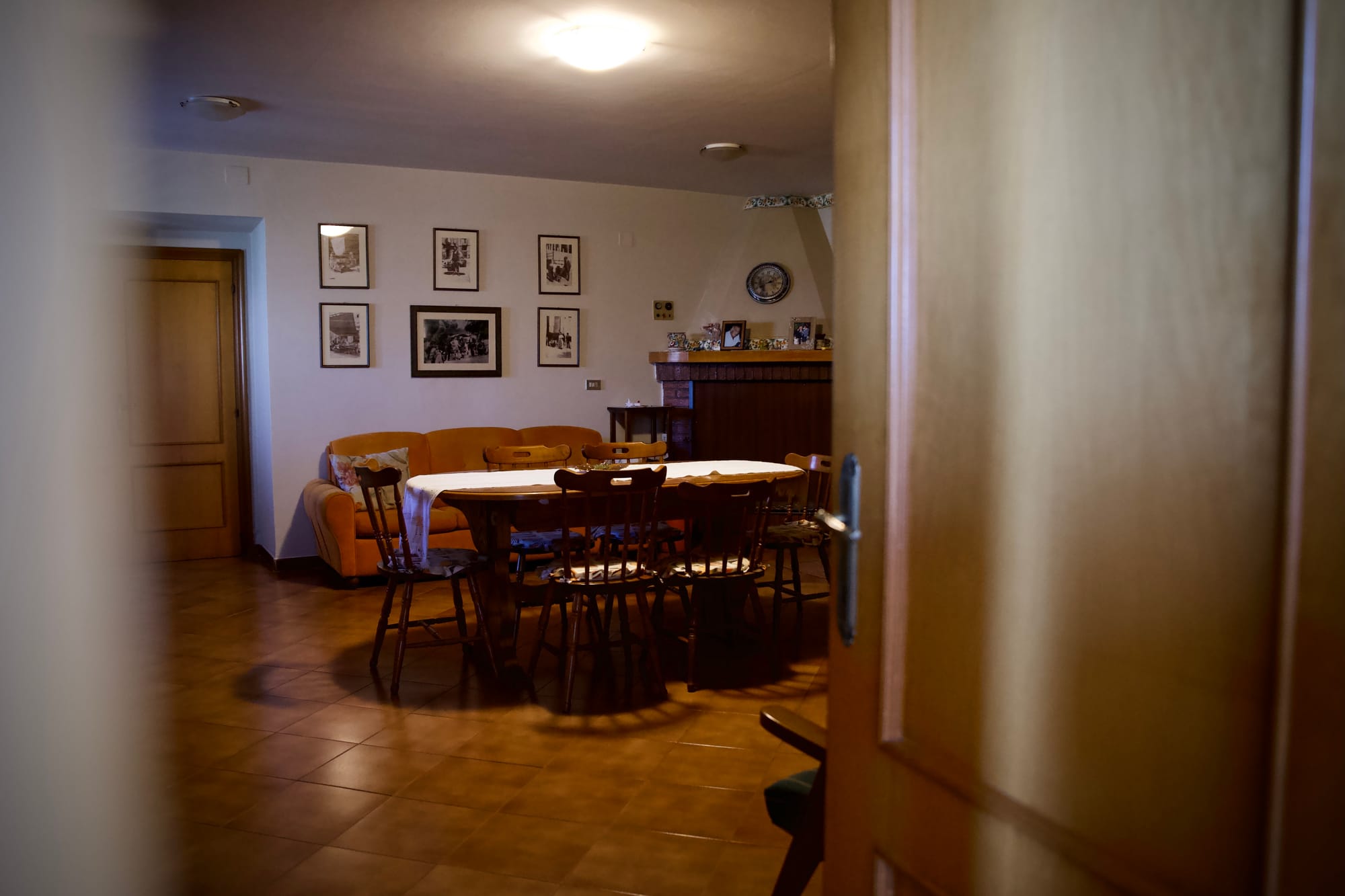
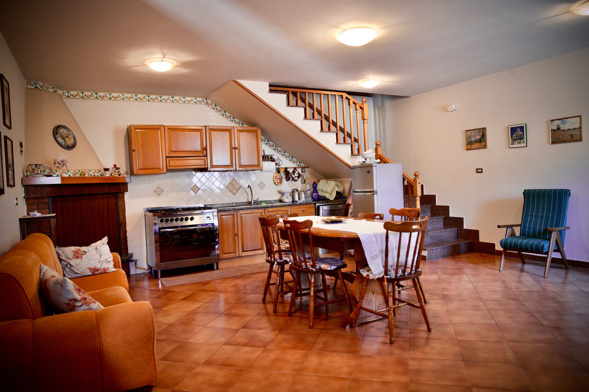
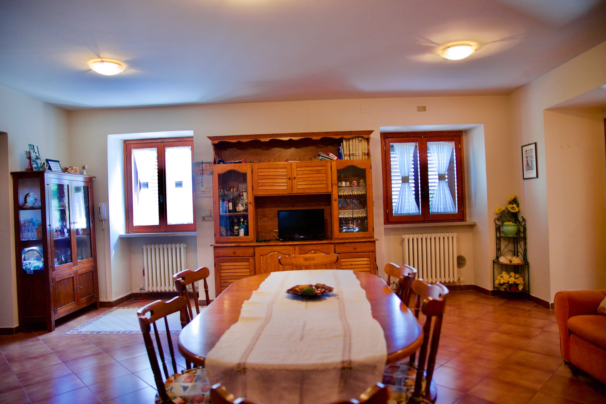
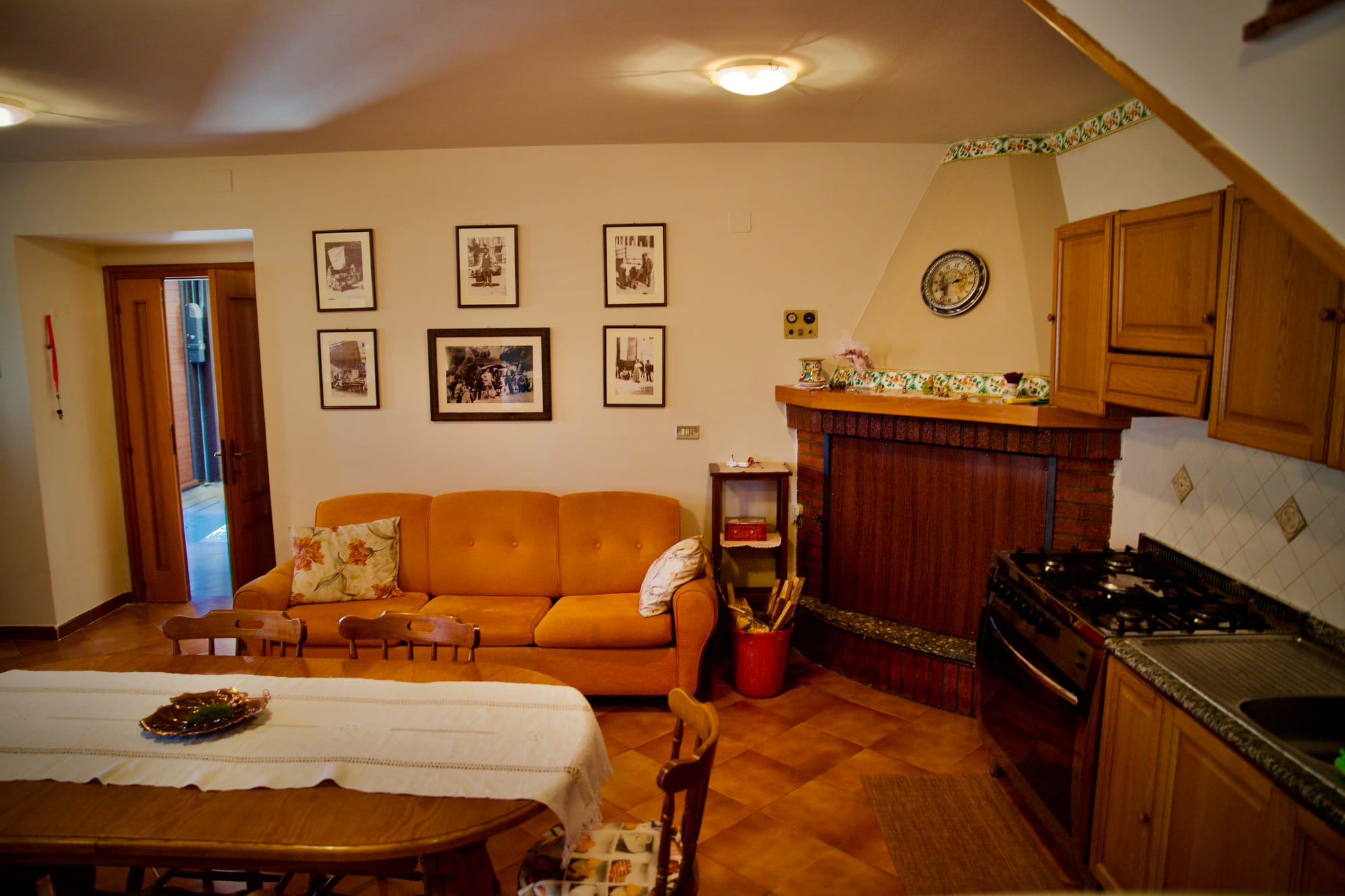
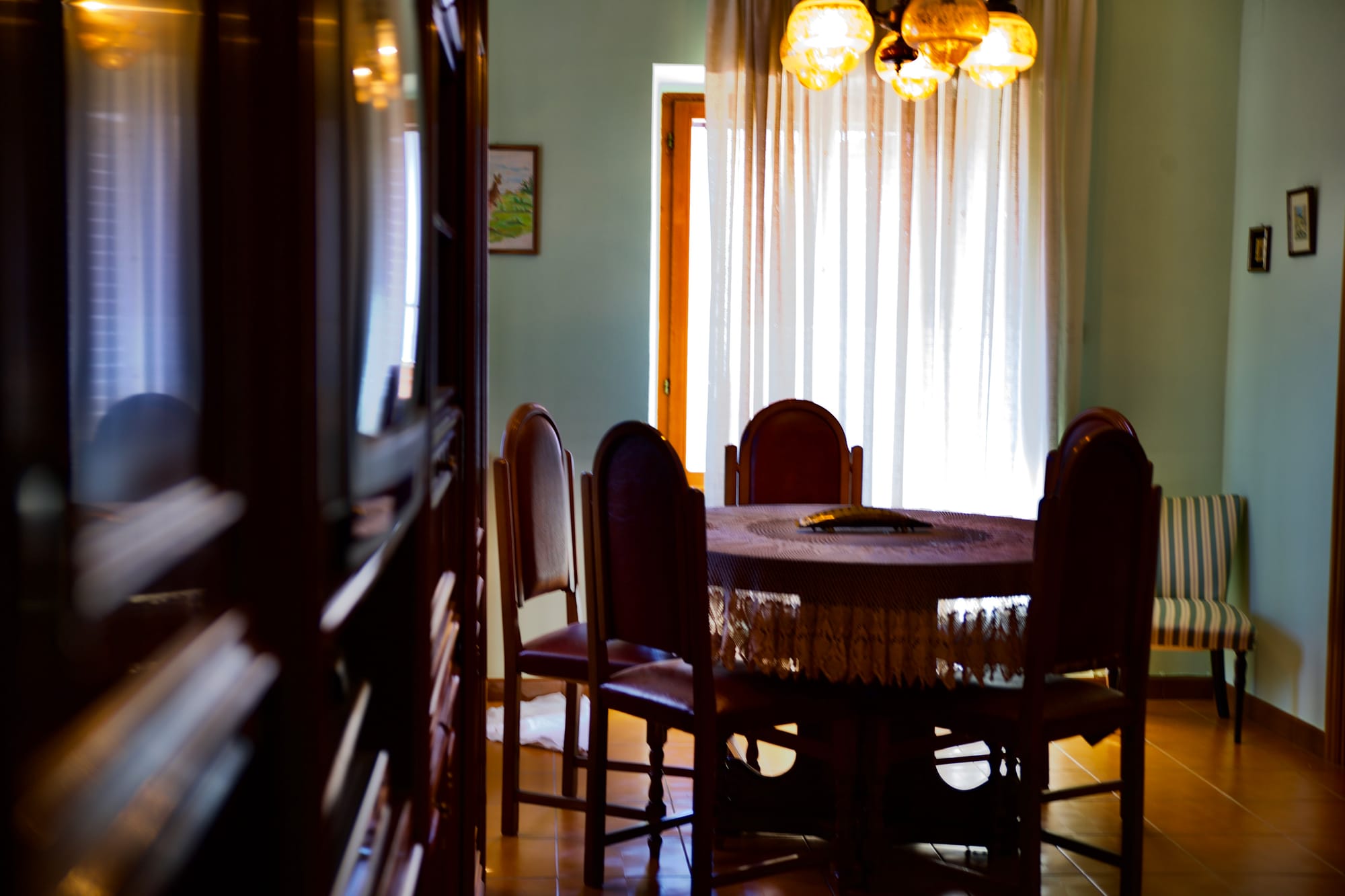
Internal photo


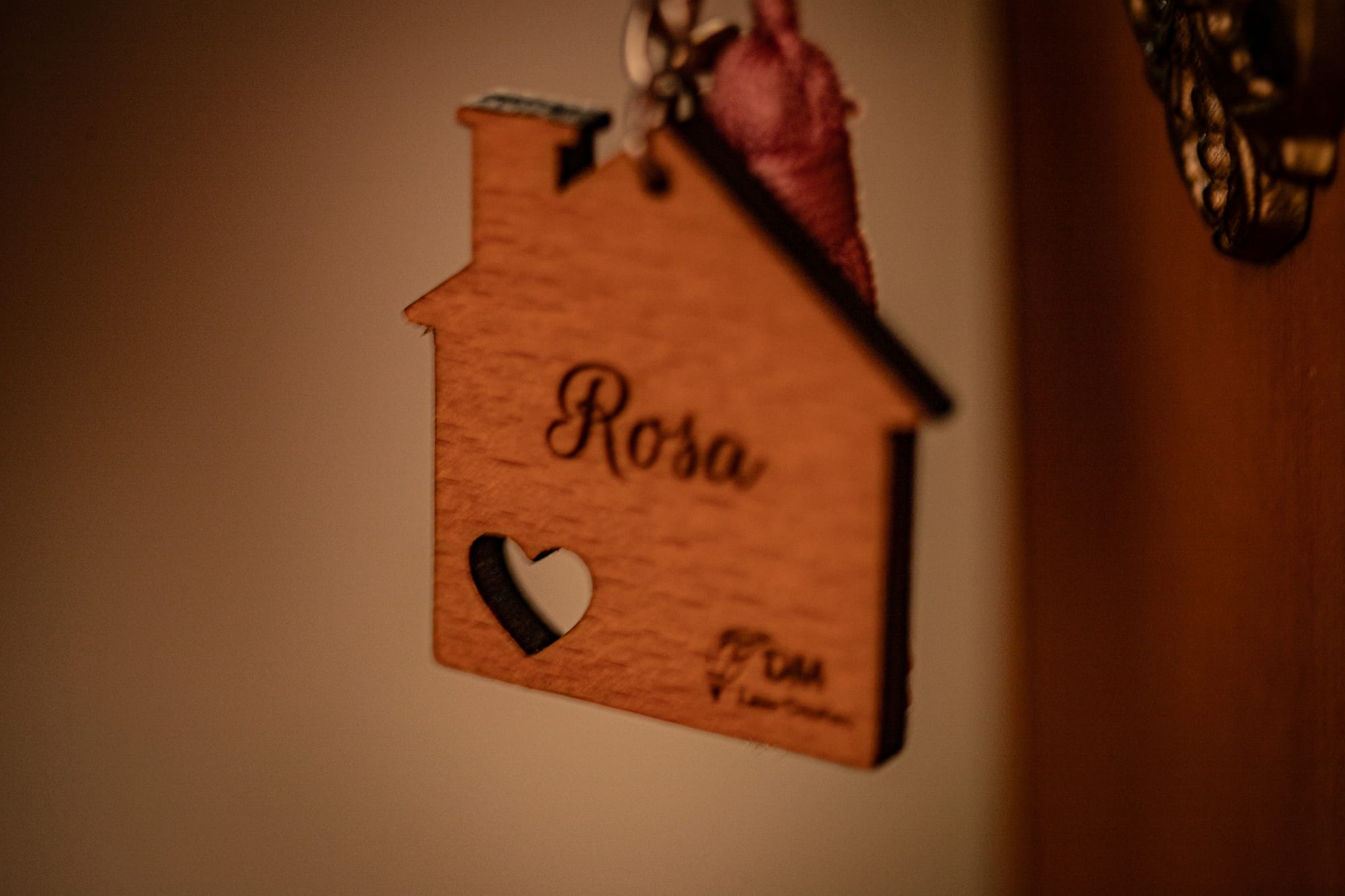
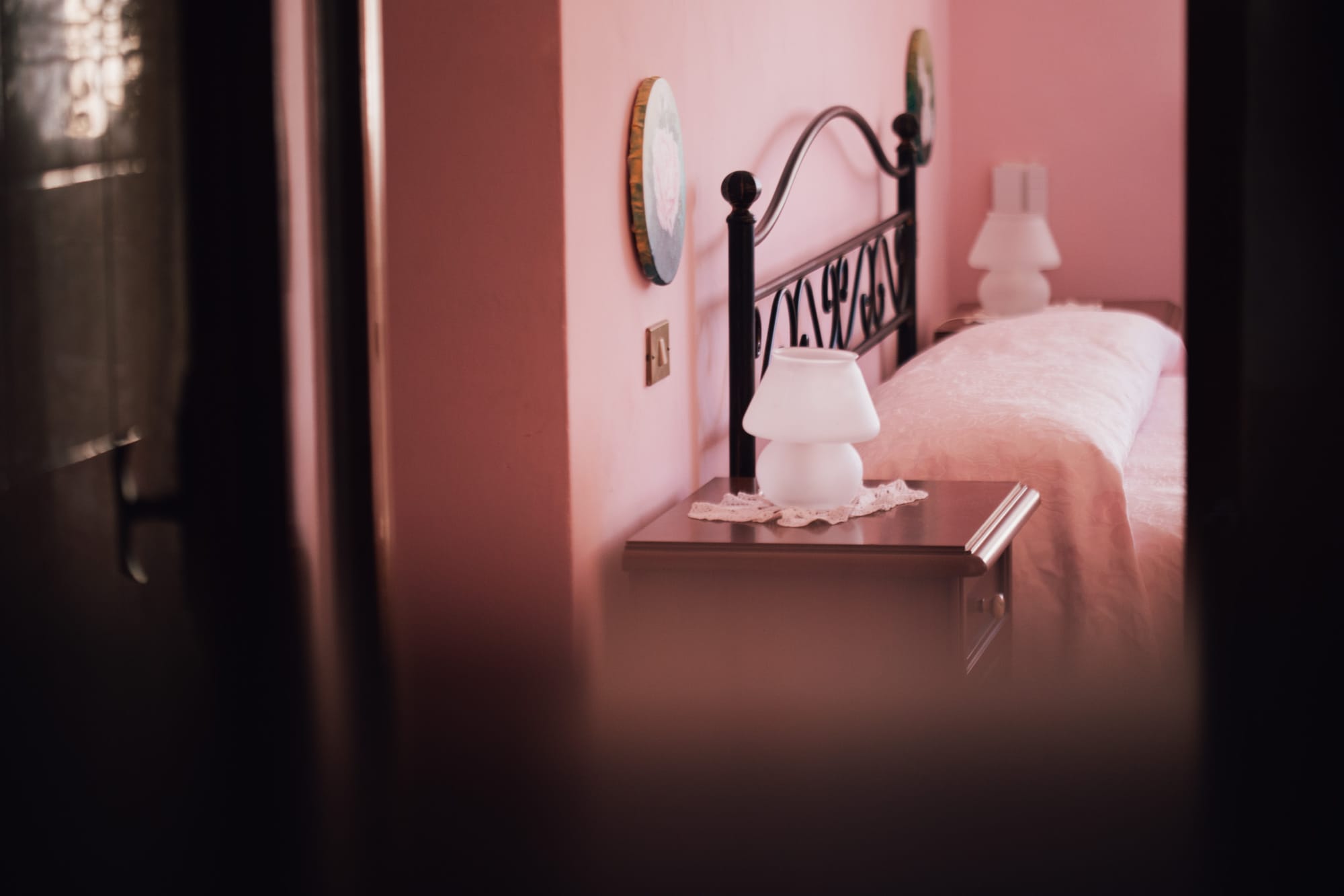
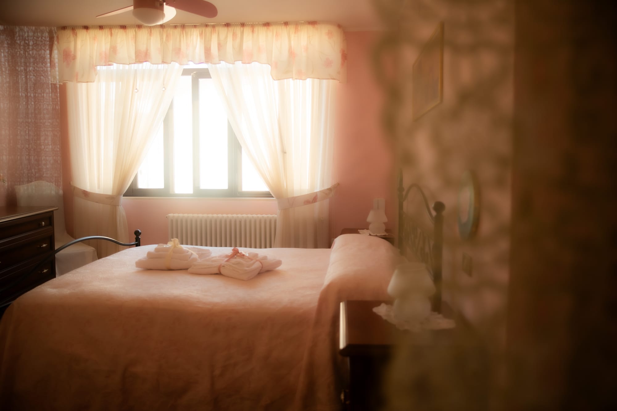
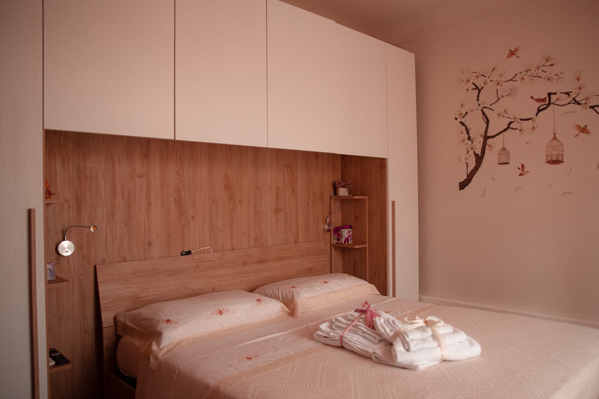
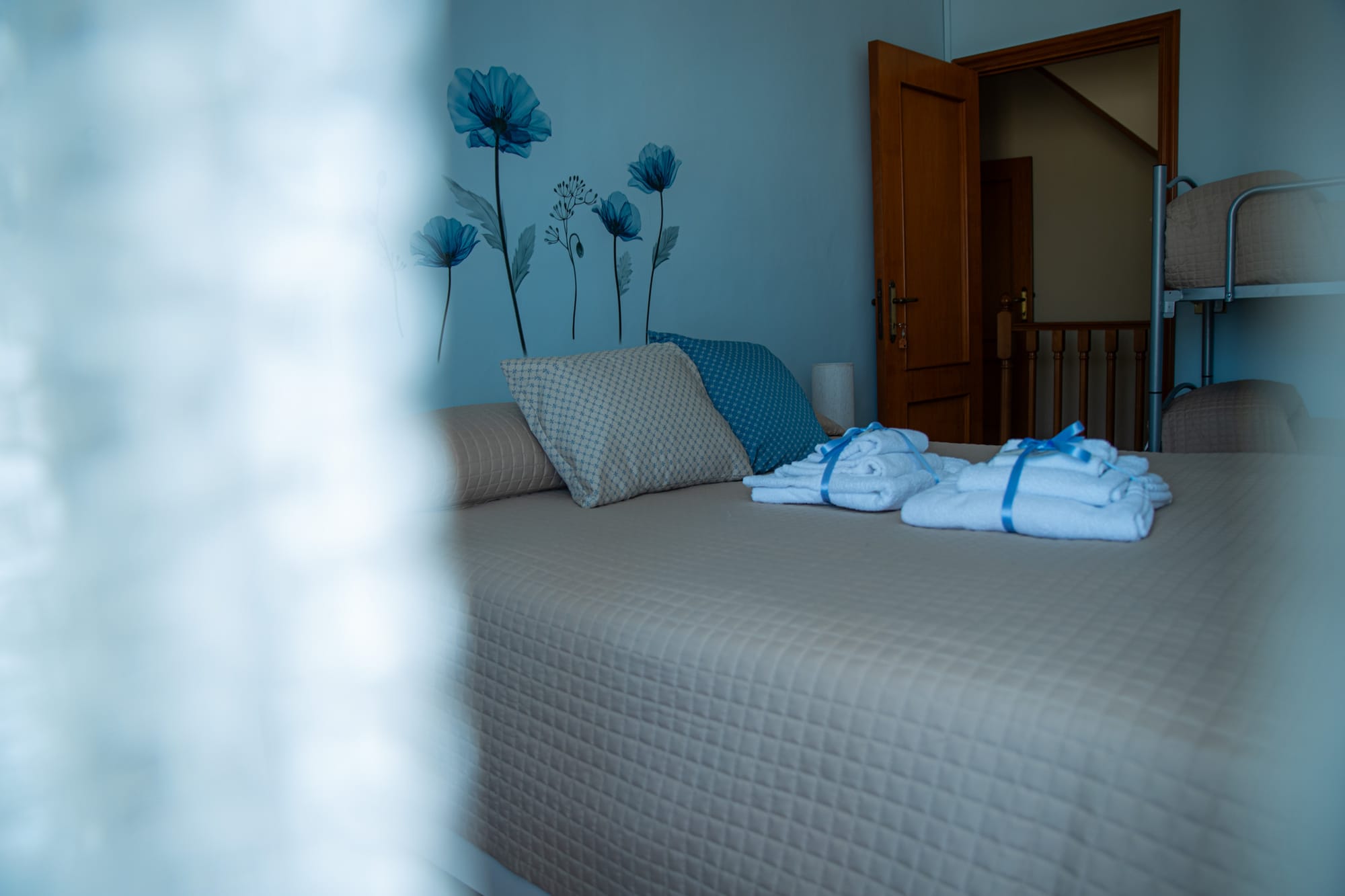
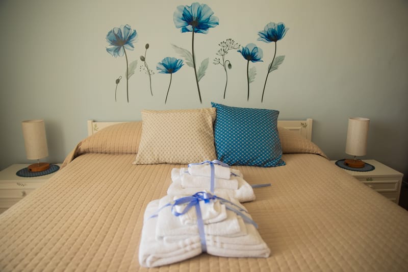
la ROSA
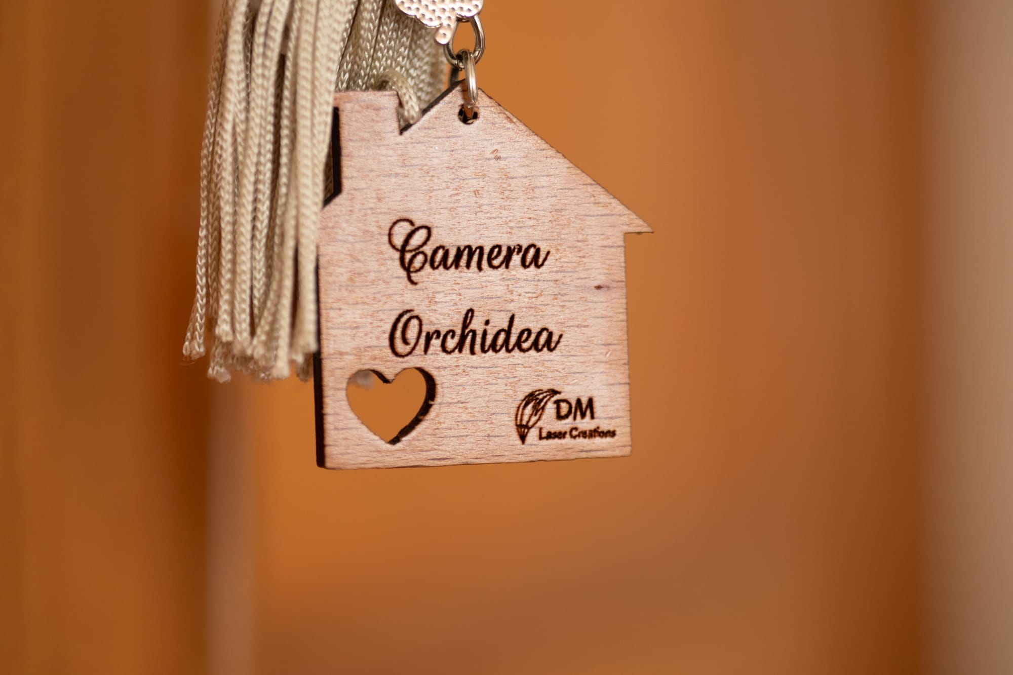
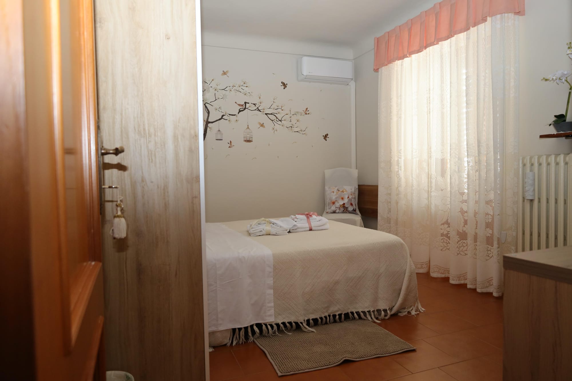
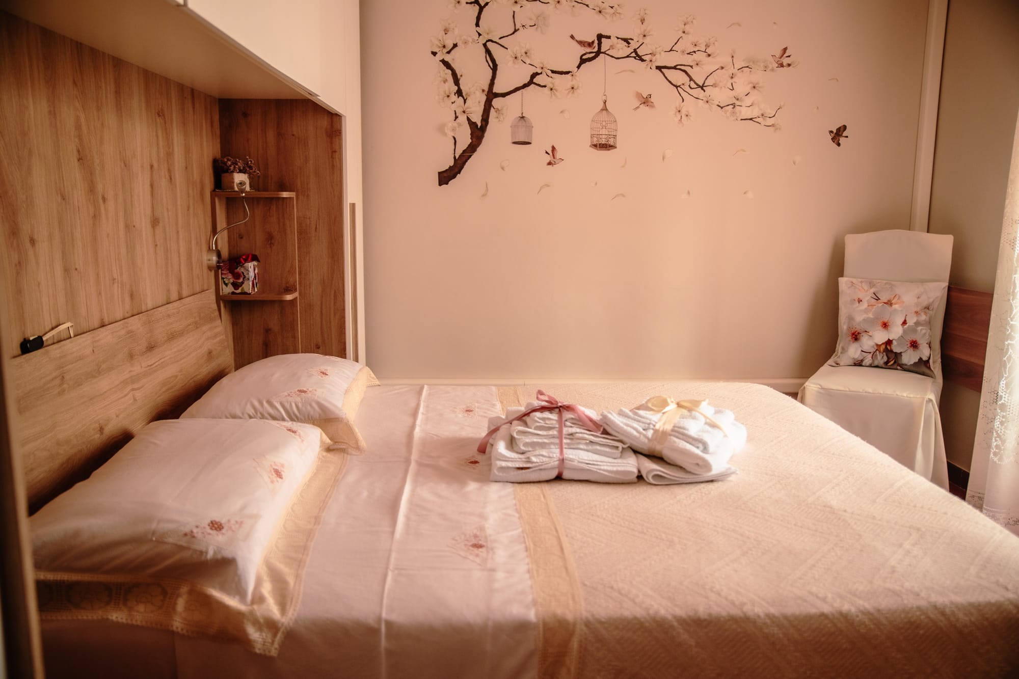
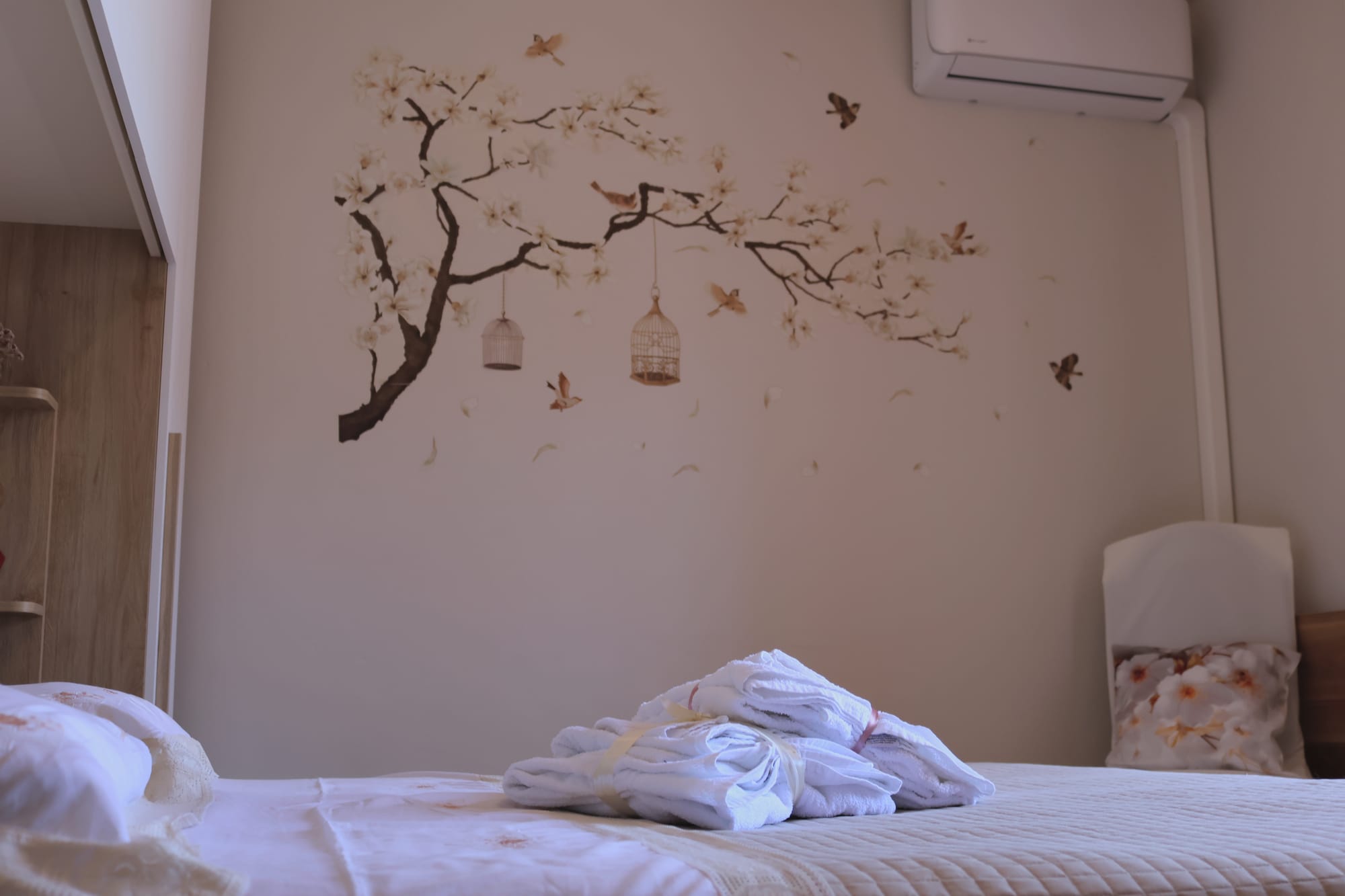
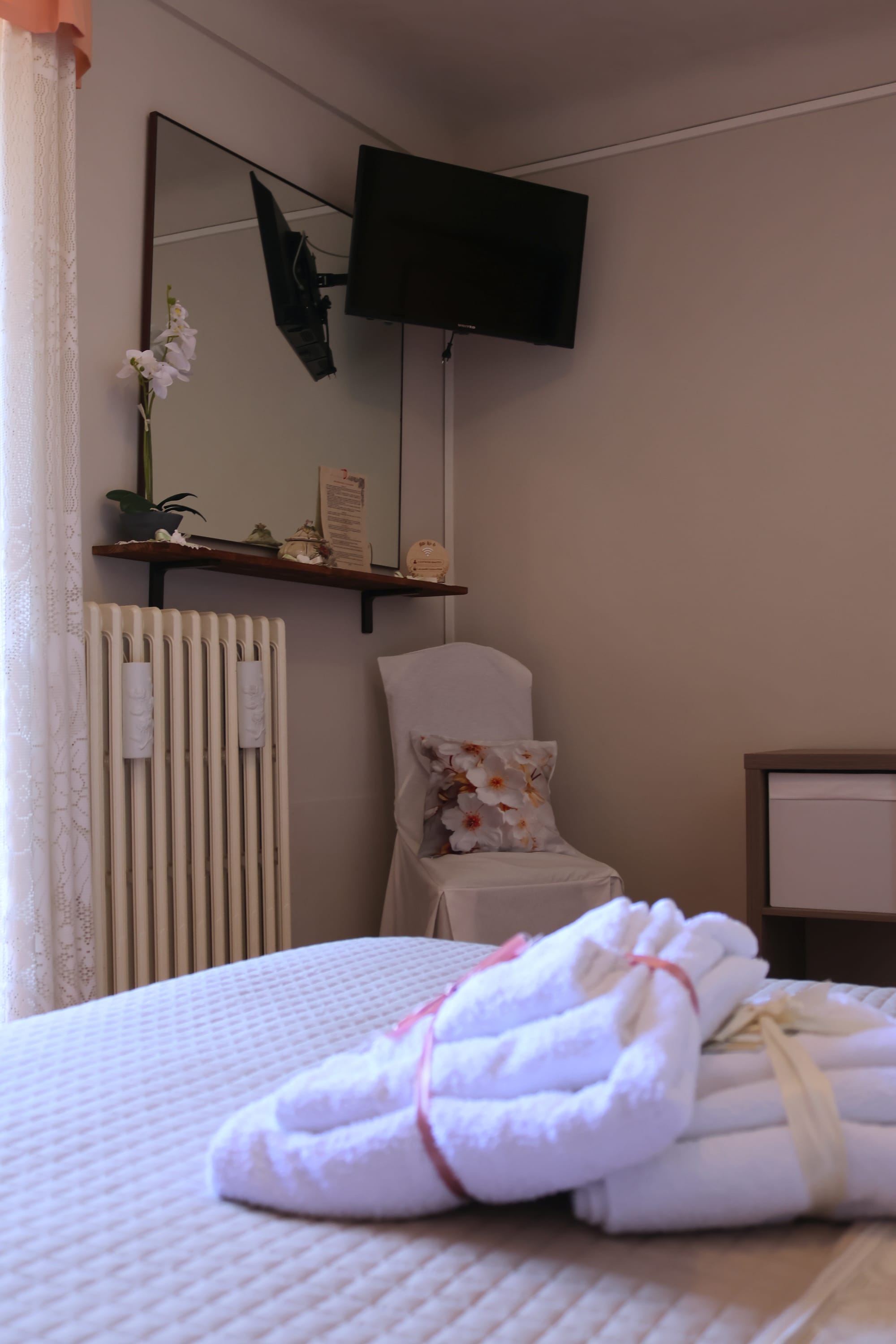
ORCHIDEA
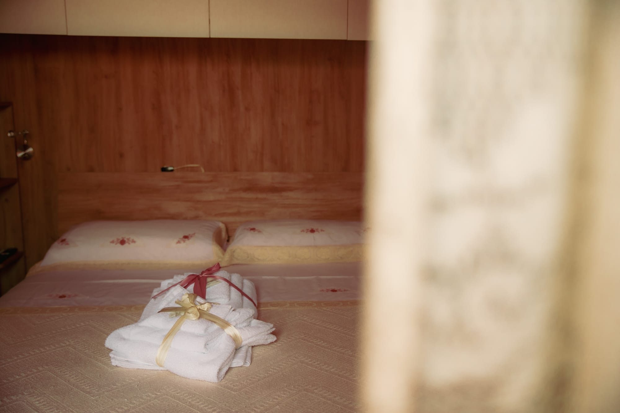
Papavero blu

LISTINO PREZZI
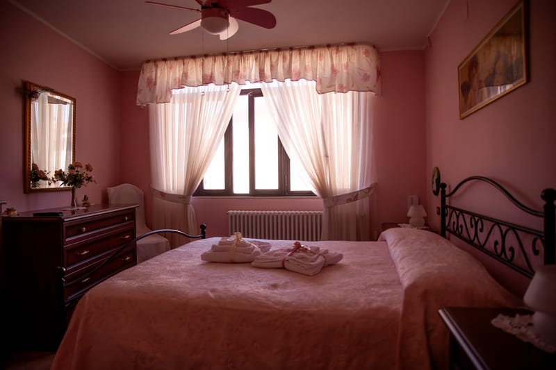
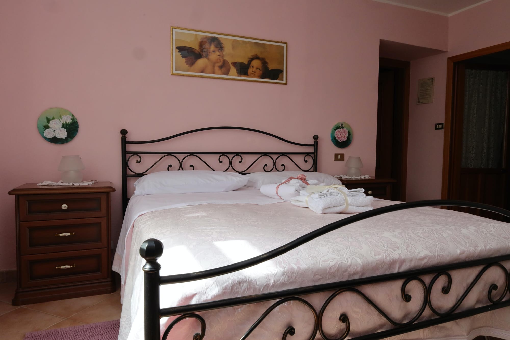
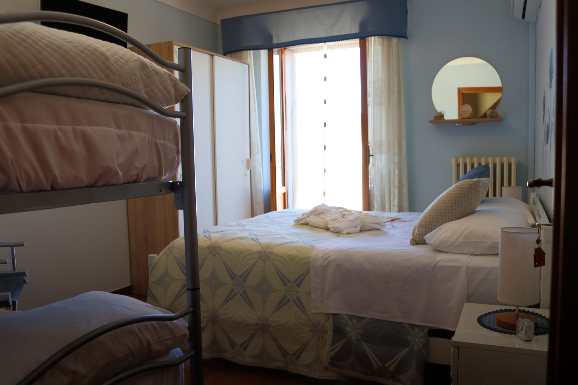
The Rose
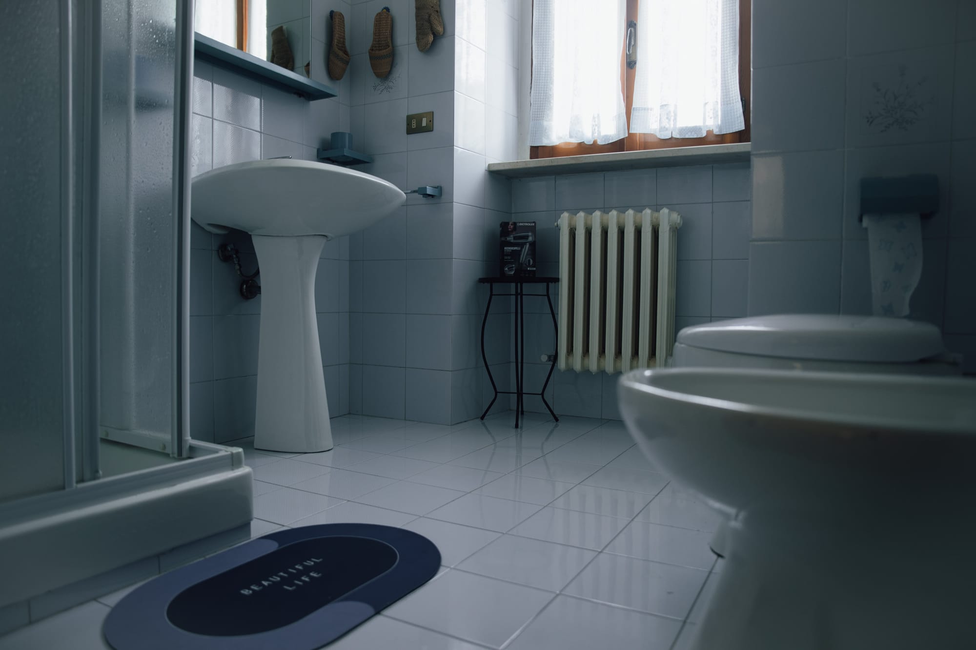
Prezzo uso singolo: 50,00 € Prezzo matrimoniale: 70,00 € La camera " la Rosa" si trova al primo piano della struttura. Essa ha un ampio bagno al proprio interno, è dotata di tutti i comfort (condizionatore, wi-fi gratis, televisione in camera) oltre che un ampio armadio, un mobile con cassetti e due comodini portaoggetti. Fino a 5 anni i bambini possono soggiornare gratuitamente se dormono nel lettone insieme ai genitori. Da 6 anni in su la tariffa sarà applicata per l'intero. Per le prenotazioni di lungo periodo (distanza di una settimana), la camera verrà bloccata previo versamento di un accanto pari alla metà del prezzo) del soggiorno e il saldo dovrà essere saldato al momento del check-in. Nel mese di agosto di si accettano prenotazioni di almeno due giorni.
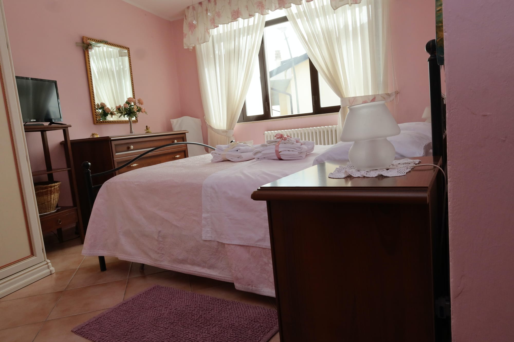
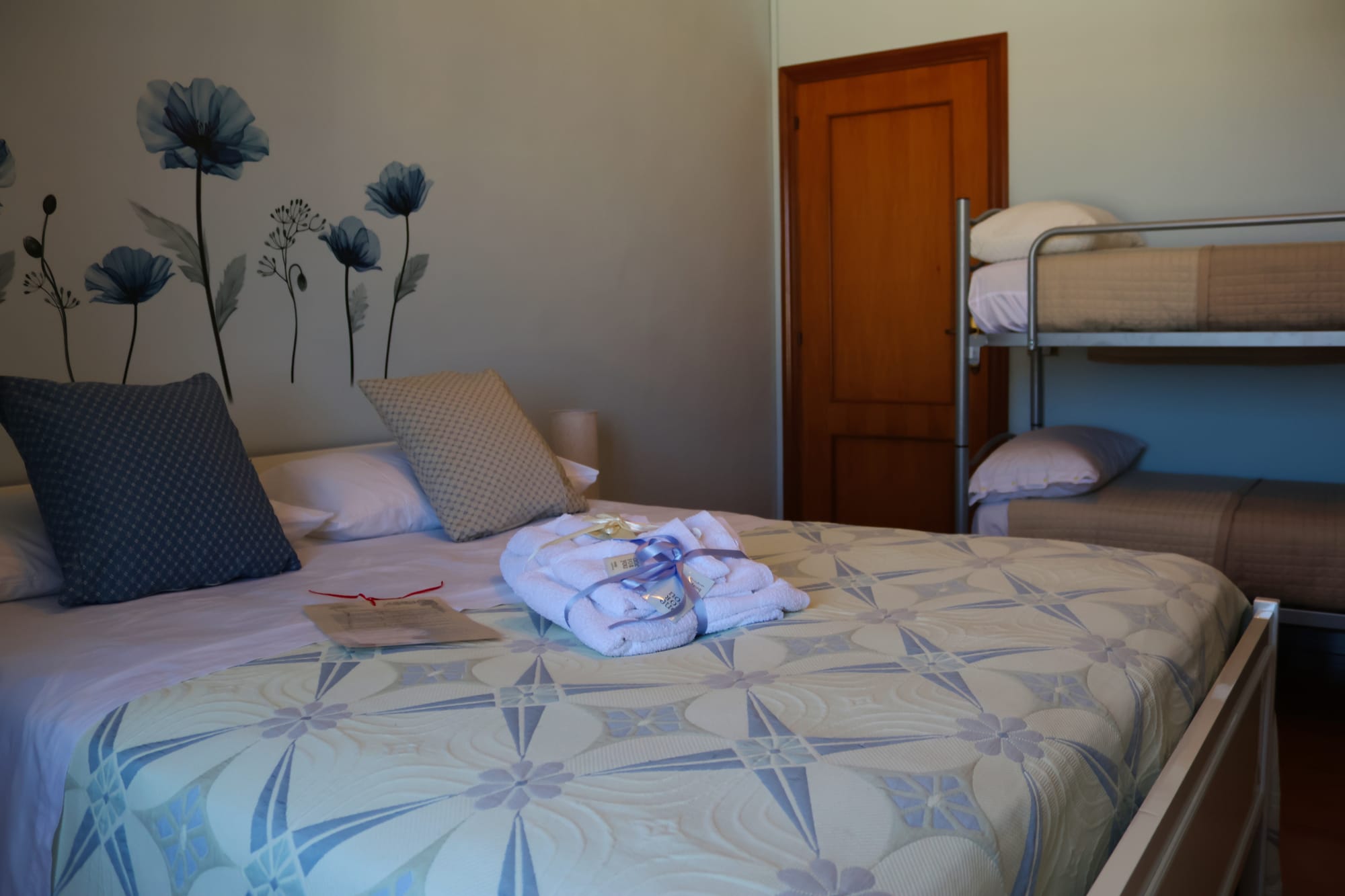
Orchid
Prezzo uso singolo: € 50,00 Prezzo camera matrimoniale: € 60,00 ( se la stanza di fianco è occupata),altrimenti il prezzo è di 70,00 € N.B. La struttura concede la possibilità agli ospiti di riservare il bagno privato, escludendo dalle prenotazioni la stanza di fianco ( camera Papavero blu). La camera "orchidea" si trova al secondo piano dell'edificio, condivide il bagno in comune con la camera "Papavero blu". Essa è dotata di tutti i comfort ( wi fi - gratuito, aria condizionata - televisione in camera), oltre che comodini porta oggetti e ampio mobile con cassetti. Fino a 5 anni i bambini possono soggiornare gratuitamente se dormono nel lettone insieme ai genitori. Da 6 anni in su la tariffa sarà applicata per intero. Per le prenotazioni di lungo periodo (distanza di una settimana), la camera verrà bloccata previo versamento di un accanto pari alla metà del prezzo) del soggiorno e il saldo dovrà essere saldato al momento del check-in. Nel mese di agosto di si accettano prenotazioni di almeno due giorni.
Blue poppy
Prezzo uso singolo: 50,00 € Prezzo matrimoniale: 60,00 € ( se è occupata anche la camera di fianco altrimenti il prezzo è di 70,00€) Prezzo uso tripla: 90,00 € Prezzo uso quadrupla:120,00 € La camera "papavero blu" è dislocata al secondo piano della struttura. Condivide il bagno con la camera "orchidea". E' dotata di tutti i comfort ( televisione in camera, aria condizionata, wi- fi gratuito) oltre che un ampio armadio, un mobile con cassetti e due comodini portaoggetti. Accedendo sul lungo balcone, si può ammirare la Maiella. Fino a 5 anni i bambini possono soggiornare gratuitamente se dormono nel lettone insieme ai genitori. Da 6 anni in su la tariffa sarà applicata per intero Per le prenotazioni di lungo periodo (distanza di una settimana), la camera verrà bloccata previo versamento di un accanto pari alla metà del prezzo) del soggiorno e il saldo dovrà essere saldato al momento del check-in. N.B. La struttura concede la possibilità agli ospiti di riservare il bagno privato, escludendo dalle prenotazioni la stanza di fianco ( camera Papavero blu). Nel mese di agosto si accettano prenotazioni di almeno due giorni.
Around
where to eat
In the surroundings of the bed and breakfast there are several restaurants and farmhouses where you can taste the typical dishes of the Abruzzo culinary tradition and taste the best wines and bitters of Abruzzo. Among these, in particular, the restaurant "la Grotta dei Raselli" stands out, located a few km from the B&B and the Villa Majella restaurant, recently included in the Michelin Guide. Finally, by clicking on the button below, we offer a wider choice of restaurants, wineries and farmhouses near the B&B in order to satisfy your every need.
Learn More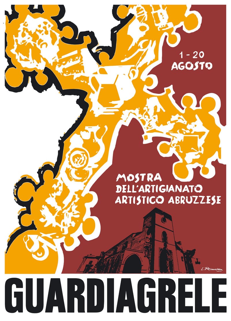
Events
Guardiagrele's summer program features a variety of cultural events of all kinds ranging from the field of art, literature, music, cinema and theatre. Among these stands out the Guardiagrele handicraft exhibition, which takes place every year in August and which aims to promote and enhance the production of Abruzzo's artistic and handicraft treasures through a rich display of regional artisan excellence. Below, by pressing the appropriate button, it is possible to see the summer program of Guardiagrele and consult the personal website of the handicraft exhibition institution.
Learn More
Abruzzo seas and mountains
Between the sea and the mountains, you don't know what to choose? There is a solution, it's called Abruzzo. Defined as the Green Region of Europe, Abruzzo offers its visitors an unforgettable experience among hilly landscapes, mountains, lively seaside resorts, small villages, cities with ancient history. This is Abruzzo, an Italian region that manages to combine truly different landscapes in its territory and that has made the multiplicity of landscapes and territories its strong point, together with its long history and its millenary traditions. It is no coincidence that the coat of arms of Abruzzo is an Italian shield divided into bands of three different colours: white like the snow-capped mountains, green like the inland hills and blue like the sea.
Learn More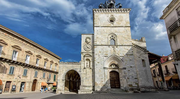
What to visit
Walking through the historic center you can see both numerous churches that testify to the importance that religion has had for the country and historic buildings and various historic buildings. Among the first stand out the Cathedral, the Cathedral of Santa Maria Maggiore whose facade, built in stone, is almost entirely occupied by the imposing bell tower, along via Modesto della porta is the church of Santa Maria del Carmine. There are also several museums: among these the most important museum is that of Abruzzo costume and craftsmanship.
Learn MoreEscursioni
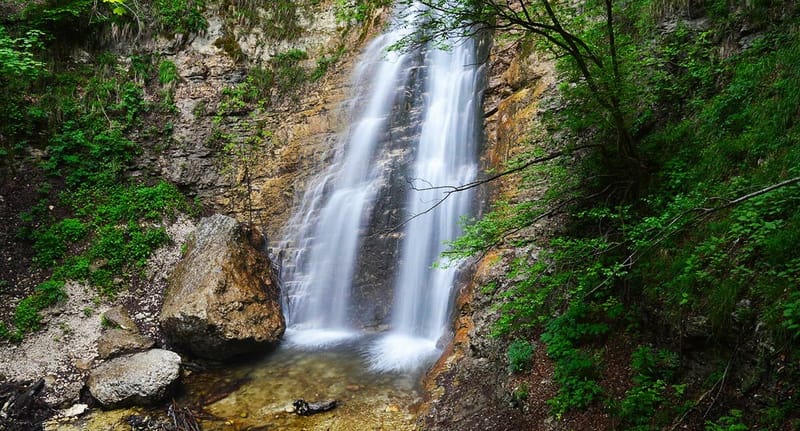
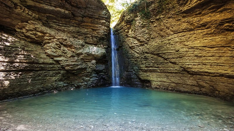
San Giovanni Waterfall
The ring of the S. Giovanni waterfall allows you to get to know the valley of the Vesola torrent: one of the typical river valleys deeply engraved in the eastern sector of the Maiella. The dominant environment is that of the beech forest and the excursion is enhanced by the presence of the stream and above all by the San Giovanni waterfall. During the return, from the panoramic point of view of the clearing of Paina della Civita you can see the Adriatic Sea and, in optimal conditions, also the Tremiti Islands. The itinerary that leads to the San Giovanni waterfall starts from the Fontanile of Bocca di Valle and takes the path that runs alongside the Vesola stream for the entire stretch. At the end of the cart track, turn right, to then reach, after a reservoir on the right, again the Vesola stream near the Cannilluccia (spring spring on the wall invaded by moss). Cross the stream and, following the signs, after a short climb, you arrive at the San Giovanni waterfall. On the way back, before getting back on the cart track, take the path on the right following the signs for Piano della Civita and Bocca Di Valle, flanking and leaving the Favorana Valley on the right after a while. After crossing the clearing of Piano della Civita, you descend in a zigzag pattern in a pine forest until you reach the Fontanile. The excursion does not present particular difficulties, the route is typical of low mountains, not exposed, with slight and constant climbs. It does not require specific technical equipment but it is advisable to use suitable clothing (trousers and trekking shoes). Starting from the Fountain of Bocca di Valle, the walking time, on average, taken to reach the San Giovanni waterfall is one hour / one hour and a quarter. By clicking on the link below, a short video will open which will allow you to see some sections of the route that leads to the San Giovanni waterfall
Learn More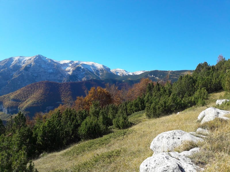
Fonte Carlese
Classic circular excursion along the ridge with wide views of the surrounding peaks and with the presence of large beech woods. Having parked the car near the Bocca di Valle fountain, start climbing on the left, following the indication F2, until you reach Piana della civita at an altitude of 804 m. Continue along the plain, then leave path F2 which leads to the San Giovanni waterfall and proceed straight ahead towards Pietro Cioppo at an altitude of 1638 m. Leave the path that leads to Pomilio and continue on the right along a path that is not very obvious, until you reach Fonte Carlese, where you can admire the valley in all its breadth. After having refreshed yourself at the spring, you begin to descend along path F1 which leads to Bocca di Valle, passing through Campanaro, Valle delle Monache and Piana delle Mele.
The valley
Classic excursion in the lower valleys of the Maiella characterized by thick pine forests which, especially in the summer period, offer an incomparable coolness. On the way back it is possible to admire the Grotta dei Pulcini where you can admire stalactites and stalagmites. The itinerary of the excursion starts from Bocca di Valle, from the car park at the crossroads for Piana delle Mele. Continue on the paved road towards rapino for one kilometre, until you arrive, on the left, at the crossroads for Forcatura. You begin to climb and at an abandoned quarry, turn left along a clear cart track, ignoring the one on the right. Go through the pine forest until you take the cart track again on the right which leads to the Ornello spring. After a well-deserved break at the spring, you begin to climb to the left, along path E1, until you meet the road that leads to Valle Monache. Going all the way and, having arrived at the site, take path F5 until you reach the valley where the Vesola stream flows. Then go back towards Valle delle Monache and from here take path F1 which leads to Piana delle Mele. Then follow the signs for the Grotta dei Pulcini which is less than a kilometer from Piana delle Mele. Descend towards the cart track until you meet the paved road and, once you have crossed it, take the path which, with several small hairpin bends, leads back onto the road and from here, to the left, to the starting point. The excursion does not present particular difficulties or exposed points.
Nuns Valley
The Valle delle nuns can be reached both starting directly from the upper parking lot of Piana delle Mele and starting from the Fontanella di Bocca di Valle. In the first case, following path F1, you can continue along the dirt road, a very gentle, wide and not very tiring climb that allows you to reach Valle delle Monache in less than half an hour. Once you arrive, you will find the Alpine hut, a picnic area and a fountain. Instead, starting from the path that begins to the right of the Fontanile di Bocca Di Valle, continuing on the same you reach, on the right, a small bridge after which you continue for a 20-minute zig-zag climb until you reach Piana delle Mele and from here take path F1 which leads to Valle Delle Monache.
Balzolo – Grotta dell'Acqua picnic area – Linaro:
From the square of Balzolo, take the easy dirt road which, after the tunnel, introduces us into the fascinating landscape of the Avella river valley, continue on the road reaching, after a short climb, the "tre cantoni" locality. After passing a high tunnel, the road descends almost along the river and after passing the "brick cave", you arrive at the large bifurcation between the "vallone di Selvaromana" and the "vallone delle tre grotte". Among the coolness of the wood, you reach the picnic area of "Grotta dell'Acqua" (930 m asl), an area equipped with tables, cooking point and fountain. Going further up you reach “Linaro” (1100 m asl), where the road ends. Travel time is three hours, plus return.
Balzolo – Humps of Selvaromana – Blockhouse:
Following the itinerary described for "Linaro", after the picnic area "La Grotta dell'Acqua", ford the river and, going slightly uphill, cross the wood, passing through "Grotta Remora" and, following the path on the left, you reach the “Grotta del Vento” from where, with a steep descent, you reach the riverbed. Following the path between the narrow walls of the valley, you pass the entrance to "Valle dell'Inferno", reaching the "Piana dei Faggi". Still, along the river path, between the snowfields and the high walls of the Morelle, after "la Mucchia", you leave the valley on the eastern side of "Monte Cavallo". Enter the lily of the valley in a northerly direction until you reach path G2 on the crest of "Monte Cavallo". Continue halfway up the G2 path up to the "Blokhaus" road, passing by the shepherds' shelter of "Grottilicchia".
PARCO NAZIONALE DELLA MAIELLA
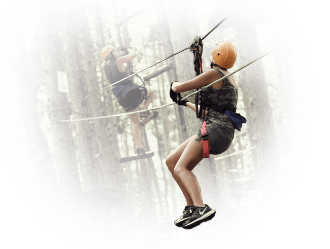
Indiana Park and Vertical Park
Il Parco Avventura Majella è il più grande Parco Avventura d’Italia e si trova in località Piana delle Mele. Dista soli 10 minuti dal B&B ed è facilmente raggiungibile da Chieti, da Pescara, da Lanciano e da tutta la costa adriatica. L’attività del Parco Avventura consiste nell’affrontare gli oltre 250 giochi sospesi tra gli alberi, camminando tra passerelle, ponti tibetani, tunnel e tirolesi mozzafiato, il tutto nella massima sicurezza e con l’assistenza del personale qualificato. Nel parco ci sono cinque percorsi per bambini dai 2 ai 4 anni, 6 sei percorsi per bambini dai 5 ai 7 anni e altri 16, per ragazzi e adulti. Tantissimi percorsi sospesi nel vuoto, surf sulla cresta degli alberi, ponti e reti, a diverse altezze e con diversi gradi di difficoltà.
Tutte le attività naturalistiche sono effettuate con personale qualificato quali accompagnatori di Media Montagna, Guide Alpine, operatori del parco avventura, maestri, guide di mountain bike ed educatori. Dal parco di Piana Delle Mele non partono solo sentieri escursionistici da percorrere a piedi ma c'è anche una una ampia scelta di percorsi mtb di tutte le difficoltà. Infatti l’offerta del Bike Park prevede il noleggio di E-Bike a pedalata assistita e di MTB a pedalata muscolare. Inoltre, avrete la possibilità di richiedere escursioni con la guida che vi accompagnerà alla scoperta dei bellissimi tracciati montani della Maiella Orientale.
Il Forest Park è un'attività esperienziale nel bosco con guida che si compone di diverse attività:
1) ESPLORANATURA 1 -Missione salva uova (attività adatta per bambini dai 4 ai 7 anni): Una vera avventura nella natura! Il tuo compito è proteggere le uova d'oro della chioccia e riportarle nel nido. Per fare questo devi affrontare delle prove: superare fitti boschi, introdurti in misteriose grotte alla ricerca delle uova, trovare la roccia dove si posa l'aquila e finalmente scalare la montagna per portare al sicuro le uova nel nido di mamma chioccia. Per portare a termine queste difficili prove avrai bisogno della giusta attrezzatura: ti saranno dati un casco e una torcia elettrica per esplorare le grotte, un contenitore per le uova, un binocolo e una bussola per individuare la roccia dell'aquila e naturalmente una mappa e uno zaino per trasportare tutto. Cosa aspetti?! Parti per questa grande avventura, salva le uova d'oro!
2) ESPLORANATURA 2 - Missione Cura il Re del Bosco (attività adatta per bambini dai 5 agli 8 anni):
Un bellissimo cervo è stato ferito da un predatore e ha bisogno di cure. Grazie alla conoscenza della medicina naturale e al manuale delle piante curative dovrai raccogliere le essenze medicinali, preparare la pomata e curare il cervo ferito. Trovare e riconoscere le piante medicinali non è facile! Dovrai inoltrarti nel bosco e grazie all'aiuto della mappa trovare e raccogliere foglie, cortecce e semi curativi. Solo quando avrai trovato e raccolto tutte e 4 le piante medicinali potrai preparare la pozione che salverà la vita al cervo!
3) ESPLORANATURA 3 - Esploratori nel Bosco (attività adatta per bambini dai 6 ai 12 anni)
Immergersi nella natura e avventurarsi alla ricerca di piante, foglie, fiori e cortecce sarà la vostra missione. La bussola, la mappa e l’aiuto della guida aiuteranno i piccoli esploratori ad orientarsi nel bosco alla ricerca delle meraviglie che li circondano
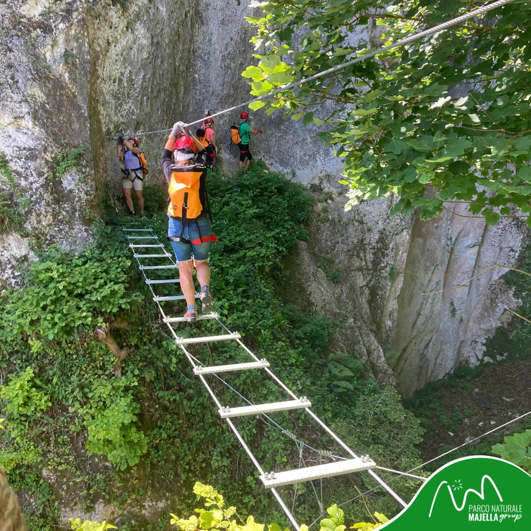
Località Valleriana - Vertical Park - Pennapiedimonte
A Pennapiedimonte, in Località Valleriana c'è questo nostro nuovo sogno. Si tratta di un percorso che si sviluppa su roccia con un dislivello positivo di 150 mati e che può essere affrontato con l’attrezzatura, messa a disposizione dal personale, per una durata massima di circa 3 ore, sotto la supervisione di professionisti della montagna, quali Guide Alpine e operatori. Comodamente raggiungibile in auto e in autobus, il Vertical Park è fruibile per gli appassionati di montagna che possono godere di affacci mozzafiato con vista mare, passaggi in grotta e ambienti naturali.
L’area di Piana delle Mele è pubblica, con aree picnic libere dove per accedervi, non c’è nessun costo di entrata, si pagano solo le attività che si effettuano. Nei link indicati di seguito, è possibile vedere un'anteprima dei percorsi avventura di Indiana Park e Vertical Park e consultare il sito del Parco Nazionale della Majella per conoscere orari, tariffe, prenotazioni, attività e ulteriori informazioni.
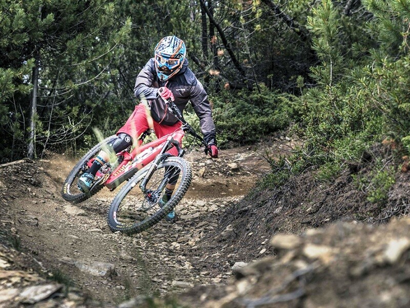
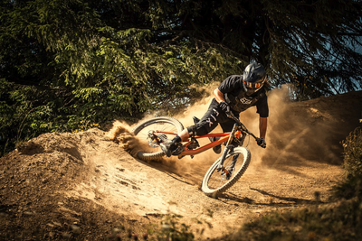
Bike park bocca di valle
Rocks and roots that intertwine, to then leave room for long sections of flow on dirt and banks, all amidst landscapes and panoramas that leave their mark!.
The Bike Park also provides the possibility of booking excursions with guides and discovering the pristine woods of the Majella surrounded by breathtaking views, pedaling in contact with nature on our paths.
Finally, it is possible to book mountain bike lessons to improve your technical riding skills for all disciplines (XC, Enduro, Downhill) and have fun with more safety, both individually and in groups!
To find out about timetables, rates, reservations and further information, click on the link below.
Mouth of the valley bike park
Mini-speed Ortona
Ready Steady………. GASsSsSsSsSsSsSs!!!!
Finally, for those wishing to come with campers and caravans, the structure offers a large 10,000 m2 equipped car park with lighting.
To see timetables, contact details and take a reconnaissance tour, click on the links below. Gaaassss!!!
Mini Track - Speed Ortona
Opening times, contact details and further information

Rapino pump track
The track is made up of climbs and descents, curves and humps on a technological surface of asphalt which makes it practicable in every season of the year. Not only by bike, but also with skates, skateboards, scooters, in short, with every tool it is possible to venture along the track following the famous red line that distinguishes the Velosolutions Rapino Pump Track. The facility is also open in the evening as it is equipped with LED lighting which allows it to be used at night.
For further information on timetables, fares, reservations and for a reconnaissance tour, click on the appropriate links, indicated below.
Pump Track Robbery
Saddle ride

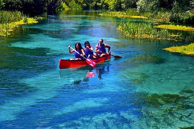
Abruzzo Rafting - Bussi sul Tirino
Canoe ride
Site Bussi sul Tirino - Canoe
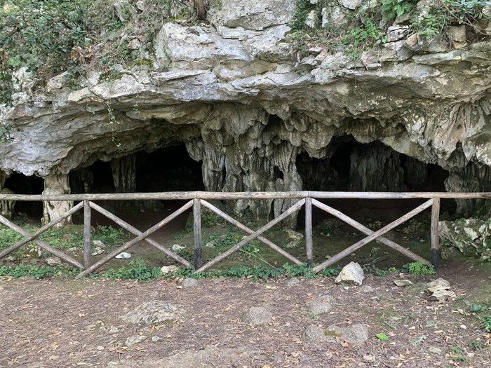
Horse cave
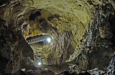
The guided tour lasts just over an hour and takes place at a constant temperature of 10°C, with a humidity of 90%, along a route that develops for over a kilometre, divided between a main gallery and three secondary branches .
For information on timetables, contacts, costs and for a guided tour inside the caves, click on the links below.
Guide into the caves
Personal site of the caves of the hourse
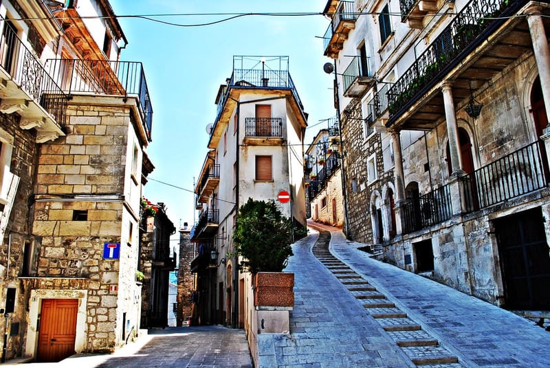
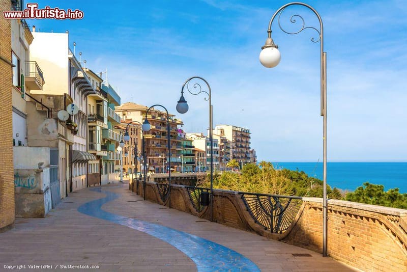
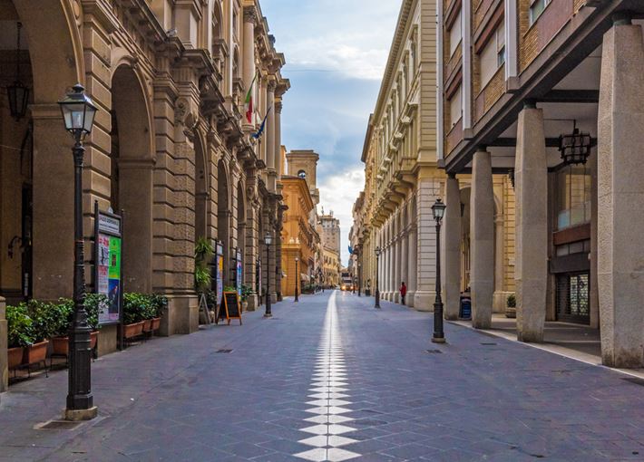
Guardiagrele
The city of stone
Guardiagrele
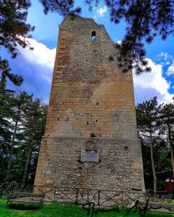
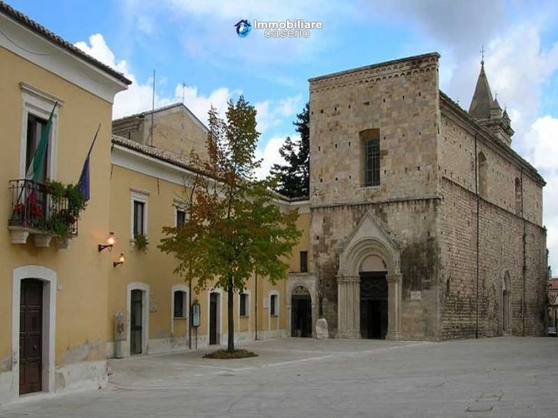
Tradition has it that the village was formed by the presence of a Lombard tower, currently called Torrione Orsini, which was and still is located in the highest and flattest part of the hill to defend the population of the village below from the frequent barbarian invasions. With the disintegration of the Roman Empire, the raids having increased, the population moved under the tower, building houses. Defined by the poet Gabriele D'Annunzio as the terrace of Abruzzo for its enchanting panorama, Guardiagrele is considered one of the most beautiful villages in Italy. In fact, thanks to its numerous terraces, it is possible to see not only the sinuous lines of the Majella National Park, but also the angular ridges of the Gran Sasso mountain massif which is in the distance and, if the weather permits, it is even possible to see the Adriatic coast which makes the vision of this marvelous landscape even more suggestive. Externally Guardiagrele is surrounded by gates and towers from the Middle Ages, which mark the entrance to the town, but the most suggestive part is certainly represented by the historic centre. The narrow streets that rise from the outer ring road towards the center wind through paved slopes, narrow alleys and streets that lead to Piazza Duomo where the Santa Maria Maggiore cathedral is located. By pressing the link below it is possible to take a walk around the village.
Learn More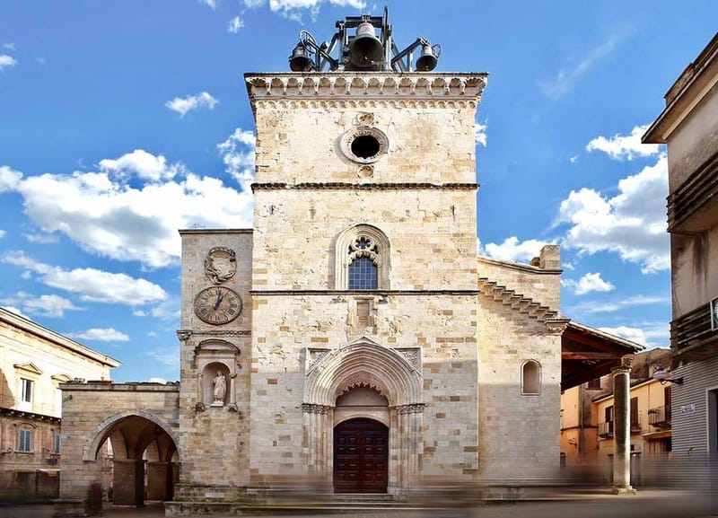
Cathedral of Santa Maggiore
Beyond a local tradition that would like to trace the foundation of the church back to 430 AD. C., built on the remains of a pagan temple, the architectural vicissitudes of Santa Maria Maggiore find their most documented origins between the tenth and twelfth centuries, and continue during the thirteenth and fourteenth centuries. Strong testimony of its most ancient history is given by the peculiarity of the facade, which immediately catches the visitor's eyes when he sees it suddenly appearing among the houses in the centre. In fact, it has a truly unusual shape, with a central tower structure that also serves as a bell tower, probably imported from the French tradition of the Cluniac monks, where this solution was quite widespread. The façade offers a beautiful fourteenth-century portal with a pointed arch and, in the lunette, a fifteenth-century sculpture depicting the Coronation of the Virgin; above a window of the so-called monofora type (i.e. with a single opening) decorated with a refined play of stone fretwork. The two small heads, one male and one female, that can be seen today were added in the fifteenth century. On the sides of the church there are two porticoes. The one on the left, partially rebuilt and freed from the houses that had been added to it over the centuries, leads to the entrance to the former chapel of the Madonna del Popolo, with its beautiful late Renaissance portal. Along the portico is a newsstand entirely decorated with stuccos which surrounds, as if it were a frame, the fresco of the Madonna del Latte by an unknown fifteenth-century artist. Under the portico which runs along the opposite side, with tall columns covered by a roof made of wooden beams, there is another Renaissance portal dated 1578. A little further on, set in the wall, are the coat of arms of the city and the emblems of the major noble families of Guardiagrele which were walled up here in 1884 so as not to disperse them. Entering Santa Maria you will notice how the inside has a completely different appearance from the outside, the result of the radical Baroque transformations that followed the disastrous earthquake of the early eighteenth century. One of the main effects of these transformations, from the point of view of the architectural structure, can be seen in the presence of a single raised space, which is accessed with a central staircase. Four stucco altars alternate along the two walls on each side. In the last altar on the right you can admire a singular and unusual work of sculpture resulting from an eclectic assemblage of pieces of various origins: a kind of tabernacle in carved and painted stone. In the lower part it has a decoration with vegetable elements from the 13th century and in the upper part two angels from the 15th century holding up a coat of arms. In the center an iron door protects the interior decorated with a composition of bas-relief panels: a central female figure that can be thought of as the Assumption and two panels with a pastoral scene and, perhaps, the biblical scene of Adam and Eve.
Church of San Francesco
The Church of S. Francesco represents, after Santa Maria Maggiore, the most important architectural and urban development of Guardiagrele. The magnificence of the fourteenth-century church bears witness to and illustrates the new role that this part of the town assumed: the square in front of the church, used as a market, became the economic hub of the urban settlement. The main façade of the Church is rectangular in type, covered with stone ashlars with a frame of small arches and a median frame in pure fourteenth-century style. On the right side of the monument, on the structure built with the use of stones, the outlines of the pre-existing windows now walled up, and the eighteenth-century masonry above in irregular stone, built to allow the construction of the barrel vault inside. Still on the right side there are two portals, a smaller one, now walled up and the other which constitutes the second entrance to the Franciscan church. Moving inside, the architectural layout of the church of San Francesco has a single nave, without side chapels with a presbytery choir and a sacristy behind it, above which the bell tower rises. In the compartment below the bell tower it is still possible to see an original ogival cross vault with cylindrical stone ribs and polychrome decorations.
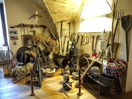
Museum of tradition and customs
The Costume and Tradition Museum of Guardiagrele was born in the eighties and today, with its approximately seven hundred exhibits, it tells and bears witness to a particular historical period, the one between the nineteenth and twentieth centuries, in which the Guardiagrele reality was predominantly peasant and artisan. A visit to the Museum allows you to grasp two important aspects of the life of the Guardia di Campiglio of the past: that of the patriarchal family, with its rules, its rhythms, its affections and that of the peasant and artisan community which is expressed through images of great industriousness in which many trades find space, some of which have disappeared. Some of the most characteristic environments of the domestic life and of the artisan industriousness of the Guardiagrele between the 19th and 20th centuries have been rearranged in the rooms. The kitchen features authentic elements, a kitchen with oven and fireplace, sideboards, pantries and crockery furniture with plates, glasses and copper pots, as well as the necessary for bread-making and an all-female space dedicated to spinning and weaving activities, with still working loom, spinning wheel, warper and other tools. The bedroom, reconstructed to witness ancient customs linked to marriage, such as the display and the "appreciation" (esteem) of the dowry, which relatives were invited to admire; a section is dedicated to women's clothing and handcrafted jewels, worn on the most important occasions. The Hall of Arts and Crafts Other spaces are instead reserved for the artisan activity, always flourishing in Guardiagrele, and exhibit tools that are now disused or even unknown to the new generations, such as those of cabinetmakers and carpenters, dyers and shoemakers, potters, chair-makers, coppersmiths and the masters of wrought iron. The Costume Museum, the pride of the city of Guardiagrele, welcomes thousands of visitors every year and takes them on a real journey through time.

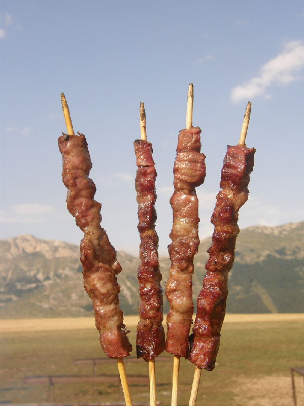
Gastronomy
The culinary symbol of the town is the renowned sweet with three peaks: le sise delle monache. There are various hypotheses on the origins of this name: the most probable would be linked to the nuns who lived in the Convent of the Poor Clares around 1300 and who would have invented the dessert in memory of the martyrdom of the cutting of Sant'Agata's breasts. The more mischievous thesis instead refers to the nuns' habit of inserting a bundle of cloth between the two breasts in order to make the surface of the chest, compressed by a band, flat and without protuberances. On the other hand, there are those who associate the shape of the product, also known as Tre Monti, with the three most important massifs in Abruzzo, the Apennines, namely the Gran Sasso d'Italia, the Maiella and Monte Sirente-Velino. The original recipe is still secret and well-kept in the cookbooks of Guardia, which are handed down from generation to generation. However what can be said is that the sponge cake base is made with flour, eggs and sugar and cooked in the oven for about 35 minutes. While the custard is the classic one, made with flour, eggs, sugar, milk and cinnamon. The dessert is entirely handmade, also for the creation of the characteristic three-pointed shape, which is given when mixing. After the cooking phase, the desserts are filled with the cream, left to cool and dusted with plenty of icing sugar.
Pennapedimonte
The Matera of Abruzzo
Pennapedimonte
On the slopes of the eastern slope of the Majella, stands Pennapiedimonte, a characteristic village with stone houses often dug out of the rock. Called the Matera of Abruzzo, it was once a thriving center of craftsmanship of the master stonemasons, where time now seems to have stopped. Legend has it that the town originates from an indigenous village called "Pinna dei Frentani", then called "Penna" and finally Pennapiedimonte, in reference to its foothill position. Surrounded by the Feudo Ugni nature reserve, it is an area of extraordinary beauty. Walking through the narrow streets of the village you can still come across small shops and it is easy to understand the slow and peaceful rhythms of life here. By pressing the link below you can admire the small village.
Learn More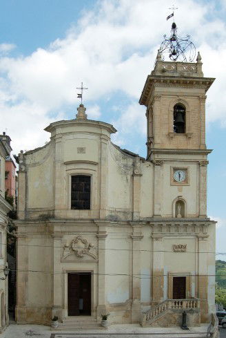
Church of San Silvestro
The building probably derives from an ancient pagan temple which, with the conversion of the inhabitants to Christianity in the 6th century, was transformed into a Christian church. In the 12th century, during the fortification phase, the population of the countryside poured into the fortified village, dedicating the church to San Silvestro. In the 18th century expansion works were carried out on a project by the Pennese architect Monacelli which envisaged the construction of a large religious complex in the Baroque style, with the bell tower and the rectory, also incorporating part of the public road, including the door with the arch pointed arch which led to the town and which serves as a support for the bell tower. The facade is made of finely worked stone. Inside there are pictorial works by Nicola Bonaventura Ranieri from the nearby village of Gurdiagrele, who established an Abruzzo school between the 18th and first half of the 19th century.
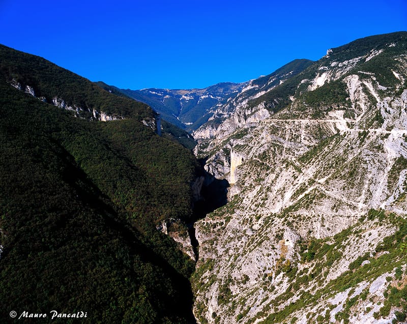
Balzolo
The Belvedere del Balzolo allows for a magnificent view that ranges from the mountains to the coast passing through the green hills in what can be summed up as the essence of Abruzzo. From the balcony of Abruzzo, in fact, you can admire a unique panorama that goes from the Avello Valley to the Trabocchi Coast. The small square adjacent to the infamous balcony of the Balzolo, as well as being a meeting point where you can refresh yourself or simply drink a coffee, is the starting point of various hiking trails that were once the routes used by shepherds with their flocks to find new pastures . From here, in fact, it is possible to take a comfortable walk and crossing the small pedestrian tunnel, you arrive on the path that runs along this side of the mountain, offering beautiful panoramic points. We are on the cart track in the Avella torrent valley, built between 1967 and 1972 to carry out work on the aqueduct built in the 1920s.
Pretoro
A bit of history
The name derives from the Latin Praetorium ("place of gathering of soldiers") and indicates a point of observation and surveillance of the passages in the Peligna valley, inhabited by the Italic populations of the Peligni of Sabellic lineage and the Frentani of Samnite lineage, both of Oscan language. The first certain information on the origin of the village comes from the appearance in the documents of the name Praetorium, signifying a "gathering of soldiers", probably to guard the pastures of the Maiella. In the 15th-16th centuries, the feudal lords were the Orsinis, followed by the D'Alvianos at the beginning of the 16th century and then by the Colonnas, the Cantelmos and the Acclozamoras. The Cantelmos built a castle on the remains of the destroyed medieval castrum Pretorii de Theti and it was around the new castle, now in ruins, that the current village was formed and developed, transferring the original settlement from the valley upstream. At the turn of the 19th-20th centuries, wood lathe working and other craft activities such as stone working developed. Immersed in a naturalistic context of great charm and countless attractions, Pretoro shows itself to visitors with its cluster of houses perched on the rocks, presenting itself as a small nativity scene set among the mountains. Walking through the narrow streets of the village you come across magnificent religious buildings among which, the most important in the country, is the church of Sant'Andrea Apostolo with the particular floor that adapts to the shape of the rock. No less important are the church of San Nicola, also known as the church of San Domenico and the church of the Madonna della Mazza or Santa Maria della Mazza from the 13th century which bears witness to the passage of the French, was built by Cistercian monks with the facade facing northwest, towards France. What distinguishes this small Abruzzo village is the craftsmanship of wood and stone. Woodworking is an art that has been practiced for many generations. In particular, the village of Pretoro is famous for the creation of spindles, traditional Abruzzo guitars for pasta, kitchen utensils, as well as chairs and furnishings.
Learn More
St Andrew's Church
The church of Sant'Andrea is located inside the historic centre, upstream of the village and represents the main church of the village. The facade, preceded by a wide staircase, has a square stone wall facing with ashlar corner pieces and portal and window frames. In axis there is the main portal with corbels, semicircular tympanum, window and gable above the horizontal crowning frame of the seventeenth-century type. The church has an irregular layout with two naves and a chapel on the right side. The central nave is covered with a barrel vault with lunettes, ribbed vaults on the side bays and on the right side chapel. The external covering is made with staggered pitches on an irregular plan with a roof of tiles. The internal decoration, of the seventeenth-eighteenth century type, is extremely simple and has an order of Doric pilasters leaning against the pillars and squares in the vaults. The altar, on the other hand, is made of commisso marble and is inserted in the right side niche and polychrome glass windows.
St. Nicholas Church
The Church of San Nicola is located in the historic center of Pretoro, in the Majella National Park. Its current configuration dates back to the years between the 16th and 17th centuries, although traces of the previous Romanesque layout remain in the external masonry and in the single-lancet windows overlooking the valley. Dedicated to the eastern saint, the church actually venerates San Domenico Abate, patron saint of Pretoro and object of a very ancient popular cult that goes beyond the borders of the town. In fact, it is from here that the complex celebrations in honor of the Saint begin on the first Sunday of May, with the fervent participation of the faithful, which then conclude in the upper part of the village with the representation of "Lu Lope", a re-enactment in the form drama of a miracle performed by the Saint. The building has a facade in Majella stone in which a large arch leads to a portico which in turn leads to the portal of the church. The interior has three naves with an irregular plan: the central nave and the lateral one on the right have a rectangular shape and the lateral one on the left, which leads to the place of worship, has a trapezoidal shape. In it, in addition to several statues of saints particularly venerated in the area, you can admire two works of particular artistic value: a Pietà in polychrome terracotta from the 17th century and a large portal carved in wood dating back to 1630, recently restored and placed on a wall near the entrance.
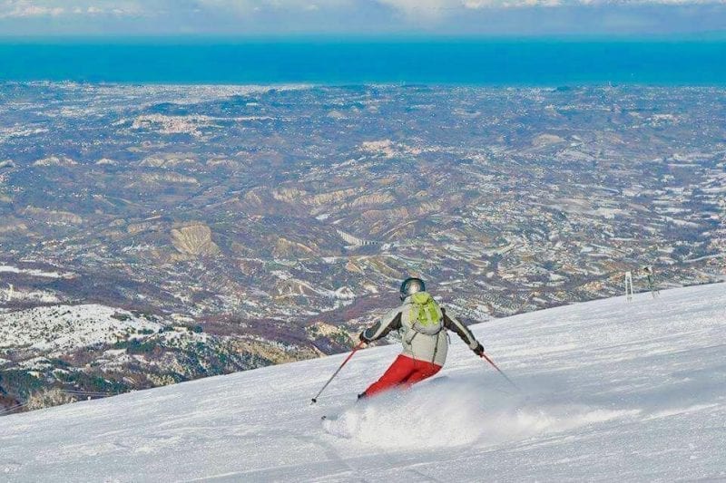
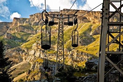
Maielletta ski resorts
When we talk about Abruzzo and its mountains, the Gran Sasso immediately comes to mind, however the other mountain that dominates this land, the Maiella, also known as "The Sleeping Beauty" is also worthy of the same attention. In fact, thanks to its wonderful landscapes it is also a very popular destination for ski enthusiasts. The two localities Passo Lanciano and Mammarosa develop in one of the few points suitable for skiing on the impervious Maiella massif (2798 metres). The wide scenarios range from the slopes to the Adriatic Sea, and the landscape, from the top, is truly breath-taking so much so that, if the day is very clear, it is possible to see the Adriatic Sea (with the centers of Pescara and further inland Chieti), the peaks of Velino-Sirente and Gran Sasso itself. Passolanciano and Mammarosa are 1.5 km apart, however, to move from one to the other, you need a ski bus or a snow taxi, since they are not joined by skis. Going up from Pretoro, further downstream (starting from 1350 metres) is the Passo Lanciano station equipped with a three-seater chairlift, two ski lifts and two conveyor belts. The slopes for alpine skiing are: a red slope "the third", a black one "piston", a blue one "la Panoramica" which descend into the beech forest for a total length of 6.150 km. There is also a snow park area, a school camp, a kindergarten for the little ones and a 5 km Piane di Tarica cross-country ring. After passing the ski resorts of Passolanciano, continuing on the same road, after 10 minutes by car, you arrive at the highest ski resort (2000m) of Mammarosa. Here the ski slopes are more numerous: there are slopes for children and novice beginners and several slopes for more experienced skiers. Below you can consult the personal website of the two ski resorts and watch a descent on skis. Below you can consult the personal website of the two ski resorts and watch a descent on skis.
Learn MoreOrtona
The Stalingrad of Italy
A bit of history
Ortona, also known as Ortona a Mare until the 1930s, is an Italian town of 23,277 inhabitants in the province of Chieti in Abruzzo and overlooks the Adriatic Sea. The port of Ortona is one of the most important in the entire Adriatic and is the main one in Abruzzo in terms of basin, seabed and movement. The very ancient history of the city dates back to the Frentani people, who used the commercial port as the main economic source of the area. Roman city from the beginning of the 3rd century BC, it was occupied, after the fall of the Western Roman Empire, first by the Goths, then by the Byzantines, by the Lombards and finally by the Normans who set it on fire (11th century). Resurrected in the Swabian era, it returned to flourish economically. In 1258 the city permanently housed the relics of St. Thomas the Apostle in the Cathedral, becoming a point of reference in the religious field. After various battles with the rival city of Lanciano, Ortona passed into the hands of Jacopo Caldora who rebuilt the walls. City dear to Margaret of Austria, who had Palazzo Farnese built there (second half of the 16th century). During the nineteenth century it was culturally represented by the composer Francesco Paolo Tosti and the poet Gabriele D'Annunzio. During the Second World War, Ortona became the maritime head of the Gustav Line with the opposite end to Cassino and was the scene of a hard battle between the Germans and the Allies which involved uninterrupted bombardments for 6 months and which also involved the center of the city, so much so that Winston Churchill he called it "The Stalingrad of Italy", as, similarly to the Russian city, Ortona experienced a long battle in the heart of the city with the destruction of a large part of its artistic treasure. Today the city is highly developed and rebuilt, the main seaport of the Abruzzo region with its port, as well as several times decorated with the Blue Flag.
Learn More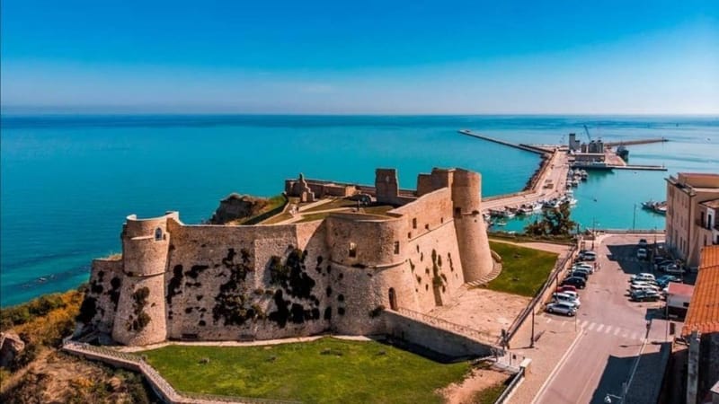
Aragonese castle
The Aragonese castle is one of the symbols of the city of Ortona. The current building dates back to the years between 1450 and 1470, but in this panoramic position there was already a medieval fort previously present. The previous structure was wanted by the leader Giacomo Caldora, who fortified the city with the imposing walls that today bear his name. The fort and the walls served to protect Ortona from the invasion of the Aragonese, who however managed to enter the city in 1452. At that point they decided to modify the castle giving it a quadrangular shape in the Renaissance style. Its position is directly overhanging the sea, so as to protect the city port. From here it is also possible to admire the Trabocchi coast which starts right from Ortona and stretches southwards up to Vasto. Ortona had always needed to be protected, because it has been an important commercial port since ancient times. Originally the castle had five towers arranged along the walls surrounded by a moat. Inside the castle there was a tower that was used for any retreats. Today only four towers are left standing, i.e. the corner bastions, round in shape and highly sloping, as was usual in the Aragonese scheme. The scarping technique is also found in the base of the walls and was used to ensure greater protection for the fort. The towers of the Aragonese castle have the same height as the walls and this was designed to make the patrol walk easier. In the second half of the 16th century, the castle was revised by Spanish architects who, in the meantime, controlled the territory. In that context the central tower was eliminated and a smaller quadrangular was added along the western walls. In the following centuries it changed hands several times between private individuals and the municipality and performed various functions, such as a gunpowder deposit, a private home and an English garden. Today it is again in the ownership of the municipality of Ortona which, after a consolidation and a profound restructuring due to the damage sustained during the Second World War, has returned it to the citizens. Of the four corner towers, only three have survived. Furthermore, only a perimeter wall with decorations on the frame remains of the residential building leaning against the western side.
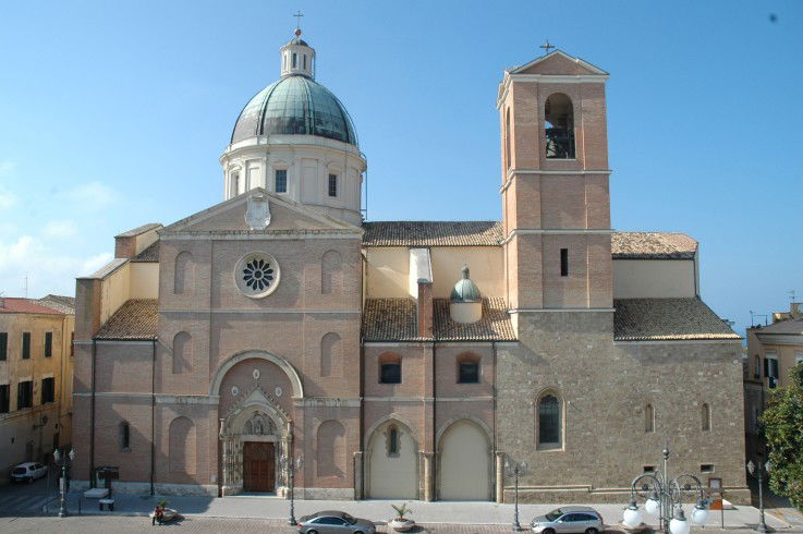
St. Thomas Cathedral
The cathedral of San Tommaso is the most important church in Ortona. Over the centuries it was rebuilt several times, such as in 1125 due to an earthquake and, in 1127, due to the destructive fury of Goffredo the Norman. Even in the sixteenth century it was rebuilt, after the Turkish invasion in 1566. Other reconstructions were carried out in the seventeenth and eighteenth centuries, while the last, necessary one, was carried out between 1946 and 1949 when the city fell victim to the bombings of the second war world in 1943. The cathedral is dedicated to St. Thomas, whose relics it has kept since 1258, when his remains were transferred here from the island of Scio. From an architectural point of view, the large facade is made of terracotta and its monumental portal is the original one from 1311, reassembled after damage from the bombings. Even the side entrance is the historic one, recovered after the war. The interior of the church is organized around a large nave overlooked by the side chapels. The presbytery is raised and covered by a dome that is clearly visible even from the square in front of the church. Under the cathedral of San Tommaso there is a crypt, in which the remains of the saint are kept. This space is covered with a system of radial beams dating back to 1969. In the lower part of the stone there are two holes which in the first centuries of Christianity were used to introduce balms and perfumes such as aloe, myrrh and incense into the tombs. Furthermore, contact relics were made through these holes, i.e. objects that were kept in contact with the remains of the saint. To complete the cathedral of San Tommaso there is the diocesan museum, which preserves various works, such as sacred vestments, ceramics, silverware and ancient medieval finds. This is housed in three rooms that mark the left side of the church, where in ancient times there were the chapels of the Rosary, the Baptistery and Sant'Onofrio.
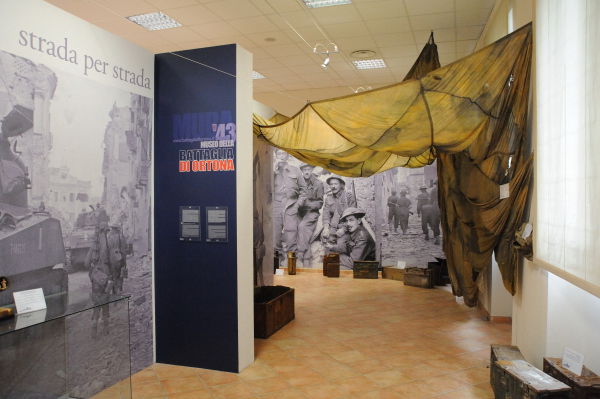
Battle Museum
The museum of the battle of Ortona was set up inside the former convent of Sant'Anna, after the same spaces were used as the Casa del Fascio in the twenty years. The battle of Ortona took place between 20 and 28 December 1943, during the Second World War, on the Gustav Line. The clash was between the Canadian allies and the German Nazis. In that clash, Hitler commanded that the fortress of Ortona should be defended to the last man. The clashes had been quite violent and were strategic for the allies in order to open a passage towards Rome on the Adriatic side. About one million and two hundred thousand bullets rained down on the city, which turned it into a pile of rubble and the Germans, with the intention of eliminating landmarks, blew up the bell tower of the city. The arrival of Canadian reinforcements by sea forced the Germans to retreat. The toll had been dramatic: 800 German dead, 1,400 Canadian dead and 1,300 civilian dead who didn't want to leave their homes during the clashes. The museum of the battle of Ortona opened its doors in 2002 and displays a detailed itinerary on the events that saw Ortona as a protagonist during the Second World War. Inside, the materials used by the soldiers and generals who took part in the battle and who, returning from the war, donated their equipment to the city are exhibited. These pieces are flanked by armor, weapons and war material found in the area. The exhibition itinerary is divided into three sections: the first is dedicated to the population involved in the war. Here photos, drawings and diagrams tell the climate of the period and are placed side by side with the first war memorabilia, such as telescopes, helmets and German and American tins. The second pertains to the two sides that confronted each other in Ortona: the Nazis and the allies. Through the signs on the wall the story is explained in detail. Added to this are the reconstructions of life in the trenches for the soldiers and in the caves for the displaced persons. Finally, the third shows military strategies through drawings and maps used in battle planning.
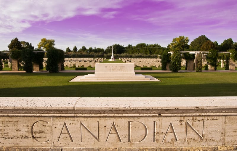
Canadian Military Cemetery
The Commonwealth cemetery of Ortona stands near the river 'Moro' and takes its name from it. On 3 September 1943 the Allies invaded the Italian continent, the invasion coincided with an armistice made with the Italians who then returned to the war alongside the Allies. The Allied objective was to draw German troops from the Russian front and more particularly from France, where an offensive was planned for the following year. Progress through southern Italy was rapid despite stiff resistance, but by the end of October, the Allies were facing the German winter defensive position known as the Gustav Line, which stretched from the Garigliano River in the west to the Sangro in the east. The Allied force which had fought its way up the Adriatic occupied the Sangro River positions by 30 November. The 1st Canadian Division crossed the Moro River on December 6 and despite strenuous resistance, captured Ortona on the 28th, after a week of fierce fighting on the ground. The 2nd New Zealand Division advanced inland, but thereafter there was virtually no movement east of the Apennines until after the fall of Rome. The cemetery site was selected by the Canadian Corps in January 1944 and contains 1615 graves of those who died during that fight at the Moro River. The burials, other than those of members of the Canadian Forces, are mostly located in lots 12, 13 and 16.
Learn More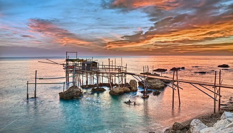
Trabocchi coast
Chiunque sia mai stato in Abruzzo e abbia visto il suo bellissimo litorale, non potrà dimenticare lo splendido panorama dei trabocchi, insoliti giganti che emergono dalle acque. Siamo lungo la Costa dei Trabocchi, quel tratto di litorale del Medio Adriatico compreso tra Ortona e Vasto che ha ispirato anche Gabriele D’Annunzio. I trabocchi sono strutture davvero particolari: esse infatti si reggono su palafitte che si stagliano sull’azzurro del mar Adriatico e offrono un panorama incredibile. Molti trabocchi sono stati restaurati e riportati alla loro bellezza originaria – alcuni di essi ospitano ristoranti dove potrete gustare qualche saporita pietanza locale, nel pieno rispetto delle tradizioni abruzzesi. Impossibile descriverli tutti: ciascuno di loro ha una storia lunga millenni da raccontare, e solo ammirandone la maestosità è possibile capire appieno quale meraviglia possa suscitare nei visitatori. Ma la Costa dei Trabocchi ha ancora molte altre bellezze da regalare ai turisti. Le sue spiagge, ad esempio, sono tra le più affascinanti dell’intero litorale dell’Adriatico, e hanno il vantaggio di non essere ancora molto conosciute al turismo di massa. Luoghi splendidi come la spiaggia di Ripari di Giobbe, oggi considerata area protetta, o come le piccole calette del Golfo di Venere meritano assolutamente di essere scoperte. Acque azzurre, sabbia fine e panorami mozzafiato sono garantiti. Se siete alla ricerca di una vacanza a contatto con la natura, poi, avrete solamente l’imbarazzo della scelta. litorale. E che dire della Riserva Naturale di Punta Aderci? Splendide distese verdi che alternano vigneti a campi di grano, magnifici colori e odori che lasceranno un segno indelebile tra i vostri ricordi. Premendo il link indicato di seguito è possibile effettuare una pedalata lungo la costa dei trabocchi
Learn MoreChieti
The city of Achilles
A bit of history
The city of Chieti, capital of the province of the same name, perched on a hill at 330 m above sea level, enjoys a favorable geographical position between the Adriatic coast and the Majella and Gran Sasso massifs. Its history began in ancient times, the legend, in fact, has it that Chieti was founded in 1181 BC. from the Greek hero Achilles who called it Teate in honor of his mother Thetis. The Homeric hero is represented in the coat of arms of the Municipality on a prancing horse, holding a spear and a shield on which is depicted a white cross on a red field with four keys representing the four entrance gates of medieval Chieti (Porta Sant 'Anna, Porta Santa Maria, Porta Napoli and Porta Pescara). Capital of the Marrucini people, Teate Marrucinorum, in 91 BC. definitively entered the Roman orbit. Erected as a Town Hall, it became the main economic center of the region, counting over 60,000 inhabitants, a considerable population for the time. It was enriched with a Forum, a theater with five thousand seats and about eighty meters in diameter, a medium-sized amphitheater with four thousand seats (restored and usable), an aqueduct with related canalizations, including underground ones, and the baths, still partially visible structures, equipped with large-capacity nine-room underground cistern. Following the collapse of the Roman Empire, Chieti was destroyed by the barbarian waves of the Visigoths and Heruli but returned to have a predominant role under the domination of the Lombards who made it Gastaldato of royal domain, until it was destroyed by Pepin and remained for two centuries employed by the Duchy of Benevento. Subsequently, under the control of the Norman Counts, the city recovered and continued to assert its role of pre-eminence even under the Swabian domination. In 1600 Chieti assumed the urban conformation that still distinguishes it today, favored by the ecclesiastical power which, in the era of the Counter-Reformation, did its utmost in the construction of imposing buildings, including the Palazzo del Seminario Diocesano. In the second half of the 18th century a certain dynamism, especially cultural, developed again, which led to the establishment of schools and academies with a consequent increase in the development of the artistic heritage. In the 19th century the French occupation began which enriched the city with new administrative structures. The city currently consists of two main nuclei: Chieti Alta and Chieti Scalo. Chieti Alta is the oldest nucleus and includes the historic center which, located on the hill, hosts numerous archaeological remains and buildings that tell the various historical phases crossed by the Theatine capital, Chieti Scalo is the new and purely commercial part of the city, home to the Campus University of the University "Gabriele d'Annunzio". Lying in the valley north of the hill and extending up to the right bank of the Aterno-Pescara river, it developed following the path of the ancient Via Tiburtina Valeria and the railway that crosses it. In the link given below you can walk through the historic center of the city
Learn More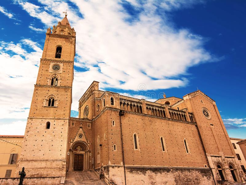
St. Justin Cathedral
La Chiesa Cattedrale di San Giustino, intitolata anche all’apostolo Tommaso e alla Vergine Assunta, sorge su un‘antica fabbrica di una Chiesa precedente al 1069. Nel 1335 Bartolomeo di Giacomo innalzava i primi tre piani della torre campanaria che veniva completata nel 1498 da Antonio da Lodi che costruiva la cella campanaria della torre ed il suo coronamento in forma di tempietto ottagonale. Tra la fine del ‘500 e i primi del ‘600 l'arcivescovo Matteo Saminiato restaurava la Chiesa e faceva eseguire nel 1599 il Fonte Battesimale in porfido di Verona. Nel 1703 un devastante terremoto faceva crollare la cuspide del campanile. Tra il 1764 e il 1770 l'Arcivescovo Francesco Brancia trasformava completamente la Chiesa dandole il suo aspetto attuale. La decorazione della volta venne fatta a metà del XIX sec. ad opera dell'artista locale Del Zoppo. Nel XX sec l'architetto Guido Cirilli eseguiva una "progettazione in stile" dell'intero complesso religioso. La prima fase dell'intervento, negli anni '10 del secolo scorso, riguardava per lo più l'isolamento della torre campanaria e il suo consolidamento. Successivamente creava un rivestimento dell'edificio imprigionandolo in un contenitore murario che non lasciava in vista nessuna delle parti della costruzione precedente, univa il corpo della cattedrale con il campanile progettando un portale a ghimberga al disopra del quale si alza il fronte della facciata e infine Integrava il campanile con la ricostruzione della cuspide. Tra il 1970 e il 1976 venivano eseguiti lavori di restauro e consolidamento dell’intero bene riportando alla luce la struttura altomedievale della cripta distruggendo la decorazione barocca, per l’intervento dell’allora Soprintendente Mario Moretti. Nel Presbiterio e nel Segretariato si trovano tele di pregevole fattura di Saverio Persico: la pala maggiore del Presbiterio che raffigura l'incredulità di San Tommaso, mentre i teleri del Segretariato, che rappresentano "la lavanda dei piedi" e "l'ultima cena". Una tela del Persico è presente anche nella Cappella dell'Immacolata fatta erigere dall'Arcivescovo Nicola Sanchez de Luna (l’altare a sinistra del transetto). La Cripta della Cattedrale di San Giustino presenta una pianta irregolare che si articola in sei piccole navate di due campate ciascuna. Ad oggi risulta essere interamente realizzata in laterizio con elementi lapidei solo nei capitelli delle colonne e nei pilieri a fascio. Nella cripta, inoltre, sono conservati lacerti di affreschi riferibili al sec. XIV e XV ed un’arca marmorea in cui sono custodite le reliquie di San Giustino, patrono di Chieti e primo Vescovo della città, fatto scolpire nel 1432 dal vescovo Marino del Tocco. L’immagine odierna della Cripta è il risultato dei lavori di restauro eseguiti tra il 1970 e il 1976, con cui se ne è riportata alla luce la struttura altomedievale distruggendo la decorazione barocca, per l’intervento dell’allora Soprintendente Mario Moretti che faceva distaccare tutta la decorazione in stucco barocca per ritrovare l’antico assetto medievale della costruzione. Adiacente alla Cripta vi è la Cappella dell’Arciconfraternita del Sacro Monte dei Morti, notevole esempio di barocco con grandiosi stucchi dorati forgiati con perizia dallo stuccatore lombardo Giovan Battista Giani, maestro di mano pregiatissima e di grande importanza in questo tipo di decorazione nella nostra regione. Tutta la decorazione della cappella risulta essere altamente simbolica e sottolinea quelli che sono i dettami dell’opera dell’arciconfraternita. La preziosa pala d’altare è opera di Paolo De Mattheis, artista di scuola napoletana del Solimena e raffigura una Sancta Maria succurre miseris, resa con ampie panneggiature e con preziosi colori pastello, da notare il Bambino benedicente posto in piedi su un cuscino sulle gambe della Vergine, che rivolge lo sguardo, e quindi la sua benedizione, allo spettatore; mentre la Madonna si rivolge alle anime sottostanti. Infine La Cappella ancora oggi è di proprietà della Arciconfraternita del Sacro Monte dei Morti di Chieti, importante ed antichissima Congregazione che cura e custodisce i riti della Processione del Venerdì Santo.
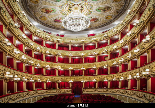
Marrucino Theater
Con la fine del regno e la nascita del Governo unitario, nel giugno del 1861 il teatro di Chieti prendeva il nome di Teatro Marrucino, in ricordo dell’antica popolazione italica che abitava la città preromana, l’antica Teate. I nuovi interventi realizzavano un quinto ordine di palchi (il loggione) e la scala d’accesso autonoma alla balconata. La volta della sala teatrale veniva, pertanto, decorata con un grande rosone ligneo, ornato da una ghirlanda di fiori e diviso in otto settori, nei quali trovano collocazione altrettante figure femminili, raffiguranti le allegorie delle arti teatrali e della musica. Il rosone è inoltre, corredato di medaglioni circolari nei quali sono raffigurati, su fondo oro, i profili dei grandi Goldoni, Pergolesi, Shakespeare, Goethe, Paisiello, Alfieri, Rossini e Verdi e scene del Marrucino venivano calcate dagli artisti più illustri del panorama culturale italiano a partire da Eleonora Duse, Emma ed Irma Gramatica, Cesco Baseggio, Nicola Rossi Lemeni, Nanda Primavera, per ricordarne solo alcuni, e vedevano la realizzazione di opere straordinarie tra le quali la prima abruzzese de “La Figlia di Iorio”, messa in scena nel 1904 da Gabriele D’Annunzio. Prosa, lirica, cabaret, operette, teatro dialettale, teatro per bambini, concerti costituiscono il ricco cartellone stagionale del Marrucino che si apre anche ad eventi non strettamente teatrali come convegni, incontri e concerti di musica leggera. Di seguito, cliccando sul link sottostante, è possibile consultare il sito del Teatro per informazioni su, orari, spettacoli e tariffe.
Learn More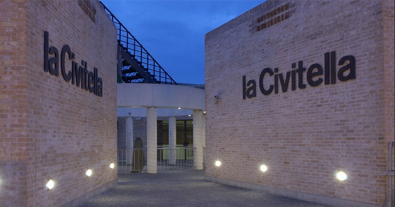
Archaeological Museum of Civitella
ll Museo «La Civitella» offre un interessante spaccato culturale sull’evoluzione urbana della città di Chieti, documentata soprattutto attraverso le ricerche condotte nell’area del centro storico tramite innovative soluzioni espositive. La sede del museo fa parte di un percorso che gravita intorno alla zona archeologica dell’anfiteatro romano scoperto nel 1982 durante i lavori al campo sportivo. Questo percorso rientra nell’ambito di un progetto di recupero e di valorizzazione finalizzato a restituire ai cittadini di Chieti un’area qualificata a livello museale nella quale illustrare la storia del sito e dell’intera città. La struttura accoglie al suo interno i frammenti delle statue e delle lastre in terracotta dei templi rinvenuti nel 1965 e la ricostruzione di parti delle facciate degli edifici religiosi che nel II secolo a.C. sorgevano in questa zona, chiamata oggi Civitella, nel cuore dell’acropoli dell’antica Teate. Il percorso espositivo si articola in tre diverse sezioni. «L’inizio della storia urbana» mostra i materiali del III-II secolo a.C. provenienti dai due quartieri religiosi della città, l’acropoli e l’area sacra dei cosiddetti «Tempietti». Degli edifici di culto presenti sull’acropoli sono esposti gli elementi in terracotta policroma relativi alle parti strutturali e all’apparato figurativo di almeno tre frontoni. Della decorazione del tempio cittadino principale, il Capitolium, è stato possibile ricomporre undici personaggi a partire dai frammenti, fra cui le divinità della triade capitolina romana: Giove, Giunone e Minerva. La sezione «Da Roma a ieri» è organizzata per settori monumentali: il foro, le terme, il teatro, l’anfiteatro, le necropoli e documenta le notizie ed i reperti relativi alla storia della città fino al declino tardo-antico. «La terra dei Marrucini» infine narra della fiera popolazione italica che occupava il territorio dell’antica Teate prima della dominazione romana, un luogo che per la valenza strategica della sua posizione geografica compresa tra le gole montane di Popoli e il mare Adriatico, era sempre il centro egemone dell’attuale Abruzzo.
Learn More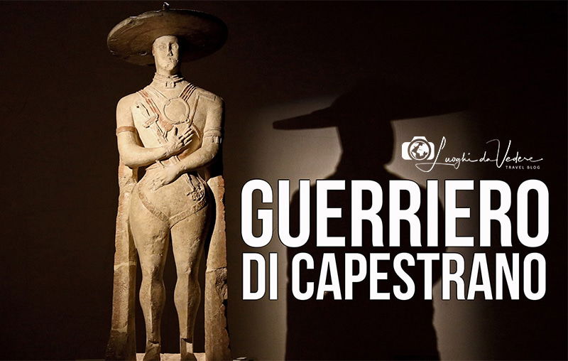
National Archaeological Museum - Villa Frigerj
Il museo ha sede a Chieti in una elegante villa neoclassica, progettata dall’architetto napoletano Errico Riccio per volere del barone Ferrante Frigerj nel 1830. L’edificio domina un piccola altura, originariamente un terreno agricolo di proprietà della famiglia Frigerj localizzato all’esterno delle mura cittadine. Dalla sommità della collina si gode di un panorama mozzafiato e si possono ammirare sia la villa comunale, con il profilo degli edifici del centro storico, sia il maestoso massiccio montuoso della Majella con la vallata sottostante. Nel 1864 l’immobile diveniva proprietà comunale e fu sede scolastica. Nel 1959, grazie all’interessamento dell’allora soprintendente archeologo Valerio Cianfarani, diventava museo archeologico nazionale e dal 2014 veniva assegnato al Polo Museale dell’Abruzzo. All’esterno il visitatore può osservare il rivestimento delle facciate, in bugnato liscio di mattoni al pian terreno e in semplici mattoni nei restanti livelli. La facciata principale, rivolta verso la città, è coronata da un tempietto. All’interno, è esposta la più importante raccolta archeologica abruzzese, fruibile attraverso il nuovo percorso museale, allestito nel 2011 e ampliato nel 2014 seguendo criteri espositivi che privilegiano gli aspetti etnici e topografici delle antiche popolazioni della regione. Al piano terra il visitatore potrà approfondire le tematiche legate alla statuaria antica e, in particolare, potrà contemplare il famoso Guerriero di Capestrano, un capolavoro artistico del VI secolo a.C., al quale è dedicata la sala “Al di là del tempo". Al piano terra è presente anche una ricca sezione numismatica e la ottocentesca collezione Pansa, con oggetti eterogenei. Al primo piano sono presentati i reperti ritrovati nei più rilevanti contesti archeologici abruzzesi datati tra le fasi protostoriche e quelle alto-medievali, soprattutto necropoli e santuari, e il visitatore potrà, quindi, andare alla scoperta della cultura materiale dei Vestini, dei Peligni, dei Marrucini e dei Carricini. Attraverso la scalinata monumentale si torna al piano terra e si prosegue la visita alla scoperta degli antichi popoli dell’Abruzzo osservando i manufatti dei Sabini, dei Frentani, degli Equi e dei Marsi. Premendo il link di seguito si può effettuare un tour virtuale del museo.
Learn More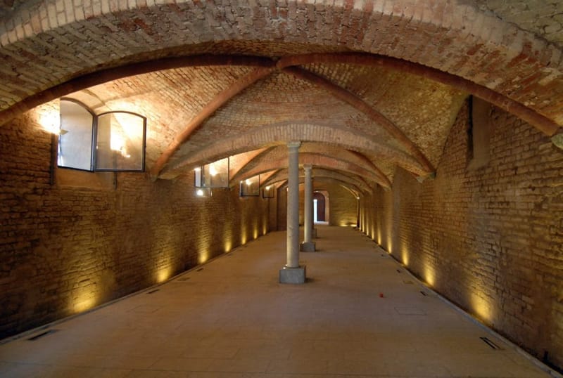
Underground Chieti
Between the end of the century B.C. and the beginning of the second century AD, Chieti reached its maximum expansion, the inhabited center extended over an area that went from Civitella to via Arniense. Based on rough estimates, the population was estimated at between 30,000 and 60,000. It is obvious that such a number of inhabitants had problems with the water supply: for this purpose, in the subsoil of Chieti, a system of cisterns with intercommunicating arches was created and connected by a set of tunnels. The latter, in turn, possessed aeration wells regularly located along the route. Some tunnels have a barrel vault in opus coementicium (cast concrete) and walls in opus incertum, with the probable function of transporting the water from the cisterns in a higher position to those located at lower levels, passing from room to room up to 9 large water preserves included in the complex of the Roman thermal establishment. Other tunnels, with a cappuccina vault (brick slabs placed in contrast without the use of mortar) and walls in opus terraceum, made it possible to collect water both from the hillside aquifer and from perennial drips along the entire route. It was possible to ascertain that, above the vaults of the underground water reservoirs, there were impluvia – waterproof platforms paved with opus spicatum (bricks arranged in a herringbone pattern) emerging from the ground – slightly sloping towards manholes (circular section holes ) practiced at regular distances at the tops of the underlying vaults. In this way, rainwater and melted snow collected inside the cisterns. This system of Roman tunnels and cisterns has come down to our days partly intact, so as to give life to a sort of "underground Chieti". Starting from the Civitella, the first Roman hypogeum of significant dimensions is the one located below a building between Largo dei Carbonari and Via G. Rossetti, measuring 45 x 8.50 m, consisting of six rooms side by side and covered by barrel vaults. It is assumed, from the holes visible on the vaults and from the impermeability of the walls and floor, that these were watertight environments. Two other cisterns are one in via Ravizza, and the other in via Spaventa. By pressing the link below it is possible to learn more about the journey in the underground Chieti.
Learn More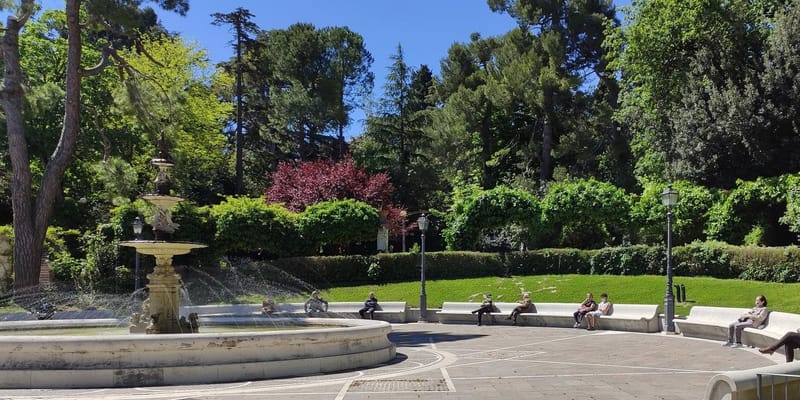
Municipal villa
The city villa is an elegant example of a nineteenth-century style urban park. Born from the unification of the gardens of the noble villas of the Frigerj and Nolli families. When the park of Villa Frigerj was used as an experimental field of the Agricultural Institute, a long avenue was opened, called stradone di S. Andrea, which was immediately used as an evening stroll. At the end of the 19th century it was therefore redesigned as a public park and subjected to a series of modifications. The whole area was divided into squares connected by paths, a large panoramic terrace was created and it was equipped with an artificial lake and artistic fountains. The heights of the park are dominated by the structures of the neoclassical villas Frigerj, today the National Archaeological Museum, and Nolli, today the Regional Seminary, as well as the complex of the Military Hospital, the ancient convent of Sant'Andrea, founded in 1420 by the Franciscan Order of the Zoccolanti adapted to military building after the Napoleonic edict and heavily remodeled until the 60s of the last century.
Learn MoreServices
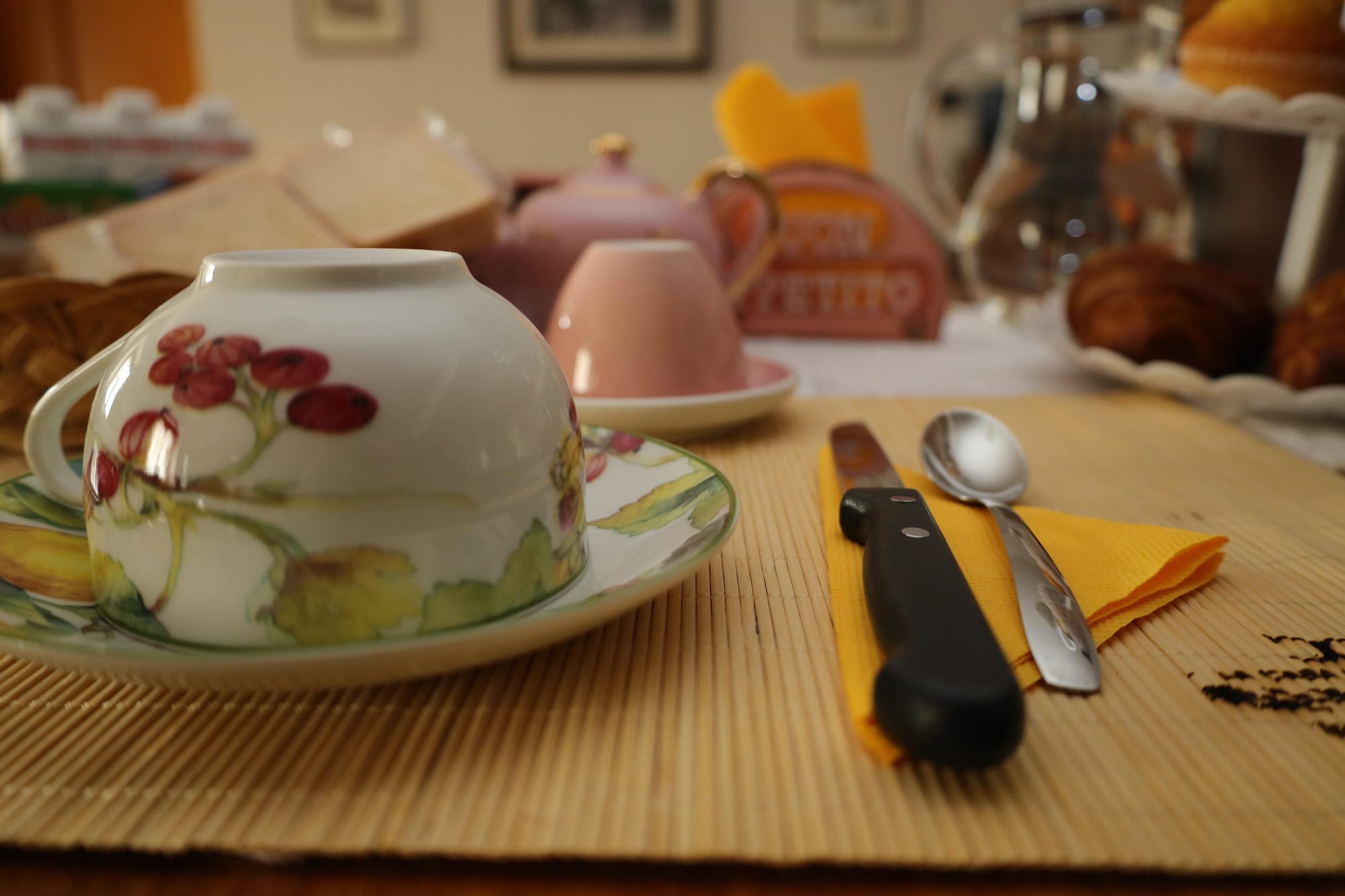
Breakfast
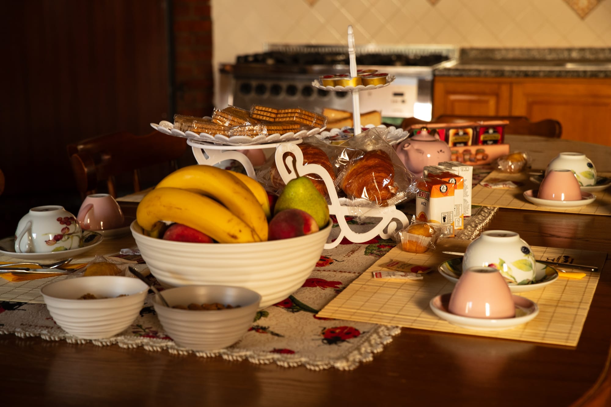
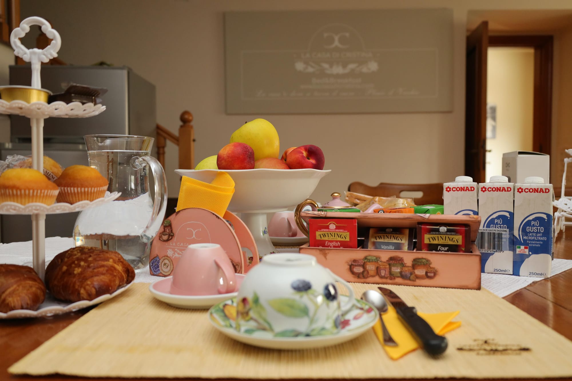
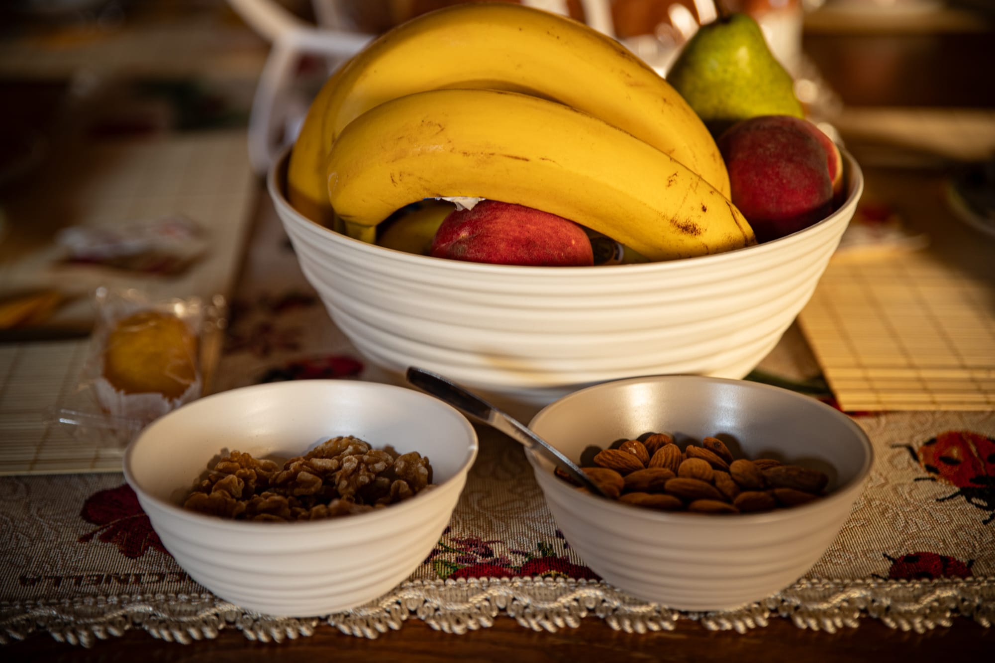
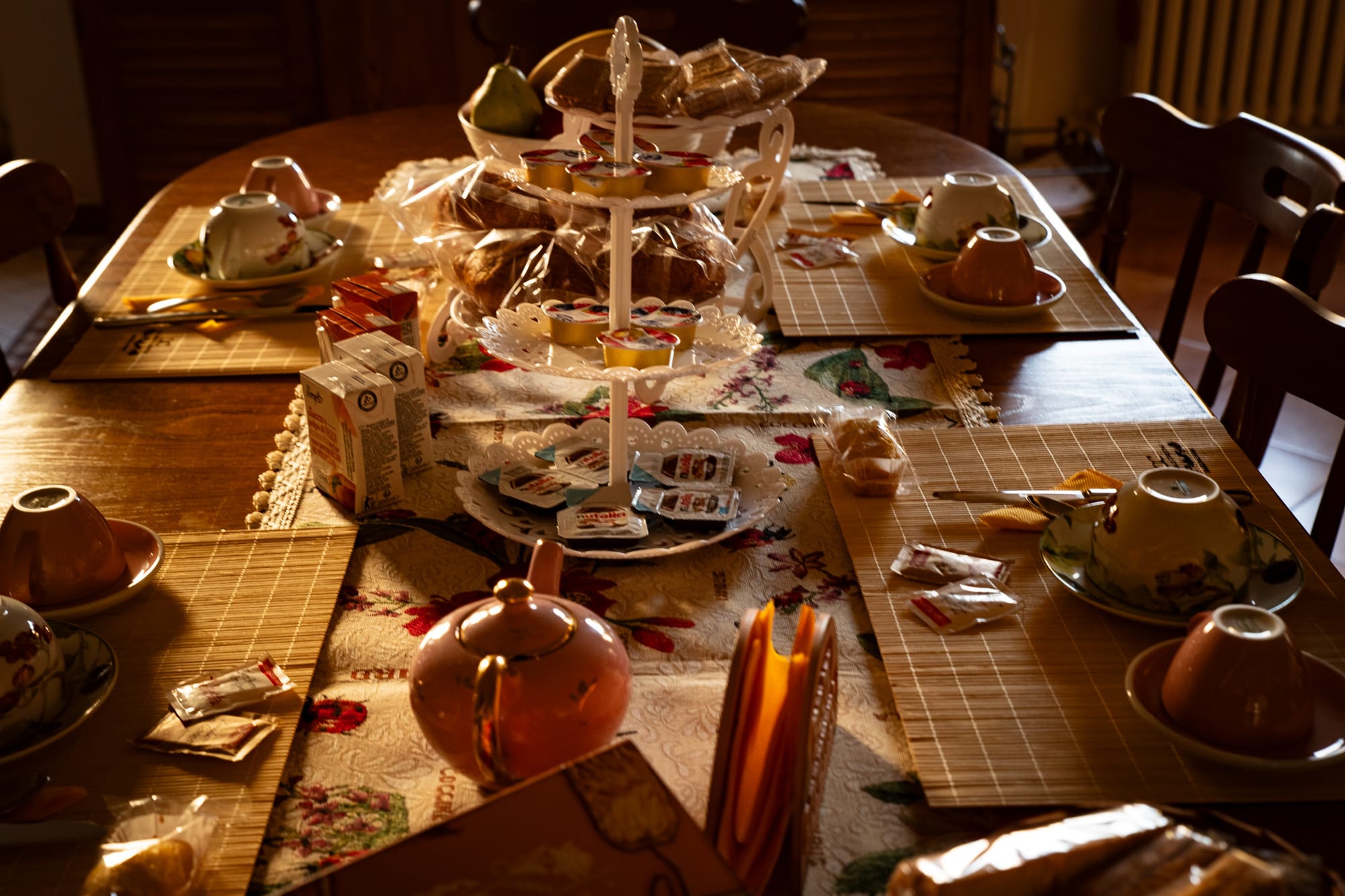
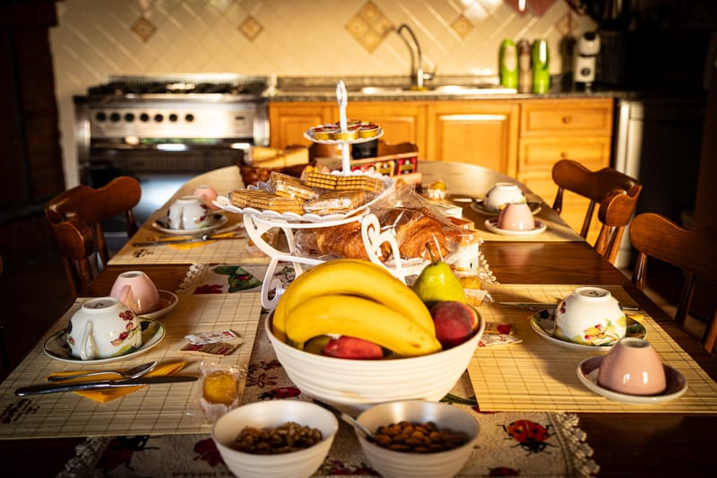
Breakfast, included in the price, is self-service: guests can serve themselves, on the ground floor, until 10.15. The property provides a coffee machine with various pods and a kettle. Breakfast includes a wide variety of fresh fruit, packaged croissants, jams, dried fruit, yogurt, milk and biscuits. Furthermore, upon prior notice, the property is also available to accommodate specific requests.

Guided tours
If you are passing through Guardiagrele you can request the service of guides and tour leaders to visit the historic center and nearby locations. Our guides are regularly registered in the register of guides of the Abruzzo Region and offer a qualified service. At the Linea Verde center a selected range of typical Abruzzo products are also available as well as all information material, books and other publications on Abruzzo's tourist locations, accommodation facilities, gastronomy and crafts. If interest is in natural environments, tourists can request trail maps and guides to independently carry out any walk or trek in the various mountains of Abruzzo. For further information contact Tel. 0871/82063

Sea
The structure provides free umbrellas, deck chairs and chairs for the seaside destinations close to the B&B: Francavilla al Mare (30 minutes), Ortona (35 minutes), San Vito (40 minutes), Fossacesia (40 minutes).
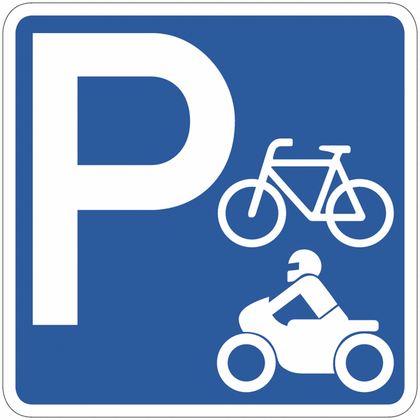
Bike and motorcycle storage
La struttura offre la possibilità di poter parcheggiare gratuitamente bici e motocicli all'interno del garage custodito del B&B. Per le automobili è previsto un supplemento di 15,00 al giorno
Contact
- Comino, Guardiagrele CH, Italy
- +undefined-3517501578 - Constantine Colagreco
- +undefined-3479812848 - Rina Di Crescenzo
- lacasadicristina1938@gmail.com
- Check in: 16.00 - 20.00 Check out: by 10.30